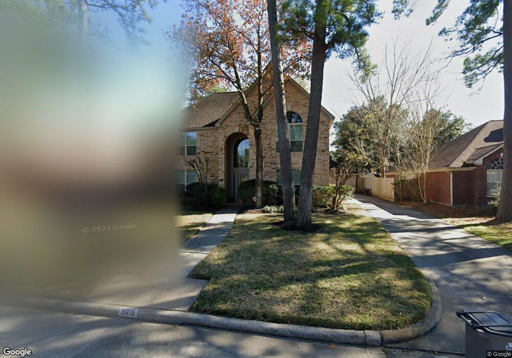
3615 Cypressdale Dr Spring, TX 77388
Champions NeighborhoodEstimated Value: $320,541 - $342,000
4
Beds
3
Baths
2,734
Sq Ft
$122/Sq Ft
Est. Value
About This Home
This home is located at 3615 Cypressdale Dr, Spring, TX 77388 and is currently estimated at $333,885, approximately $122 per square foot. 3615 Cypressdale Dr is a home located in Harris County with nearby schools including Haude Elementary School, Strack Intermediate School, and Klein Collins High School.
Ownership History
Date
Name
Owned For
Owner Type
Purchase Details
Closed on
May 29, 2003
Sold by
Reeves Michael A
Bought by
Oka Kelly and Oka Nancy
Current Estimated Value
Home Financials for this Owner
Home Financials are based on the most recent Mortgage that was taken out on this home.
Original Mortgage
$132,000
Outstanding Balance
$57,864
Interest Rate
5.79%
Mortgage Type
Purchase Money Mortgage
Estimated Equity
$276,021
Purchase Details
Closed on
Nov 15, 1995
Sold by
Watkins Michael J and Watkins Julia A
Bought by
Reeves Michael A
Home Financials for this Owner
Home Financials are based on the most recent Mortgage that was taken out on this home.
Original Mortgage
$108,450
Interest Rate
7.53%
Create a Home Valuation Report for This Property
The Home Valuation Report is an in-depth analysis detailing your home's value as well as a comparison with similar homes in the area
Home Values in the Area
Average Home Value in this Area
Purchase History
| Date | Buyer | Sale Price | Title Company |
|---|---|---|---|
| Oka Kelly | -- | Chicago Title Insurance Co | |
| Reeves Michael A | -- | First American Title |
Source: Public Records
Mortgage History
| Date | Status | Borrower | Loan Amount |
|---|---|---|---|
| Open | Oka Kelly | $132,000 | |
| Previous Owner | Reeves Michael A | $108,450 | |
| Closed | Oka Kelly | $16,500 |
Source: Public Records
Tax History Compared to Growth
Tax History
| Year | Tax Paid | Tax Assessment Tax Assessment Total Assessment is a certain percentage of the fair market value that is determined by local assessors to be the total taxable value of land and additions on the property. | Land | Improvement |
|---|---|---|---|---|
| 2025 | $5,245 | $295,147 | $58,116 | $237,031 |
| 2024 | $5,245 | $312,610 | $58,116 | $254,494 |
| 2023 | $5,245 | $326,978 | $58,116 | $268,862 |
| 2022 | $5,977 | $313,266 | $58,116 | $255,150 |
| 2021 | $5,789 | $225,112 | $29,445 | $195,667 |
| 2020 | $5,747 | $215,699 | $29,445 | $186,254 |
| 2019 | $6,001 | $222,531 | $29,445 | $193,086 |
| 2018 | $2,491 | $199,166 | $29,445 | $169,721 |
| 2017 | $5,330 | $199,166 | $29,445 | $169,721 |
| 2016 | $4,846 | $190,480 | $29,445 | $161,035 |
| 2015 | $3,553 | $190,480 | $29,445 | $161,035 |
| 2014 | $3,553 | $146,000 | $23,633 | $122,367 |
Source: Public Records
Map
Nearby Homes
- 3638 Lost Oak Dr
- 3647 Marywood Dr
- 3422 Aldergrove Dr
- 19007 Pinewood Glen Dr
- 3434 Coltwood Dr
- 3511 Coltwood Dr
- 3502 Chapel Square Dr
- 3642 Chapel Square Dr
- 3606 Rolling Terrace Dr
- 19218 Country Village Dr
- 18318 Navajo Trail Dr
- 3603 Rolling Terrace Dr
- 19315 Puget Ln
- 3427 Rolling Terrace Dr
- 3639 Fir Forest Dr
- 18615 Minden Oaks Dr
- 3602 Vashon Ln
- 3902 Marywood Dr
- 3902 Broken Elm Dr
- 4202 Blue Sage Terrace
- 3611 Cypressdale Dr
- 3619 Cypressdale Dr
- 3614 Marywood Dr
- 3618 Marywood Dr
- 3623 Cypressdale Dr
- 3607 Cypressdale Dr
- 3610 Marywood Dr
- 3622 Marywood Dr
- 3614 Cypressdale Dr
- 3606 Marywood Dr
- 3618 Cypressdale Dr
- 3610 Cypressdale Dr
- 3627 Cypressdale Dr
- 3603 Cypressdale Dr
- 3606 Cypressdale Dr
- 3622 Cypressdale Dr
- 3626 Marywood Dr
- 3602 Marywood Dr
- 3602 Cypressdale Dr
- 3626 Cypressdale Dr