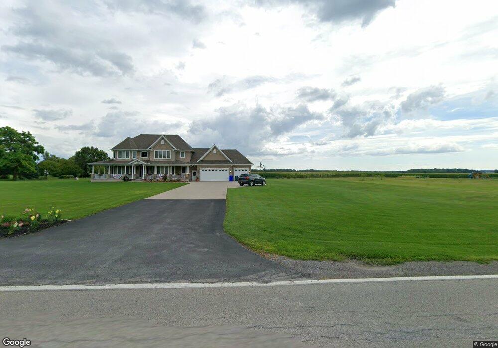
3615 Day Rd Lockport, NY 14094
Estimated Value: $522,000 - $766,000
4
Beds
3
Baths
3,233
Sq Ft
$205/Sq Ft
Est. Value
About This Home
This home is located at 3615 Day Rd, Lockport, NY 14094 and is currently estimated at $661,955, approximately $204 per square foot. 3615 Day Rd is a home with nearby schools including Newfane Elementary School, Newfane Middle School, and Newfane Senior High School.
Ownership History
Date
Name
Owned For
Owner Type
Purchase Details
Closed on
Dec 7, 2012
Sold by
Adams David J
Bought by
Adams David J and Adams Marianne M
Current Estimated Value
Home Financials for this Owner
Home Financials are based on the most recent Mortgage that was taken out on this home.
Original Mortgage
$336,000
Outstanding Balance
$232,705
Interest Rate
3.12%
Mortgage Type
Adjustable Rate Mortgage/ARM
Estimated Equity
$429,250
Purchase Details
Closed on
Nov 29, 2007
Sold by
Farley Milton
Bought by
Adams David
Create a Home Valuation Report for This Property
The Home Valuation Report is an in-depth analysis detailing your home's value as well as a comparison with similar homes in the area
Home Values in the Area
Average Home Value in this Area
Purchase History
| Date | Buyer | Sale Price | Title Company |
|---|---|---|---|
| Adams David J | -- | None Available | |
| Adams David | $100,000 | Richard D Yellen |
Source: Public Records
Mortgage History
| Date | Status | Borrower | Loan Amount |
|---|---|---|---|
| Open | Adams David J | $336,000 |
Source: Public Records
Tax History Compared to Growth
Tax History
| Year | Tax Paid | Tax Assessment Tax Assessment Total Assessment is a certain percentage of the fair market value that is determined by local assessors to be the total taxable value of land and additions on the property. | Land | Improvement |
|---|---|---|---|---|
| 2024 | $12,964 | $291,500 | $18,900 | $272,600 |
| 2023 | $12,511 | $291,500 | $18,900 | $272,600 |
| 2022 | $12,361 | $291,500 | $18,900 | $272,600 |
| 2021 | $12,272 | $291,500 | $18,900 | $272,600 |
| 2020 | $11,481 | $291,500 | $18,900 | $272,600 |
| 2019 | $10,977 | $291,500 | $18,900 | $272,600 |
| 2018 | $11,355 | $291,500 | $18,900 | $272,600 |
| 2017 | $10,977 | $291,500 | $18,900 | $272,600 |
| 2016 | $10,762 | $291,500 | $18,900 | $272,600 |
| 2015 | -- | $291,500 | $18,900 | $272,600 |
| 2014 | -- | $291,500 | $18,900 | $272,600 |
Source: Public Records
Map
Nearby Homes
- 7233 Ridge Rd
- 3301 Hess Rd
- 3708 Lockport Olcott Rd
- 3902 Lockport Olcott Rd
- 4180 Day Rd
- 6358 Ridge Rd
- 6255 Hatter Rd
- 6603 Mulligan Dr
- 3248 Lockport Olcott Rd
- 6358 Dale Rd
- 4307 Lake Ave
- 4311 Lake Ave
- 6270 Corwin Station
- 6284 Autumnview Station
- 6266 Bayview Station
- 6276 Autumnview Station
- 6250 Corwin
- 3023 Springview
- 3980 Ridgelea Dr
- 0 Kerwin Rd