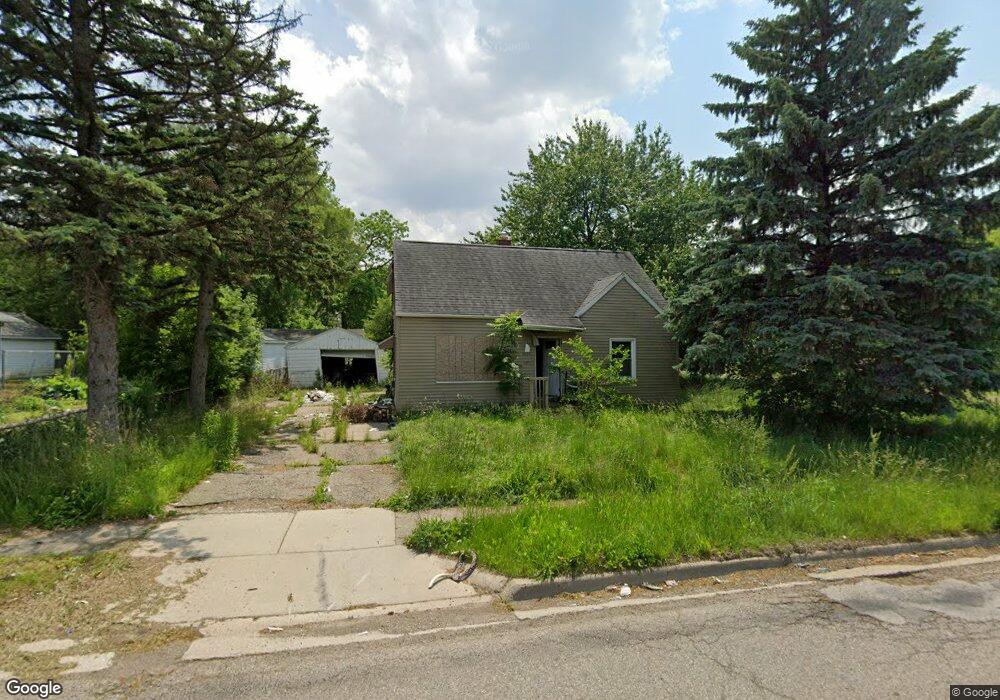
3615 W Court St Flint, MI 48532
Mannhall Park NeighborhoodEstimated Value: $44,547 - $75,000
3
Beds
1
Bath
1,002
Sq Ft
$58/Sq Ft
Est. Value
About This Home
This home is located at 3615 W Court St, Flint, MI 48532 and is currently estimated at $57,887, approximately $57 per square foot. 3615 W Court St is a home located in Genesee County with nearby schools including Durant-Tuuri-Mott Elementary School, St. Paul Lutheran School, and First Flint Seventh-day Adventist Christian School.
Ownership History
Date
Name
Owned For
Owner Type
Purchase Details
Closed on
Jul 8, 2005
Sold by
Allen Bradley J and Allen Bradley James
Bought by
Maxwell Leslie and Nolff Marshall
Current Estimated Value
Create a Home Valuation Report for This Property
The Home Valuation Report is an in-depth analysis detailing your home's value as well as a comparison with similar homes in the area
Home Values in the Area
Average Home Value in this Area
Purchase History
| Date | Buyer | Sale Price | Title Company |
|---|---|---|---|
| Maxwell Leslie | $65,500 | Sargents Title Company |
Source: Public Records
Tax History Compared to Growth
Tax History
| Year | Tax Paid | Tax Assessment Tax Assessment Total Assessment is a certain percentage of the fair market value that is determined by local assessors to be the total taxable value of land and additions on the property. | Land | Improvement |
|---|---|---|---|---|
| 2025 | $1,124 | $20,300 | $0 | $0 |
| 2024 | $1,014 | $20,400 | $0 | $0 |
| 2023 | $1,272 | $25,000 | $0 | $0 |
| 2022 | $0 | $20,300 | $0 | $0 |
| 2021 | $1,192 | $17,600 | $0 | $0 |
| 2020 | $864 | $15,700 | $0 | $0 |
| 2019 | $841 | $14,400 | $0 | $0 |
| 2018 | $844 | $12,400 | $0 | $0 |
| 2017 | $821 | $0 | $0 | $0 |
| 2016 | $815 | $0 | $0 | $0 |
| 2015 | -- | $0 | $0 | $0 |
| 2014 | -- | $0 | $0 | $0 |
| 2012 | -- | $15,800 | $0 | $0 |
Source: Public Records
Map
Nearby Homes
- 3821 W Court St
- 960 Salisbury Ave
- 916 Mann Ave
- 3921 Joyner St
- 976 Barney Ave
- 960 Mann Ave
- 863 Tacken St
- 996 Barney Ave
- 3414 Van Buren Ave
- 874 Tacken St
- 870 Tacken St
- 866 Tacken St
- 959 Tacken St
- 3705 Gratiot Ave
- 3517 Norwood Dr
- 1017 Stocker Ave
- 911 Hughes Ave
- 1010 Hughes Ave
- 3413 Augusta St
- 3801 Augusta St
- 3605 W Court St
- 909 Johnson Ave
- 920 S Ballenger Hwy
- 913 Johnson Ave
- 917 Johnson Ave
- 924 S Ballenger Hwy
- 921 Johnson Ave Unit Bldg-Unit
- 928 S Ballenger Hwy
- 3701 W Court St
- 912 Johnson Ave
- 3614 W Court St
- 3606 W Court St
- 916 Johnson Ave
- 909 S Ballenger Hwy
- 3610 W Court St
- 901 S Ballenger Hwy
- 917 S Ballenger Hwy
- 920 Johnson Ave
- 932 S Ballenger Hwy
- 921 S Ballenger Hwy