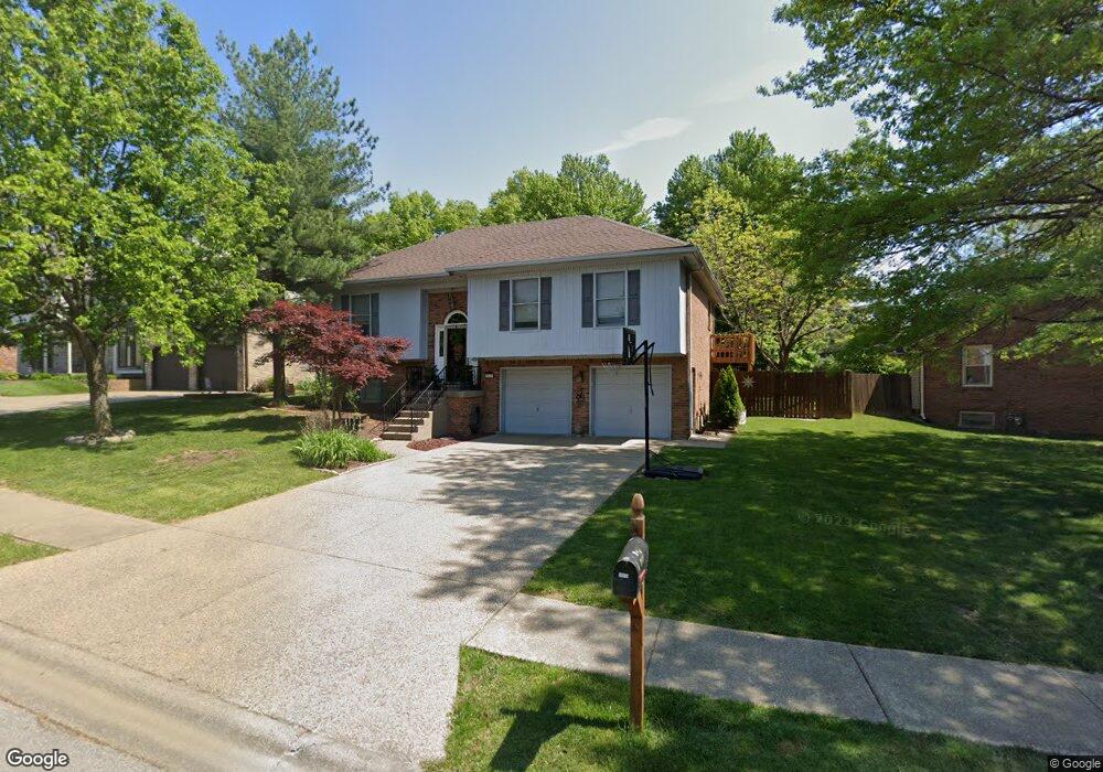
3616 Sundance Dr New Albany, IN 47150
Estimated Value: $310,435 - $353,000
3
Beds
3
Baths
1,706
Sq Ft
$197/Sq Ft
Est. Value
About This Home
This home is located at 3616 Sundance Dr, New Albany, IN 47150 and is currently estimated at $336,859, approximately $197 per square foot. 3616 Sundance Dr is a home located in Floyd County with nearby schools including Grant Line School, Nathaniel Scribner Middle School, and New Albany Senior High School.
Ownership History
Date
Name
Owned For
Owner Type
Purchase Details
Closed on
Jan 30, 2006
Sold by
The Bank Of New York
Bought by
Head Mark A and Head Tara
Current Estimated Value
Home Financials for this Owner
Home Financials are based on the most recent Mortgage that was taken out on this home.
Original Mortgage
$99,120
Outstanding Balance
$56,131
Interest Rate
6.3%
Mortgage Type
New Conventional
Estimated Equity
$280,728
Create a Home Valuation Report for This Property
The Home Valuation Report is an in-depth analysis detailing your home's value as well as a comparison with similar homes in the area
Home Values in the Area
Average Home Value in this Area
Purchase History
| Date | Buyer | Sale Price | Title Company |
|---|---|---|---|
| Head Mark A | -- | Security Title Services Llc |
Source: Public Records
Mortgage History
| Date | Status | Borrower | Loan Amount |
|---|---|---|---|
| Open | Head Mark A | $99,120 |
Source: Public Records
Tax History Compared to Growth
Tax History
| Year | Tax Paid | Tax Assessment Tax Assessment Total Assessment is a certain percentage of the fair market value that is determined by local assessors to be the total taxable value of land and additions on the property. | Land | Improvement |
|---|---|---|---|---|
| 2024 | $1,990 | $253,700 | $27,200 | $226,500 |
| 2023 | $1,712 | $233,200 | $27,200 | $206,000 |
| 2022 | $1,794 | $233,800 | $27,200 | $206,600 |
| 2021 | $1,635 | $217,900 | $27,200 | $190,700 |
| 2020 | $1,620 | $217,900 | $27,200 | $190,700 |
| 2019 | $1,407 | $200,200 | $27,200 | $173,000 |
| 2018 | $1,465 | $209,000 | $27,200 | $181,800 |
| 2017 | $1,326 | $182,700 | $27,200 | $155,500 |
| 2016 | $1,164 | $176,000 | $27,200 | $148,800 |
| 2014 | $1,058 | $150,700 | $27,100 | $123,600 |
| 2013 | -- | $146,800 | $27,200 | $119,600 |
Source: Public Records
Map
Nearby Homes
- 4105 Stone Place
- 3617 Doe Run Way
- 3810 Wayne St
- BERKSHIRE Plan at Jefferson Gardens
- AUBURN Plan at Jefferson Gardens
- 3807 Homestead Dr
- 1130 Eastridge Dr
- 4722 Timber Pine Dr Unit 99
- 4724 Timber Pine Dr Unit 100
- 3941 Carver St
- 3903 Rainbow Dr
- 3517 Kamer Miller Rd
- 3920 Windsor Creek Dr
- 4834 Ashbury Dr
- 4724 Black Pine Blvd Unit 73
- 30 Doebrook Ct
- 3021 Grace Marie Way
- Elm Plan at Koehler Woods
- Downing Plan at Koehler Woods
- PINE Plan at Koehler Woods
- 3614 Sundance Dr
- 3618 Sundance Dr
- 3617 Greenfield Dr
- 3615 Greenfield Dr
- 3619 Greenfield Dr
- 3617 Sundance Dr
- 3613 Greenfield Dr
- 3615 Sundance Dr
- 3610 Sundance Dr
- 3619 Sundance Dr
- 3611 Greenfield Dr
- 3613 Sundance Dr
- 3621 Sundance Dr
- 3621 Greenfield Dr
- 4116 Stone Place
- 3614 Greenfield Dr
- 4118 Stone Place
- 3612 Greenfield Dr
- 3609 Greenfield Dr
- 3616 Greenfield Dr