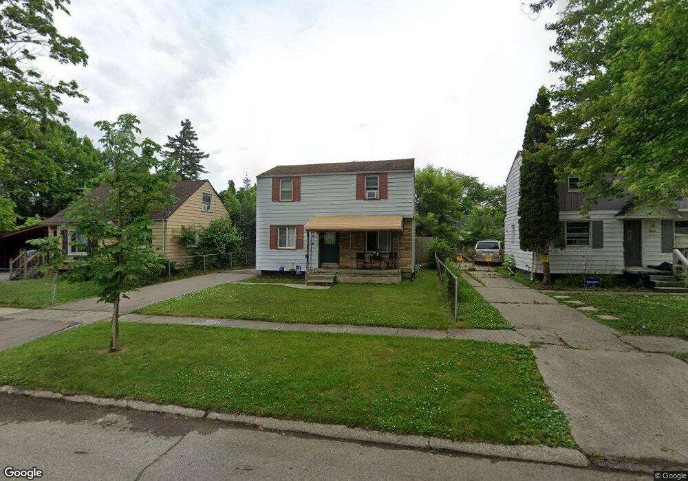
3618 Bennett Ave Flint, MI 48506
Potter Longway NeighborhoodEstimated Value: $84,000 - $104,000
3
Beds
2
Baths
999
Sq Ft
$97/Sq Ft
Est. Value
About This Home
This home is located at 3618 Bennett Ave, Flint, MI 48506 and is currently estimated at $97,196, approximately $97 per square foot. 3618 Bennett Ave is a home located in Genesee County with nearby schools including Potter School, Richfield Public School Academy, and Richfield Early Learning Center.
Ownership History
Date
Name
Owned For
Owner Type
Purchase Details
Closed on
Apr 24, 2023
Sold by
Metcalfe William James
Bought by
Metcalfe Holdings Llc
Current Estimated Value
Purchase Details
Closed on
Dec 2, 2013
Sold by
Smith Daniel Joseph
Bought by
Metcalfe William James
Purchase Details
Closed on
Nov 20, 2013
Sold by
Genesee County Treasurer
Bought by
Smith Daniel J
Purchase Details
Closed on
Dec 10, 2004
Sold by
Mccummings Robert E and Mccummings Ila M
Bought by
Roda Rebecca
Purchase Details
Closed on
Mar 22, 2004
Sold by
Baumgart Richard A
Bought by
Mccummings Robert E and Mccummings Ila M
Create a Home Valuation Report for This Property
The Home Valuation Report is an in-depth analysis detailing your home's value as well as a comparison with similar homes in the area
Home Values in the Area
Average Home Value in this Area
Purchase History
| Date | Buyer | Sale Price | Title Company |
|---|---|---|---|
| Metcalfe Holdings Llc | -- | None Listed On Document | |
| Metcalfe William James | -- | M & G Title Service Co | |
| Smith Daniel J | $3,000 | None Available | |
| Roda Rebecca | $75,500 | Sargents Title Company | |
| Mccummings Robert E | $57,500 | Lawyers Title |
Source: Public Records
Tax History
| Year | Tax Paid | Tax Assessment Tax Assessment Total Assessment is a certain percentage of the fair market value that is determined by local assessors to be the total taxable value of land and additions on the property. | Land | Improvement |
|---|---|---|---|---|
| 2025 | $1,404 | $43,600 | $0 | $0 |
| 2024 | $1,294 | $34,300 | $0 | $0 |
| 2023 | $1,260 | $26,800 | $0 | $0 |
| 2022 | $0 | $23,200 | $0 | $0 |
| 2021 | $1,281 | $18,300 | $0 | $0 |
| 2020 | $1,172 | $15,500 | $0 | $0 |
| 2019 | $1,141 | $13,900 | $0 | $0 |
| 2018 | $1,144 | $14,100 | $0 | $0 |
| 2017 | $1,113 | $0 | $0 | $0 |
| 2016 | $1,105 | $0 | $0 | $0 |
| 2015 | -- | $0 | $0 | $0 |
| 2014 | -- | $0 | $0 | $0 |
| 2012 | -- | $17,500 | $0 | $0 |
Source: Public Records
Map
Nearby Homes
- 3614 Holly Ave
- 3617 Davison Rd
- 3813 Holly Ave
- 3814 Beechwood Ave
- 3739 Marmion Ave
- 3232 Dale Ave
- 3213 Holly Ave
- 2146 N Center Rd
- 3149 Whittier Ave
- 3740 Ivanhoe Ave
- 3602 Dakota Ave
- 3421 Brewster St
- 3314 Dakota Ave
- 3413 Dakota Ave
- 3806 Pitkin Ave
- 2002 Branch Rd
- 2274 N Center Rd
- 3734 Craig Dr
- 2719 Branch Rd
- 3018 Dakota Ave
- 3614 Bennett Ave
- 3622 Bennett Ave
- 3610 Bennett Ave
- 3605 Holly Ave
- 3617 Holly Ave
- 3621 Holly Ave
- 3609 Holly Ave
- 3617 Bennett Ave
- 3613 Bennett Ave
- 3621 Bennett Ave
- 3602 Bennett Ave
- 3609 Bennett Ave
- 3601 Holly Ave
- 3605 Bennett Ave
- 2110 N Dexter St
- 3526 Bennett Ave
- 2120 N Dexter St
- 3702 Bennett Ave
- 3601 Bennett Ave
- 3525 Holly Ave
Your Personal Tour Guide
Ask me questions while you tour the home.