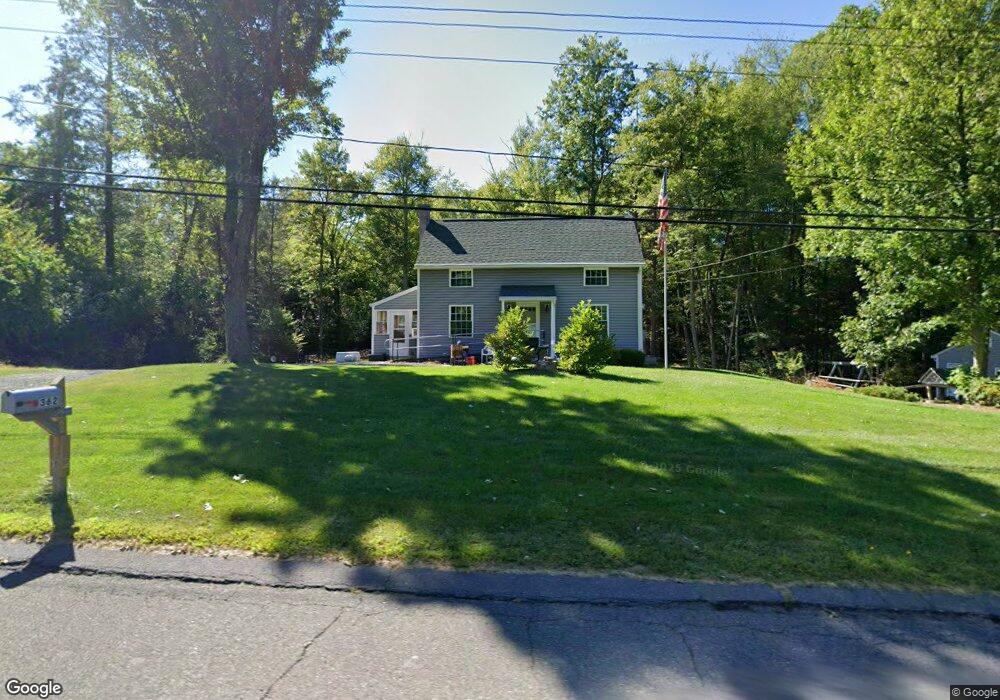
362 College Hwy Southampton, MA 01073
Estimated Value: $289,000 - $344,000
3
Beds
2
Baths
1,200
Sq Ft
$265/Sq Ft
Est. Value
About This Home
This home is located at 362 College Hwy, Southampton, MA 01073 and is currently estimated at $318,180, approximately $265 per square foot. 362 College Hwy is a home located in Hampshire County with nearby schools including William E Norris School, White Oak School, and Westfield Christian Academy.
Ownership History
Date
Name
Owned For
Owner Type
Purchase Details
Closed on
Jan 30, 2015
Sold by
Canning Daniel
Bought by
Boulanger Matthew R
Current Estimated Value
Purchase Details
Closed on
Jul 9, 2001
Sold by
Labrie Eugene R and Labrie James R
Bought by
Cross Frances J and Cross Thomas M
Purchase Details
Closed on
Nov 3, 1998
Sold by
Bard Joyce E and Goepfert Larry A
Bought by
Labrie Eugene R and Labrie James R
Create a Home Valuation Report for This Property
The Home Valuation Report is an in-depth analysis detailing your home's value as well as a comparison with similar homes in the area
Home Values in the Area
Average Home Value in this Area
Purchase History
| Date | Buyer | Sale Price | Title Company |
|---|---|---|---|
| Boulanger Matthew R | $140,000 | -- | |
| Canning Daniel | -- | -- | |
| Cross Frances J | $60,000 | -- | |
| Labrie Eugene R | $50,000 | -- |
Source: Public Records
Tax History Compared to Growth
Tax History
| Year | Tax Paid | Tax Assessment Tax Assessment Total Assessment is a certain percentage of the fair market value that is determined by local assessors to be the total taxable value of land and additions on the property. | Land | Improvement |
|---|---|---|---|---|
| 2025 | $3,244 | $228,900 | $87,800 | $141,100 |
| 2024 | $3,262 | $228,900 | $87,800 | $141,100 |
| 2023 | $2,965 | $206,900 | $87,800 | $119,100 |
| 2022 | $2,788 | $185,000 | $78,200 | $106,800 |
| 2021 | $2,736 | $171,300 | $73,400 | $97,900 |
| 2020 | $2,694 | $170,300 | $73,400 | $96,900 |
| 2019 | $2,665 | $163,400 | $73,400 | $90,000 |
| 2018 | $2,510 | $150,100 | $66,000 | $84,100 |
| 2017 | $2,450 | $150,100 | $66,000 | $84,100 |
| 2015 | $2,372 | $151,000 | $60,400 | $90,600 |
Source: Public Records
Map
Nearby Homes
- 369 College Hwy
- Lot 5 Brickyard Rd
- 119 Brickyard Rd
- Lot 57 White Loaf Rd
- 45 Jaeger Dr
- Lot 5 Gil Farm Rd
- Lot 6 Gil Farm Rd
- 150 Middle Rd
- 94 Pequot Rd (Rear)
- 216 College Hwy
- 4 Fitch Farm Way
- 117 Russellville Rd
- 64 Old Stage Rd
- 36 County Rd
- 100 Fomer Rd
- 336 Russellville Rd
- 405 Rock Valley Rd
- 868 Southampton Rd Unit 18
- 132 North Rd
- 0 Char Dr
- 364 College Hwy
- 366 College Hwy
- 368 College Hwy
- 357 College Hwy
- 355 College Hwy
- 371 College Hwy
- 373 College Hwy
- 354 College Hwy
- 350 College Hwy
- 377 College Hwy
- 378 College Hwy
- 346 College Hwy
- 380 College Hwy
- 379 College Hwy
- 382 College Hwy
- 344 College Hwy
- 376 College Hwy Unit 1
- 384 College Hwy
- 340 College Hwy
- 383 College Hwy