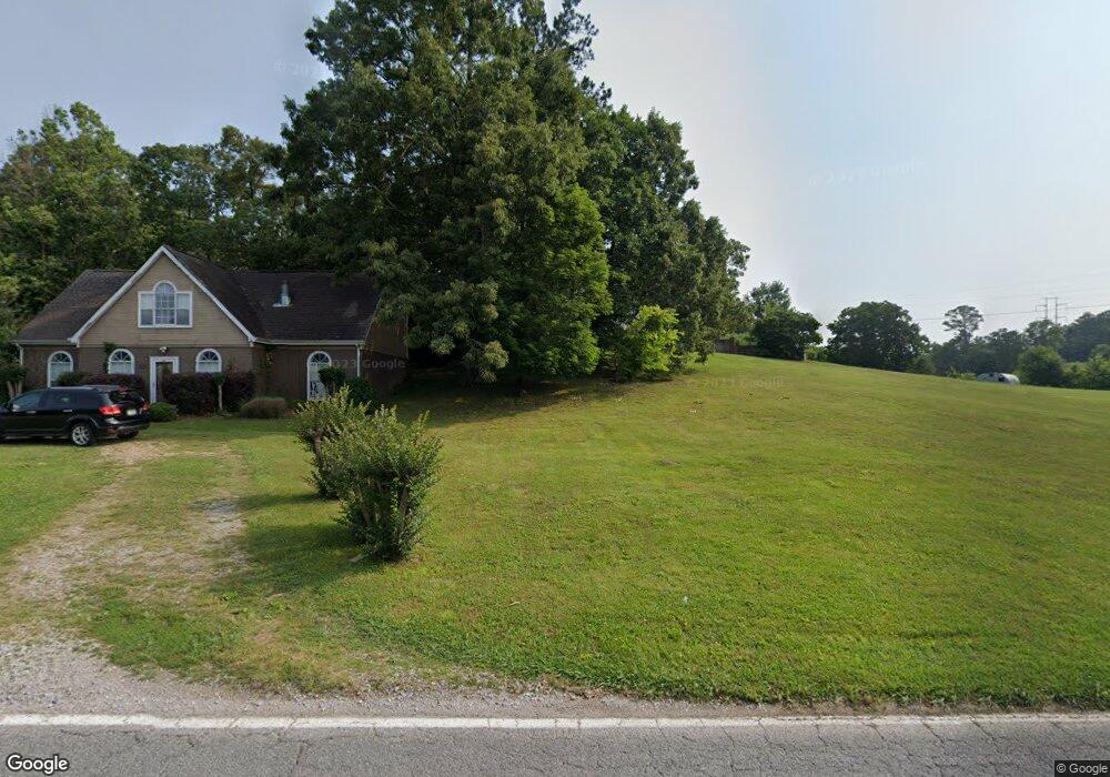
362 Dedmon Rd Ringgold, GA 30736
Estimated Value: $315,000 - $447,000
About This Home
This home is located at 362 Dedmon Rd, Ringgold, GA 30736 and is currently estimated at $392,641, approximately $178 per square foot. 362 Dedmon Rd is a home located in Catoosa County with nearby schools including Ringgold Primary School, Ringgold Elementary School, and Heritage Middle School.
Ownership History
We collect this data history from publicly available records. To have your information removed, we recommend requesting removal directly through your county’s website.
Purchase Details
Home Financials for this Owner
Home Financials are based on the most recent Mortgage that was taken out on this home.Home Values in the Area
Average Home Value in this Area
Purchase History
We collect this data history from publicly available records. To have your information removed, we recommend requesting removal directly through your county’s website.
| Date | Buyer | Sale Price | Title Company |
|---|---|---|---|
| $173,500 | -- |
Mortgage History
We collect this data history from publicly available records. To have your information removed, we recommend requesting removal directly through your county’s website.
| Date | Status | Borrower | Loan Amount |
|---|---|---|---|
| Open | $173,500 |
Tax History
We collect this data history from publicly available records. To have your information removed, we recommend requesting removal directly through your county’s website.
| Year | Tax Paid | Tax Assessment Tax Assessment Total Assessment is a certain percentage of the fair market value that is determined by local assessors to be the total taxable value of land and additions on the property. | Land | Improvement |
|---|---|---|---|---|
| 2025 | $2,838 | $149,483 | $16,326 | $133,157 |
| 2024 | $3,107 | $145,696 | $12,237 | $133,459 |
| 2023 | $2,476 | $110,584 | $12,237 | $98,347 |
| 2022 | $1,911 | $85,372 | $11,654 | $73,718 |
| 2021 | $1,786 | $85,372 | $11,654 | $73,718 |
| 2020 | $1,719 | $74,279 | $11,099 | $63,180 |
| 2019 | $1,737 | $74,279 | $11,099 | $63,180 |
| 2018 | $1,835 | $74,279 | $11,099 | $63,180 |
| 2017 | $1,812 | $73,326 | $11,099 | $62,227 |
| 2016 | $1,628 | $62,657 | $5,571 | $57,086 |
| 2015 | -- | $62,657 | $5,571 | $57,086 |
| 2014 | -- | $67,278 | $10,192 | $57,086 |
| 2013 | -- | $67,278 | $10,192 | $57,086 |
Map
- 478 Dedmon Rd
- 879 Dedmon Rd
- 56 Ginger Dr
- 255 Bent Tree Dr
- 831 Dedmon Rd
- 185 Cornerstone Dr
- 271 Chestnut Ridge Rd
- 109 Harris Dr
- 1050 Brock Cir
- 299 Southern Dr
- 81 Shrader Ln
- 42 Willowbrook Dr
- 8690 Alabama Hwy
- 204 Dodd Rd
- 391 Oak Tree Rd
- 0 Battlefield Pkwy Unit 1521890
- 45 Alese Dr
- 0 Forest Dr Unit 1537383
- 0 Etowah Unit 129188
- 518 Heritage Dr
- 371 Dedmon Rd
- 325 Dedmon Rd
- 351 Dedmon Rd
- 388 Dedmon Rd
- 331 Dedmon Rd
- 411 Dedmon Rd
- 431 Dedmon Rd
- 54 Misty Ridge Ln
- 451 Dedmon Rd
- 384 Dedmon Rd
- 25 Misty Ridge Ln
- 86 Misty Ridge Ln
- 469 Dedmon Rd
- 63 Misty Ridge Ln
- 385 Dedmon Rd
- 707 Misty Ridge Ln
- 725 Misty Ridge Ln
- 743 Misty Ridge Ln
- 75 Misty Ridge Ln
- 491 Dedmon Rd
Ask me questions while you tour the home.