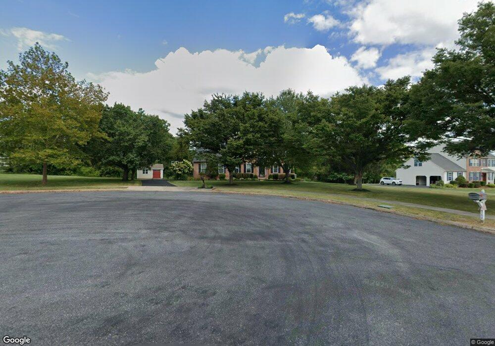
362 High St Souderton, PA 18964
Estimated Value: $778,716 - $805,000
5
Beds
3
Baths
3,314
Sq Ft
$240/Sq Ft
Est. Value
About This Home
This home is located at 362 High St, Souderton, PA 18964 and is currently estimated at $794,179, approximately $239 per square foot. 362 High St is a home located in Montgomery County with nearby schools including Franconia Elementary School, Indian Crest Middle School, and Souderton Area Senior High School.
Ownership History
Date
Name
Owned For
Owner Type
Purchase Details
Closed on
Sep 12, 2003
Sold by
Relocation Dynamics Inc
Bought by
Barnum John E and Barnum Amy B
Current Estimated Value
Home Financials for this Owner
Home Financials are based on the most recent Mortgage that was taken out on this home.
Original Mortgage
$322,700
Interest Rate
6.01%
Purchase Details
Closed on
Sep 9, 2003
Sold by
Holland James J and Holland Joyce J
Bought by
Relocation Dynamics Inc
Home Financials for this Owner
Home Financials are based on the most recent Mortgage that was taken out on this home.
Original Mortgage
$322,700
Interest Rate
6.01%
Purchase Details
Closed on
Aug 15, 1997
Sold by
Brook View Development Corp
Bought by
Holland James J and Holland Joyce J
Create a Home Valuation Report for This Property
The Home Valuation Report is an in-depth analysis detailing your home's value as well as a comparison with similar homes in the area
Home Values in the Area
Average Home Value in this Area
Purchase History
| Date | Buyer | Sale Price | Title Company |
|---|---|---|---|
| Barnum John E | $432,000 | -- | |
| Relocation Dynamics Inc | $432,000 | -- | |
| Holland James J | $290,245 | -- |
Source: Public Records
Mortgage History
| Date | Status | Borrower | Loan Amount |
|---|---|---|---|
| Open | Relocation Dynamics Inc | $87,700 | |
| Closed | Barnum John E | $87,700 | |
| Previous Owner | Barnum John E | $322,700 | |
| Previous Owner | Relocation Dynamics Inc | $322,700 |
Source: Public Records
Tax History Compared to Growth
Tax History
| Year | Tax Paid | Tax Assessment Tax Assessment Total Assessment is a certain percentage of the fair market value that is determined by local assessors to be the total taxable value of land and additions on the property. | Land | Improvement |
|---|---|---|---|---|
| 2025 | $10,829 | $269,630 | $62,860 | $206,770 |
| 2024 | $10,829 | $269,630 | $62,860 | $206,770 |
| 2023 | $10,332 | $269,630 | $62,860 | $206,770 |
| 2022 | $10,017 | $269,630 | $62,860 | $206,770 |
| 2021 | $9,807 | $269,630 | $62,860 | $206,770 |
| 2020 | $9,674 | $269,630 | $62,860 | $206,770 |
| 2019 | $8,830 | $269,630 | $62,860 | $206,770 |
| 2018 | $9,558 | $269,630 | $62,860 | $206,770 |
| 2017 | $9,317 | $269,630 | $62,860 | $206,770 |
| 2016 | $9,212 | $269,630 | $62,860 | $206,770 |
| 2015 | $8,962 | $269,630 | $62,860 | $206,770 |
| 2014 | $8,962 | $269,630 | $62,860 | $206,770 |
Source: Public Records
Map
Nearby Homes
- 478 Smokepipe Rd
- 314 Harleysville Pike
- 270 Telford Pike
- 317 Pleasant Valley Dr
- 3443 Devlin Way
- 157 Erie Ave
- 155 Harleysville Pike
- 218 Parkview Dr
- 260 Diamond St
- 365 Wile Ave
- 141 Farrington Ln
- 25 E Summit St
- 114 Green St
- 5 Ryan Ct
- 44 Diamond St
- 321 W Hamlin Ave
- 110 Trevor Square
- 20 Ryan Ct
- 308 Erie Ave
- 211 Grove Ct