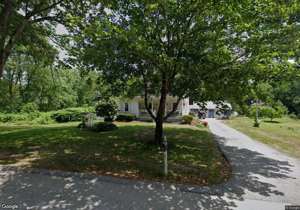
362 Leicester St Auburn, MA 01501
West Auburn NeighborhoodEstimated Value: $294,000 - $408,000
2
Beds
2
Baths
1,016
Sq Ft
$356/Sq Ft
Est. Value
About This Home
This home is located at 362 Leicester St, Auburn, MA 01501 and is currently estimated at $362,072, approximately $356 per square foot. 362 Leicester St is a home located in Worcester County with nearby schools including Auburn Senior High School and Shrewsbury Montessori School - Auburn Campus.
Ownership History
Date
Name
Owned For
Owner Type
Purchase Details
Closed on
Nov 5, 2018
Sold by
Mayo Ronald P and Mayo Pamela J
Bought by
Mayo Ronald P
Current Estimated Value
Purchase Details
Closed on
May 2, 2007
Sold by
Mayo Ronald P
Bought by
Mayo Pamela J and Mayo Ronald P
Purchase Details
Closed on
Aug 29, 1990
Sold by
Soponski Robert J
Bought by
Mayo Ronald P
Create a Home Valuation Report for This Property
The Home Valuation Report is an in-depth analysis detailing your home's value as well as a comparison with similar homes in the area
Home Values in the Area
Average Home Value in this Area
Purchase History
| Date | Buyer | Sale Price | Title Company |
|---|---|---|---|
| Mayo Ronald P | -- | -- | |
| Mayo Pamela J | -- | -- | |
| Mayo Ronald P | $82,500 | -- |
Source: Public Records
Mortgage History
| Date | Status | Borrower | Loan Amount |
|---|---|---|---|
| Previous Owner | Mayo Ronald P | $117,000 | |
| Previous Owner | Mayo Ronald P | $28,500 | |
| Previous Owner | Mayo Ronald P | $79,900 | |
| Previous Owner | Mayo Ronald P | $79,900 |
Source: Public Records
Tax History Compared to Growth
Tax History
| Year | Tax Paid | Tax Assessment Tax Assessment Total Assessment is a certain percentage of the fair market value that is determined by local assessors to be the total taxable value of land and additions on the property. | Land | Improvement |
|---|---|---|---|---|
| 2025 | $50 | $352,200 | $128,100 | $224,100 |
| 2024 | $4,675 | $313,100 | $124,500 | $188,600 |
| 2023 | $4,634 | $291,800 | $113,100 | $178,700 |
| 2022 | $4,454 | $264,800 | $113,100 | $151,700 |
| 2021 | $4,034 | $222,400 | $99,500 | $122,900 |
| 2020 | $3,882 | $215,900 | $99,500 | $116,400 |
| 2019 | $3,861 | $209,600 | $98,500 | $111,100 |
| 2018 | $3,601 | $195,300 | $91,900 | $103,400 |
| 2017 | $3,387 | $184,700 | $83,500 | $101,200 |
| 2016 | $3,240 | $179,100 | $85,900 | $93,200 |
| 2015 | $3,093 | $179,200 | $85,900 | $93,300 |
| 2014 | $3,026 | $175,000 | $81,700 | $93,300 |
Source: Public Records
Map
Nearby Homes
- Lot 2 Leicester St
- 37 Inwood Rd
- 30 Briarcliff Dr
- 3 Old Cart Rd
- 88 Wallace Ave
- 381 Oxford St N
- 707 Stafford St
- 19-20 Williams St
- 7 Sara Dr
- 28 Lorna Dr
- 16 Homestead Ave
- 88 Vine St
- 177 Oxford St N
- 19 Virginia Dr Unit 19
- 5 Main St
- 6 Ryans Way Unit 6
- 34 Rockland Rd
- 5 Virginia Dr Unit 5B
- 8 Garden St
- 3 Lancaster St
- 360 Leicester St
- 356 Leicester St
- 199 Rochdale St
- 197 Rochdale St
- 346 Leicester St
- 195 Rochdale St
- Lot 1 Leicester St
- 0 Leicester St
- 463 Leicester St
- 449451 463 Leicester St
- 449&451 Leicester St
- 341 Leicester St
- 191 Rochdale St
- 340 Leicester St
- 210 Rochdale St
- 401 Leicester St
- 337 Leicester St
- 2 Rotary Rd
- 189 Rochdale St
- 208 Rochdale St