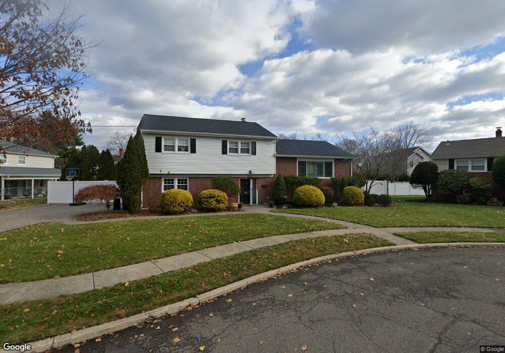
362 Ronald Ct Oradell, NJ 07649
Estimated Value: $973,000 - $1,085,000
3
Beds
3
Baths
2,206
Sq Ft
$472/Sq Ft
Est. Value
About This Home
This home is located at 362 Ronald Ct, Oradell, NJ 07649 and is currently estimated at $1,040,360, approximately $471 per square foot. 362 Ronald Ct is a home located in Bergen County with nearby schools including Oradell Elementary School, River Dell Middle School, and River Dell Regional High School.
Ownership History
Date
Name
Owned For
Owner Type
Purchase Details
Closed on
Nov 10, 2020
Sold by
Marino Kenneth and Marino Doris
Bought by
Young Travis and Young Abigail
Current Estimated Value
Home Financials for this Owner
Home Financials are based on the most recent Mortgage that was taken out on this home.
Original Mortgage
$595,237
Interest Rate
2.7%
Mortgage Type
FHA
Purchase Details
Closed on
Jul 17, 1998
Sold by
Episcopio Christina A
Bought by
Marino Kenneth and Marino Doris
Purchase Details
Closed on
Jul 22, 1995
Sold by
Episcopio Leonard
Bought by
Episcopio Christina
Create a Home Valuation Report for This Property
The Home Valuation Report is an in-depth analysis detailing your home's value as well as a comparison with similar homes in the area
Home Values in the Area
Average Home Value in this Area
Purchase History
| Date | Buyer | Sale Price | Title Company |
|---|---|---|---|
| Young Travis | $650,000 | First American Title Ins Co | |
| Young Travis | $650,000 | First American Title | |
| Marino Kenneth | $295,000 | -- | |
| Episcopio Christina | $143,000 | -- |
Source: Public Records
Mortgage History
| Date | Status | Borrower | Loan Amount |
|---|---|---|---|
| Previous Owner | Young Travis | $595,237 |
Source: Public Records
Tax History Compared to Growth
Tax History
| Year | Tax Paid | Tax Assessment Tax Assessment Total Assessment is a certain percentage of the fair market value that is determined by local assessors to be the total taxable value of land and additions on the property. | Land | Improvement |
|---|---|---|---|---|
| 2025 | $18,376 | $804,700 | $407,200 | $397,500 |
| 2024 | $17,929 | $675,100 | $322,000 | $353,100 |
| 2023 | $17,255 | $672,000 | $320,700 | $351,300 |
| 2022 | $17,255 | $645,300 | $308,200 | $337,100 |
| 2021 | $17,693 | $632,800 | $288,700 | $344,100 |
| 2020 | $17,437 | $631,100 | $286,200 | $344,900 |
| 2019 | $17,273 | $620,000 | $281,700 | $338,300 |
| 2018 | $17,019 | $620,000 | $283,200 | $336,800 |
| 2017 | $16,452 | $608,900 | $278,700 | $330,200 |
| 2016 | $15,329 | $515,100 | $254,200 | $260,900 |
| 2015 | $14,995 | $515,100 | $254,200 | $260,900 |
| 2014 | $14,340 | $515,100 | $254,200 | $260,900 |
Source: Public Records
Map
Nearby Homes
- 69 River Rd
- 171 Harrison St
- 133 Center St Unit E5
- 109 Center St
- 147 Pine Ave
- 171 Cleveland St
- 243 Main St
- 256 Stevens Ct
- 264 Demarest Ave
- 590 Center St Unit 1
- 274 Milford Ave
- 507 James St
- 627 Concord St
- 314 Hirschfeld Place
- 5 Lawrence Ave
- 608 Fermery Dr
- 377 New Milford Ave
- 211 Madison Ave
- 502 Prospect Ave
- 680 Soldier Hill Rd
- 353 Hasbrouck Blvd
- 367 Grant Ave
- 356 Ronald Ct
- 355 Grant Ave
- 361 Ronald Ct
- 353 Grant Ave
- 361 Hasbrouck Blvd
- 355 Ronald Ct
- 350 Hasbrouck Blvd
- 369 Hasbrouck Blvd
- 370 Bergen Blvd
- 358 Grant Ave
- 360 Grant Ave
- 358 Hasbrouck Blvd
- 379 Grant Ave
- 339 Beechwood Rd
- 364 Hasbrouck Blvd
- 327 Merritt Dr
- 362 Richardson Ct
- 356 Richardson Ct