Estimated Value: $361,295 - $466,000
3
Beds
2
Baths
2,904
Sq Ft
$137/Sq Ft
Est. Value
About This Home
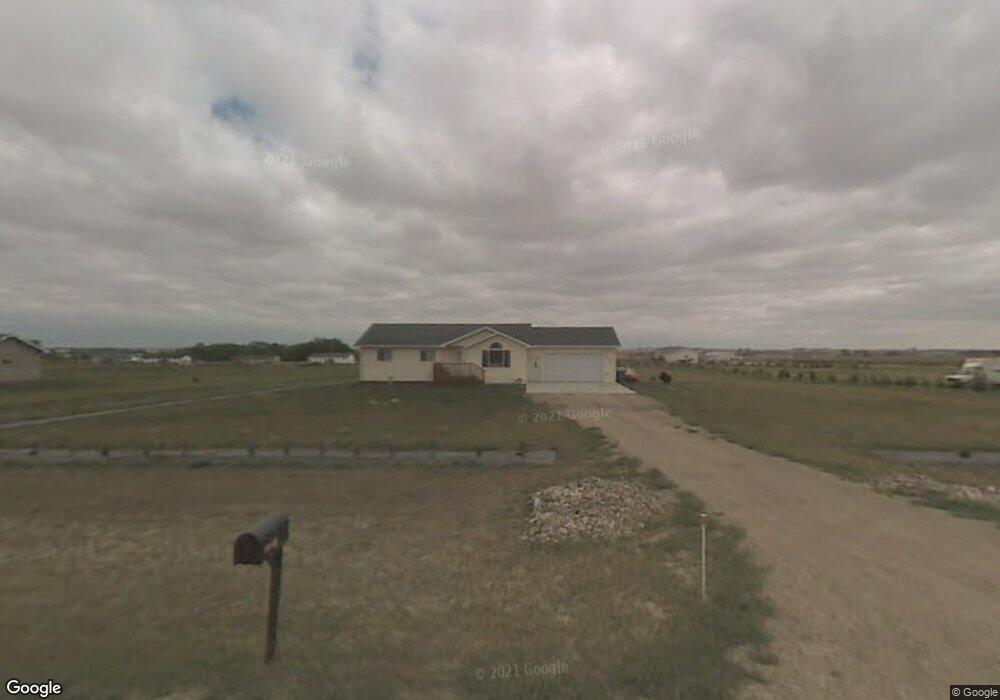
This home is located at 3620 10th St NE, Minot, ND 58703 and is currently estimated at $397,324, approximately $136 per square foot. 3620 10th St NE is a home located in Ward County with nearby schools including Lewis & Clark Elementary School, Erik Ramstad Middle School, and Central Campus School.
Ownership History
Date
Name
Owned For
Owner Type
Purchase Details
Closed on
Sep 15, 2006
Sold by
Heidrich Jeff and Heidrich Mary
Bought by
Peckham Ted D and Peckham Lisa L
Current Estimated Value
Home Financials for this Owner
Home Financials are based on the most recent Mortgage that was taken out on this home.
Original Mortgage
$143,920
Outstanding Balance
$86,571
Interest Rate
6.7%
Mortgage Type
New Conventional
Estimated Equity
$310,753
Create a Home Valuation Report for This Property
The Home Valuation Report is an in-depth analysis detailing your home's value as well as a comparison with similar homes in the area
Home Values in the Area
Average Home Value in this Area
Purchase History
| Date | Buyer | Sale Price | Title Company |
|---|---|---|---|
| Peckham Ted D | -- | None Available |
Source: Public Records
Mortgage History
| Date | Status | Borrower | Loan Amount |
|---|---|---|---|
| Open | Peckham Ted D | $143,920 |
Source: Public Records
Tax History Compared to Growth
Tax History
| Year | Tax Paid | Tax Assessment Tax Assessment Total Assessment is a certain percentage of the fair market value that is determined by local assessors to be the total taxable value of land and additions on the property. | Land | Improvement |
|---|---|---|---|---|
| 2024 | $1,140 | $159,500 | $30,500 | $129,000 |
| 2023 | $1,498 | $162,000 | $30,500 | $131,500 |
| 2022 | $1,938 | $169,000 | $35,000 | $134,000 |
| 2021 | $1,459 | $152,000 | $35,000 | $117,000 |
| 2020 | $1,573 | $146,500 | $35,000 | $111,500 |
| 2019 | $1,458 | $139,000 | $30,000 | $109,000 |
| 2018 | $1,536 | $137,500 | $30,000 | $107,500 |
| 2017 | $1,579 | $143,500 | $35,000 | $108,500 |
| 2016 | $1,683 | $160,500 | $7,200 | $153,300 |
| 2015 | $1,437 | $160,500 | $0 | $0 |
| 2014 | $1,437 | $157,400 | $0 | $0 |
Source: Public Records
Map
Nearby Homes
- 38 Mulberry Loop NE
- 3425 8th St NE
- 916 34th Ave NE
- 73 Olive Tree Cir NE
- 138 Mulberry Loop
- 134 Mulberry Loop
- 201 45th Ave Unit 225 45th Ave. NE & T
- 1505 30th Ave
- 4539 N Broadway
- 2731 N Broadway
- 0 NW Corner 4th Ave and 27th St Unit 240530
- 2621 4th St NW
- 3001 NE 27th St Unit Lot 3 Block 3
- 3001 NE 27th St Unit Lot 1 Block 1
- 3001 NE 27th St
- 2524 5th St NW
- 3801 N Broadway
- 605 N Broadway
- 2900 NE 27th St
- 3630 N Broadway
- 3720 10th St NE
- 1001 36th Ave NE
- 3701 10th St NE
- 3621 10th St NE
- 3721 10th St NE
- 1000 39th Ave NE
- 1101 36th Ave NE
- 901 36th Ave NE
- 3801 10th St NE
- 1 Mulberry Loop
- 1 Mulberry Loop Unit Stonebridge Farms
- 5 Mulberry Loop NE Unit Stonebridge Farms
- 5 Mulberry Loop NE
- 9 Mulberry Loop NE
- 1201 36th Ave NE
- 1020 39th Ave NE
- 13 Mulberry Loop NE Unit Stonebridge Farms
- 13 Mulberry Loop NE
- 17 Mulberry Loop NE
- 3611 13th St NE