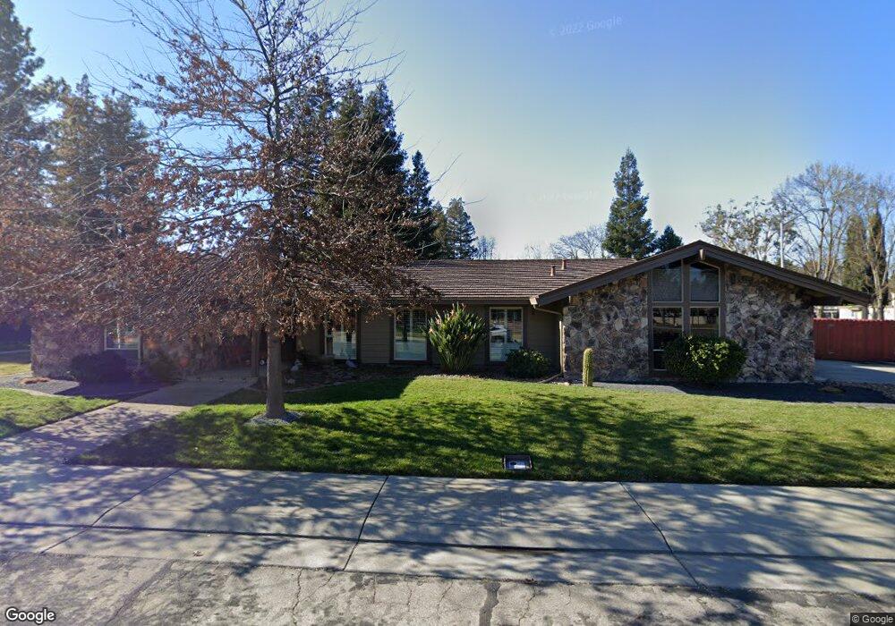
3620 Appleton Ct Stockton, CA 95219
Lincoln Village West NeighborhoodEstimated Value: $580,309 - $676,000
4
Beds
3
Baths
2,499
Sq Ft
$247/Sq Ft
Est. Value
About This Home
This home is located at 3620 Appleton Ct, Stockton, CA 95219 and is currently estimated at $617,327, approximately $247 per square foot. 3620 Appleton Ct is a home located in San Joaquin County with nearby schools including Mable Barron, Sierra Middle School, and Lincoln High School.
Ownership History
Date
Name
Owned For
Owner Type
Purchase Details
Closed on
May 3, 2011
Sold by
Caldwell Melvin E and Caldwell Salve A
Bought by
Caldwell Melvin E and Caldwell Salve A
Current Estimated Value
Purchase Details
Closed on
Nov 13, 1995
Sold by
Bartles Terry D and Bartles Linda J
Bought by
Caldwell Melvin E and Caldwell Salve A
Home Financials for this Owner
Home Financials are based on the most recent Mortgage that was taken out on this home.
Original Mortgage
$115,000
Outstanding Balance
$1,606
Interest Rate
7.58%
Estimated Equity
$615,721
Create a Home Valuation Report for This Property
The Home Valuation Report is an in-depth analysis detailing your home's value as well as a comparison with similar homes in the area
Home Values in the Area
Average Home Value in this Area
Purchase History
| Date | Buyer | Sale Price | Title Company |
|---|---|---|---|
| Caldwell Melvin E | -- | None Available | |
| Caldwell Melvin E | $215,000 | Alliance Title Company |
Source: Public Records
Mortgage History
| Date | Status | Borrower | Loan Amount |
|---|---|---|---|
| Open | Caldwell Melvin E | $115,000 |
Source: Public Records
Tax History
| Year | Tax Paid | Tax Assessment Tax Assessment Total Assessment is a certain percentage of the fair market value that is determined by local assessors to be the total taxable value of land and additions on the property. | Land | Improvement |
|---|---|---|---|---|
| 2025 | $4,436 | $357,143 | $99,665 | $257,478 |
| 2024 | $4,277 | $350,141 | $97,711 | $252,430 |
| 2023 | $4,266 | $343,277 | $95,796 | $247,481 |
| 2022 | $3,905 | $336,547 | $93,918 | $242,629 |
| 2021 | $3,853 | $329,949 | $92,077 | $237,872 |
| 2020 | $3,852 | $326,566 | $91,133 | $235,433 |
| 2019 | $3,791 | $320,164 | $89,347 | $230,817 |
| 2018 | $3,727 | $313,888 | $87,596 | $226,292 |
| 2017 | $3,650 | $307,734 | $85,879 | $221,855 |
| 2016 | $3,613 | $301,701 | $84,196 | $217,505 |
| 2014 | $3,526 | $291,351 | $81,307 | $210,044 |
Source: Public Records
Map
Nearby Homes
- 3532 W Benjamin Holt Dr
- 6620 Cumberland Place
- 3533 Harpers Ferry Dr
- 3503 Harpers Ferry Dr
- 3708 N Merrimac Cir
- 3702 W Benjamin Holt Dr Unit 24
- 6816 Cumberland Place
- 3722 W Benjamin Holt Dr Unit 16
- 3614 S Monitor Cir
- 3768 W Benjamin Holt Dr Unit 13
- 3772 W Benjamin Holt Dr Unit 112
- 6836 Cumberland Place
- 3790 W Benjamin Holt Dr Unit 6
- 6116 Herndon Place
- 3123 Sheridan Way
- 4233 Five Mile Dr
- 6869 Sumter Quay Cir
- 3928 Waynesboro Ct Unit 41
- 6713 Embarcadero Dr Unit 29
- 4044 Fort Donelson Dr
- 3624 Appleton Way
- 3618 Appleton Ct
- 3534 Appleton Ct
- 3628 Appleton Way
- 3567 Appleton Way
- 3565 Appleton Way
- 3623 Appleton Way
- 3520 Appleton Way
- 3541 Appleton Way
- 3625 Appleton Way
- 3563 Appleton Way
- 3636 Appleton Way
- 3543 Appleton Way Unit 20
- 3602 Appleton Ct
- 3610 Appleton Ct
- 3627 Appleton Way
- 3561 Appleton Way
- 3614 Appleton Ct
- 6642 Cumberland Place
- 6634 Cumberland Place
Your Personal Tour Guide
Ask me questions while you tour the home.