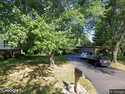
3620 Burning Tree Dr Bloomfield Hills, MI 48302
Estimated Value: $664,748 - $729,000
4
Beds
3
Baths
2,095
Sq Ft
$332/Sq Ft
Est. Value
About This Home
This home is located at 3620 Burning Tree Dr, Bloomfield Hills, MI 48302 and is currently estimated at $696,187, approximately $332 per square foot. 3620 Burning Tree Dr is a home located in Oakland County with nearby schools including Way Elementary School, South Hills Middle School, and Bloomfield Hills High School.
Ownership History
Date
Name
Owned For
Owner Type
Purchase Details
Closed on
Sep 8, 2023
Sold by
Rugienius Liuda and Rugienius Algis J
Bought by
Rugienius Family Revocable Living Trust and Rugienius
Current Estimated Value
Purchase Details
Closed on
Oct 26, 2012
Sold by
Rugienius Algis J and Rugienius Linda M
Bought by
Rugienius Algis J and Rugienius Liuda M
Home Financials for this Owner
Home Financials are based on the most recent Mortgage that was taken out on this home.
Original Mortgage
$105,300
Interest Rate
3.38%
Mortgage Type
New Conventional
Purchase Details
Closed on
Mar 28, 1997
Sold by
Rugienius Algis J
Bought by
Rugienius Trust
Create a Home Valuation Report for This Property
The Home Valuation Report is an in-depth analysis detailing your home's value as well as a comparison with similar homes in the area
Home Values in the Area
Average Home Value in this Area
Purchase History
| Date | Buyer | Sale Price | Title Company |
|---|---|---|---|
| Rugienius Family Revocable Living Trust | -- | None Listed On Document | |
| Rugienius Algis J | -- | First American Title Ins | |
| Rugienius Trust | -- | -- |
Source: Public Records
Mortgage History
| Date | Status | Borrower | Loan Amount |
|---|---|---|---|
| Previous Owner | Rugienius Algis J | $105,300 |
Source: Public Records
Tax History Compared to Growth
Tax History
| Year | Tax Paid | Tax Assessment Tax Assessment Total Assessment is a certain percentage of the fair market value that is determined by local assessors to be the total taxable value of land and additions on the property. | Land | Improvement |
|---|---|---|---|---|
| 2024 | $4,058 | $323,880 | $0 | $0 |
| 2023 | $3,927 | $304,700 | $0 | $0 |
| 2022 | $7,380 | $274,900 | $0 | $0 |
| 2021 | $7,327 | $239,140 | $0 | $0 |
| 2020 | $3,592 | $239,980 | $0 | $0 |
| 2019 | $6,895 | $230,300 | $0 | $0 |
| 2018 | $6,926 | $223,760 | $0 | $0 |
| 2017 | $6,876 | $220,430 | $0 | $0 |
| 2016 | $6,889 | $217,330 | $0 | $0 |
| 2015 | -- | $200,300 | $0 | $0 |
| 2014 | -- | $197,840 | $0 | $0 |
| 2011 | -- | $166,350 | $0 | $0 |
Source: Public Records
Map
Nearby Homes
- 371 Pine Ridge Dr
- 163 Manorwood Dr
- 3531 Brookside Dr
- 245 Chestnut Cir
- 1350 Orchard Ridge Rd
- 3403 Chickering Ln
- 3648 Shallow Brook Dr
- 3627 Shallow Brook Dr
- 830 N Pemberton Rd
- 4081 Nearbrook Rd
- 3281 Chickering Ln
- 95 W Hickory Grove Rd
- 832 N Pemberton Rd
- 164 W Hickory Grove Rd
- 559 Barrington Park
- 4061 Willoway Place Dr Unit 4
- 136 E Hickory Grove Rd Unit B6
- 801 W Long Lake Rd Unit 3
- 801 W Long Lake Rd Unit 4
- 173 Timber Trace Ln Unit 27
- 3620 Burning Tree Dr
- 3630 Burning Tree Dr
- 3610 Burning Tree Dr
- 3621 Burning Tree Dr
- 3636 Burning Tree Dr
- 3530 Lahser Rd
- 561 Woodway Ct
- 3641 Burning Tree Dr
- 3644 Burning Tree Dr
- 3601 Lahser Rd
- 3640 Holly Ln
- 558 Woodway Ct
- 3635 Lahser Rd
- 571 Woodway Ct
- VAC Lake Point Ln
- 3553 Lahser Rd
- 3652 Burning Tree Dr
- 3637 Lahser Rd
- 568 Woodway Ct
- 575 Woodway Ct