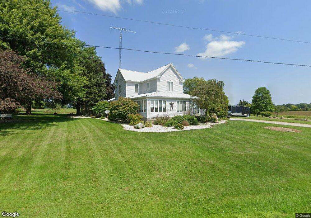
3620 Harding Hwy W Marion, OH 43302
Estimated Value: $246,000 - $316,000
3
Beds
2
Baths
2,581
Sq Ft
$110/Sq Ft
Est. Value
About This Home
This home is located at 3620 Harding Hwy W, Marion, OH 43302 and is currently estimated at $283,867, approximately $109 per square foot. 3620 Harding Hwy W is a home located in Marion County with nearby schools including Ridgedale Elementary School and Ridgedale Junior/Senior High School.
Ownership History
Date
Name
Owned For
Owner Type
Purchase Details
Closed on
Oct 10, 2020
Sold by
Kennedy Thomas P
Bought by
Wall Tyler E and Wall Brittany
Current Estimated Value
Home Financials for this Owner
Home Financials are based on the most recent Mortgage that was taken out on this home.
Original Mortgage
$138,000
Outstanding Balance
$122,744
Interest Rate
2.9%
Mortgage Type
New Conventional
Estimated Equity
$161,123
Purchase Details
Closed on
Apr 18, 2018
Sold by
Kennedy Beverly Ann and Kennedy Thomas P
Bought by
Kennedy Beverly Ann and Kennedy Thomas P
Create a Home Valuation Report for This Property
The Home Valuation Report is an in-depth analysis detailing your home's value as well as a comparison with similar homes in the area
Home Values in the Area
Average Home Value in this Area
Purchase History
| Date | Buyer | Sale Price | Title Company |
|---|---|---|---|
| Wall Tyler E | $94,000 | None Available | |
| Wall Tyler E | $94,000 | None Available | |
| Kennedy Beverly Ann | -- | None Available |
Source: Public Records
Mortgage History
| Date | Status | Borrower | Loan Amount |
|---|---|---|---|
| Open | Wall Tyler E | $138,000 |
Source: Public Records
Tax History Compared to Growth
Tax History
| Year | Tax Paid | Tax Assessment Tax Assessment Total Assessment is a certain percentage of the fair market value that is determined by local assessors to be the total taxable value of land and additions on the property. | Land | Improvement |
|---|---|---|---|---|
| 2024 | $2,091 | $61,790 | $11,120 | $50,670 |
| 2023 | $2,091 | $61,790 | $11,120 | $50,670 |
| 2022 | $2,092 | $61,790 | $11,120 | $50,670 |
| 2021 | $1,708 | $45,700 | $10,020 | $35,680 |
| 2020 | $244 | $45,700 | $10,020 | $35,680 |
| 2019 | $1,530 | $42,940 | $7,260 | $35,680 |
| 2018 | $1,537 | $46,720 | $5,810 | $40,910 |
| 2017 | $1,460 | $46,720 | $5,810 | $40,910 |
| 2016 | $1,450 | $46,720 | $5,810 | $40,910 |
| 2015 | $1,444 | $45,810 | $5,190 | $40,620 |
| 2014 | $1,447 | $45,810 | $5,190 | $40,620 |
| 2012 | $1,581 | $47,540 | $4,520 | $43,020 |
Source: Public Records
Map
Nearby Homes
- 3217 Harding Hwy W
- 1890 Bumford Rd
- 2109 Harding Hwy W
- 3422 Hillman Ford Rd
- 523 Thompson St
- 355 Lee St
- 383 Brentwood Dr
- 434 Scranton Ave
- 690 Meadow St
- 531 Toledo Ave
- 641 Blake Ave
- 472 Clinton St
- 520 Toledo Ave
- 678 Marshall St
- 2396 Marion-Upper Sandusky Rd
- 473 Avondale Ave
- 468 Avondale Ave
- 407 Latourette St
- 226 S Green St
- 213 Sharp St
- 3634 Harding Hwy W
- 3685 Harding Hwy W
- 3509 Harding Hwy W
- 3445 Harding Hwy W
- 3375 Harding Hwy W
- 1609 Prosp Upper Sand Rd N
- 1609 Prospect Upper Sandusky Rd N
- 1593 Prosp Upper Sand Rd N
- 1625 Prosp Upper Sand Rd N
- 1625 Prospect Upper Sandusky Rd N
- 1625 Prospect-Upper Sandusky Rd N
- 1641 Prosp Upper Sand Rd N
- 1657 Prosp Upper Sand Rd N
- 1673 Prosp Upper Sand Rd N
- 1689 Prosp Upper Sand Rd N
- 1673 Prospect-Upper Sandusky Rd N
- 1673 Prospect Upper Sandusky Rd N
- 1610 Prosp Upper Sand Rd N
- 1610 Prospect Upper Sandusky Rd N