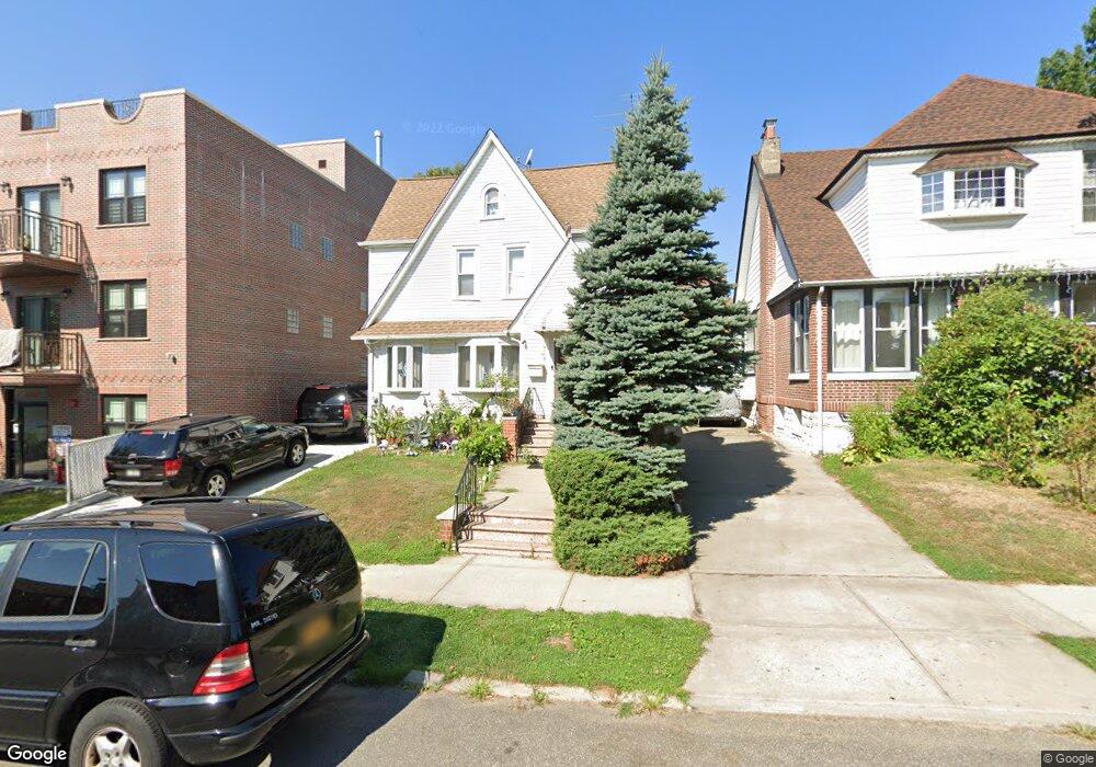
3622 172nd St Flushing, NY 11358
Flushing NeighborhoodEstimated Value: $1,005,776 - $1,238,000
--
Bed
--
Bath
1,378
Sq Ft
$808/Sq Ft
Est. Value
About This Home
This home is located at 3622 172nd St, Flushing, NY 11358 and is currently estimated at $1,113,194, approximately $807 per square foot. 3622 172nd St is a home located in Queens County with nearby schools including P.S. 32 - State Street, I.S. 25 Adrien Block, and Francis Lewis High School.
Ownership History
Date
Name
Owned For
Owner Type
Purchase Details
Closed on
Apr 25, 2014
Sold by
Hatzistefanidis Ioanna and Hatzistefanidis Konstantinos
Bought by
Hatzistefanidis Ioanna
Current Estimated Value
Purchase Details
Closed on
Sep 24, 1998
Sold by
Cheng Stella
Bought by
Hatzistefanidis Ioanna and Hatzistefanidis Konstantinos
Home Financials for this Owner
Home Financials are based on the most recent Mortgage that was taken out on this home.
Original Mortgage
$199,500
Interest Rate
6.68%
Create a Home Valuation Report for This Property
The Home Valuation Report is an in-depth analysis detailing your home's value as well as a comparison with similar homes in the area
Home Values in the Area
Average Home Value in this Area
Purchase History
| Date | Buyer | Sale Price | Title Company |
|---|---|---|---|
| Hatzistefanidis Ioanna | -- | -- | |
| Hatzistefanidis Ioanna | $285,000 | -- |
Source: Public Records
Mortgage History
| Date | Status | Borrower | Loan Amount |
|---|---|---|---|
| Previous Owner | Hatzistefanidis Ioanna | $199,500 |
Source: Public Records
Tax History Compared to Growth
Tax History
| Year | Tax Paid | Tax Assessment Tax Assessment Total Assessment is a certain percentage of the fair market value that is determined by local assessors to be the total taxable value of land and additions on the property. | Land | Improvement |
|---|---|---|---|---|
| 2025 | $9,042 | $49,205 | $16,780 | $32,425 |
| 2024 | $9,054 | $46,420 | $18,834 | $27,586 |
| 2023 | $8,515 | $43,793 | $15,446 | $28,347 |
| 2022 | $8,098 | $60,780 | $20,400 | $40,380 |
| 2021 | $8,023 | $60,900 | $20,400 | $40,500 |
| 2020 | $7,864 | $54,780 | $20,400 | $34,380 |
| 2019 | $5,761 | $54,660 | $20,400 | $34,260 |
| 2018 | $7,142 | $36,494 | $13,848 | $22,646 |
| 2017 | $6,835 | $35,001 | $14,201 | $20,800 |
| 2016 | $6,687 | $35,001 | $14,201 | $20,800 |
| 2015 | $3,763 | $34,170 | $16,745 | $17,425 |
| 2014 | $3,763 | $32,236 | $15,350 | $16,886 |
Source: Public Records
Map
Nearby Homes
- 3639 171st St Unit 26
- 170-20 Crocheron Ave Unit 206
- 170-06 Crocheron Ave Unit 5B
- 170-06 Crocheron Ave Unit 1F
- 35-20 Utopia Pkwy
- 36-20 190th St
- 3641 169th St Unit 2F
- 4005 Utopia Pkwy
- 190-05 39th Ave Unit 140
- 190-05 39th Ave Unit 142
- 35-63 168th St
- 40-12 190th St
- 4022 190th St
- 167-10 Crocheron Ave Unit 1F
- 167-10 Crocheron Ave Unit 6M
- 191-09 39th Ave Unit Lower
- 190-12 Station Rd
- 191-9 39th Ave Unit 164
- 35-73 167th St
- 192-12 39th Ave Unit 1
- 36-22 172nd St
- 36-22 172nd St
- 36-26 172nd St
- 36-26 172nd St Unit 1st Fl
- 36-26 172nd St Unit 3F
- 36-26 172nd St Unit 2F
- 36-26 172nd St Unit 1R
- 36-26 172nd St Unit 1F
- 3626 172nd St
- 3618 172nd St
- 36-18 172nd St
- 3630 172nd St
- 36-34 172nd St
- 36-34 172nd St Unit 81
- 3630 172nd St Unit 87
- 3630 172nd St Unit 96
- 3630 172nd St Unit 93
- 3630 172nd St Unit 91
- 3630 172nd St Unit 88
- 3630 172nd St Unit 83