Estimated Value: $73,000 - $289,000
--
Bed
1
Bath
1,290
Sq Ft
$121/Sq Ft
Est. Value
About This Home
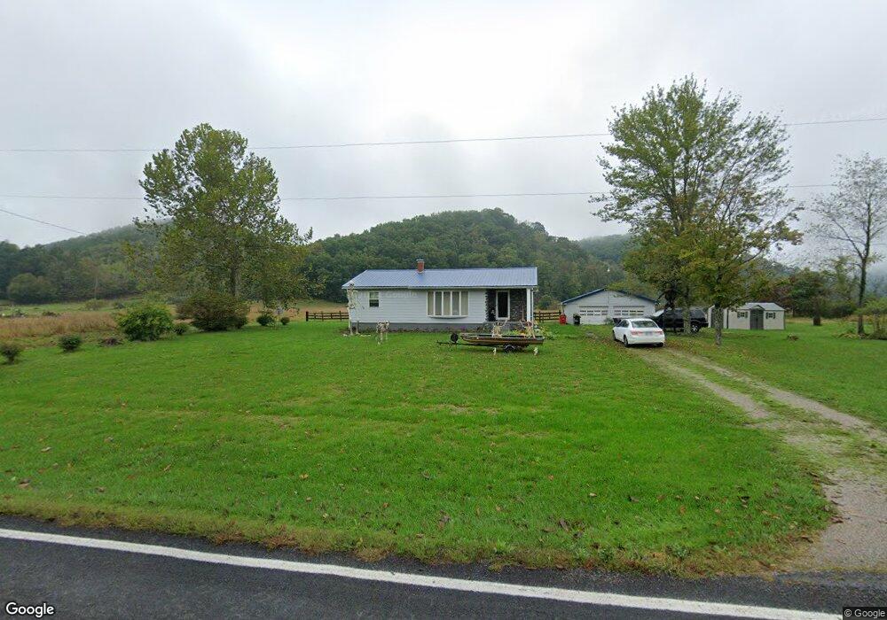
This home is located at 36222 State Route 327, Ray, OH 45672 and is currently estimated at $155,988, approximately $120 per square foot. 36222 State Route 327 is a home located in Vinton County with nearby schools including Vinton County High School.
Ownership History
Date
Name
Owned For
Owner Type
Purchase Details
Closed on
Apr 16, 2021
Sold by
Barker Richard L and Barker Linda S
Bought by
Barker Sean K
Current Estimated Value
Home Financials for this Owner
Home Financials are based on the most recent Mortgage that was taken out on this home.
Original Mortgage
$54,150
Outstanding Balance
$40,648
Interest Rate
3%
Mortgage Type
New Conventional
Estimated Equity
$115,340
Purchase Details
Closed on
Apr 27, 2019
Sold by
Buskirk David L
Bought by
Barker Richard L and Barker Linda S
Purchase Details
Closed on
Dec 19, 2018
Sold by
Estate Of Sarah I Buskirk
Bought by
Buskirk David L
Create a Home Valuation Report for This Property
The Home Valuation Report is an in-depth analysis detailing your home's value as well as a comparison with similar homes in the area
Home Values in the Area
Average Home Value in this Area
Purchase History
| Date | Buyer | Sale Price | Title Company |
|---|---|---|---|
| Barker Sean K | $57,000 | None Available | |
| Barker Richard L | $42,500 | None Available | |
| Buskirk David L | -- | None Available |
Source: Public Records
Mortgage History
| Date | Status | Borrower | Loan Amount |
|---|---|---|---|
| Open | Barker Sean K | $54,150 |
Source: Public Records
Tax History Compared to Growth
Tax History
| Year | Tax Paid | Tax Assessment Tax Assessment Total Assessment is a certain percentage of the fair market value that is determined by local assessors to be the total taxable value of land and additions on the property. | Land | Improvement |
|---|---|---|---|---|
| 2024 | $1,086 | $30,580 | $5,170 | $25,410 |
| 2023 | $916 | $23,440 | $3,590 | $19,850 |
| 2022 | $919 | $23,440 | $3,590 | $19,850 |
| 2021 | $915 | $23,440 | $3,590 | $19,850 |
| 2020 | $835 | $20,230 | $3,120 | $17,110 |
| 2019 | $834 | $20,230 | $3,120 | $17,110 |
| 2018 | $458 | $20,230 | $3,120 | $17,110 |
| 2017 | $397 | $18,420 | $2,840 | $15,580 |
| 2016 | $396 | $18,420 | $2,840 | $15,580 |
| 2015 | $393 | $19,430 | $2,630 | $16,800 |
| 2014 | $393 | $19,430 | $2,630 | $16,800 |
Source: Public Records
Map
Nearby Homes
- 36266 State Route 327
- 36188 State Route 327
- 36330 State Route 327
- 36372 State Route 327
- 51995 W Junction Rd
- 35930 State Route 327
- 52369 Clary Rd
- 36636 Woodruff Rd
- 52423 Clary Rd
- 52463 Clary Rd
- 52467 Clary Rd
- 52960 Clary Rd
- 51583 W Junction Rd
- 35643 State Route 327
- 35643 State Route 327
- 3600 Scout Camp Rd
- 51560 W Junction Rd
- 51560 W Junction Rd
- 36556 State Route 327
- 36536 State Route 327