Estimated Value: $237,000 - $399,000
3
Beds
3
Baths
2,350
Sq Ft
$124/Sq Ft
Est. Value
About This Home
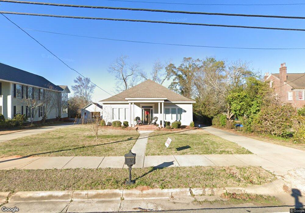
This home is located at 363 E Broad St, Ozark, AL 36360 and is currently estimated at $291,193, approximately $123 per square foot. 363 E Broad St is a home located in Dale County with nearby schools including Lisenby Primary School, Mixon Intermediate School, and D. A. Smith Middle School.
Ownership History
Date
Name
Owned For
Owner Type
Purchase Details
Closed on
Jan 12, 2021
Sold by
Johnson Benjamin Alden and Johnson Haley Wages
Bought by
Teeter Terry W and Teeter Paula M
Current Estimated Value
Home Financials for this Owner
Home Financials are based on the most recent Mortgage that was taken out on this home.
Original Mortgage
$11,222
Interest Rate
3.05%
Mortgage Type
VA
Purchase Details
Closed on
Aug 1, 2018
Sold by
Bynum Elizabeth C and Etress Daniel
Bought by
Wages Johnson Benjamin Alden and Wages Johnson Haley
Purchase Details
Closed on
Dec 30, 2015
Sold by
Roe Jacob M and Roe Mandy N
Bought by
Bynum Elizabeth C
Create a Home Valuation Report for This Property
The Home Valuation Report is an in-depth analysis detailing your home's value as well as a comparison with similar homes in the area
Purchase History
| Date | Buyer | Sale Price | Title Company |
|---|---|---|---|
| Teeter Terry W | $245,000 | None Available | |
| Wages Johnson Benjamin Alden | $172,000 | None Available | |
| Bynum Elizabeth C | $160,000 | -- |
Source: Public Records
Mortgage History
| Date | Status | Borrower | Loan Amount |
|---|---|---|---|
| Previous Owner | Teeter Terry W | $11,222 |
Source: Public Records
Tax History
| Year | Tax Paid | Tax Assessment Tax Assessment Total Assessment is a certain percentage of the fair market value that is determined by local assessors to be the total taxable value of land and additions on the property. | Land | Improvement |
|---|---|---|---|---|
| 2024 | $1,220 | $25,040 | $1,320 | $23,720 |
| 2023 | $1,265 | $21,760 | $1,320 | $20,440 |
| 2022 | $751 | $15,940 | $680 | $15,260 |
| 2021 | $696 | $14,860 | $1,320 | $13,540 |
| 2020 | $696 | $15,640 | $1,320 | $14,320 |
| 2019 | $736 | $15,640 | $1,320 | $14,320 |
| 2018 | $771 | $15,260 | $1,320 | $13,940 |
| 2017 | $771 | $15,260 | $1,320 | $13,940 |
| 2016 | $691 | $14,760 | $1,320 | $13,440 |
| 2015 | $734 | $15,600 | $1,320 | $14,280 |
| 2014 | $722 | $15,360 | $1,320 | $14,040 |
| 2013 | $715 | $15,360 | $1,320 | $14,040 |
Source: Public Records
Map
Nearby Homes
- 385 E Broad St
- 332 E Broad St
- 496 E Broad St
- 546 E Broad St
- 373 E College St
- 0 Pierces Station 46c Unit 207554
- 0 Pierces Station 45c Unit 207553
- 120 N Court Square
- 479 N Union Ave
- 174 Roosevelt Ave
- 447 N Union Ave
- TBD N Merrick Ave
- 376 Northwood Dr
- 480 N Merrick Ave
- 1028 E Eufaula St
- 216 Simmons Ave
- 254 Newton Ave
- 602 N Union Ave
- 645 N Union Ave
- 535 Northwood Dr
- 363 E Broad St
- 349 E Broad St
- 331 E Broad St
- 403 E Broad St
- 313 E Broad St
- 350 E Broad St
- 384 E Broad St
- 421 E Broad St
- 416 E Broad St
- 416 E Broad St
- 301 E Broad St
- 285 E Broad St
- 298 E Broad St
- 146 Carroll Ave
- 146 Carroll Ave
- 440 E Broad St
- 461 E Broad St
- 139 Carroll Ave
- 160 Carroll Ave
- 276 E Broad St