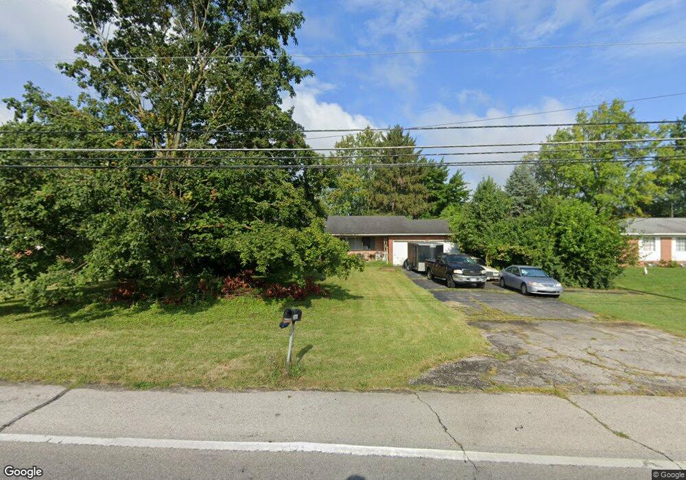
363 Galloway Rd Galloway, OH 43119
Estimated Value: $324,811 - $361,000
2
Beds
2
Baths
1,666
Sq Ft
$206/Sq Ft
Est. Value
About This Home
This home is located at 363 Galloway Rd, Galloway, OH 43119 and is currently estimated at $342,953, approximately $205 per square foot. 363 Galloway Rd is a home located in Franklin County with nearby schools including Galloway Ridge Intermediate School, Darby Woods Elementary School, and Pleasant View Middle School.
Ownership History
Date
Name
Owned For
Owner Type
Purchase Details
Closed on
Dec 19, 2025
Sold by
Central City Solutions Llc
Bought by
Jones Bobbi Lee
Current Estimated Value
Purchase Details
Closed on
Nov 25, 2025
Sold by
Paiz Carole M
Bought by
Central City Solutions Llc
Purchase Details
Closed on
Aug 31, 2001
Sold by
Duvall Thomas G
Bought by
Boyd John and Paiz Carole M
Home Financials for this Owner
Home Financials are based on the most recent Mortgage that was taken out on this home.
Original Mortgage
$104,000
Interest Rate
7.03%
Mortgage Type
Purchase Money Mortgage
Purchase Details
Closed on
Jul 22, 1988
Bought by
Duvall Thomas G
Create a Home Valuation Report for This Property
The Home Valuation Report is an in-depth analysis detailing your home's value as well as a comparison with similar homes in the area
Home Values in the Area
Average Home Value in this Area
Purchase History
| Date | Buyer | Sale Price | Title Company |
|---|---|---|---|
| Jones Bobbi Lee | $208,000 | Axxis Title Agency | |
| Central City Solutions Llc | $88,000 | Axxis Title Agency | |
| Boyd John | $130,000 | -- | |
| Duvall Thomas G | -- | -- |
Source: Public Records
Mortgage History
| Date | Status | Borrower | Loan Amount |
|---|---|---|---|
| Previous Owner | Boyd John | $104,000 |
Source: Public Records
Tax History
| Year | Tax Paid | Tax Assessment Tax Assessment Total Assessment is a certain percentage of the fair market value that is determined by local assessors to be the total taxable value of land and additions on the property. | Land | Improvement |
|---|---|---|---|---|
| 2025 | $4,209 | $93,560 | $17,750 | $75,810 |
| 2024 | $4,209 | $93,560 | $17,750 | $75,810 |
| 2023 | $4,017 | $93,555 | $17,745 | $75,810 |
| 2022 | $4,052 | $66,300 | $10,190 | $56,110 |
| 2021 | $4,117 | $66,300 | $10,190 | $56,110 |
| 2020 | $4,099 | $66,300 | $10,190 | $56,110 |
| 2019 | $4,125 | $58,280 | $8,860 | $49,420 |
| 2018 | $3,909 | $58,280 | $8,860 | $49,420 |
| 2017 | $4,361 | $58,280 | $8,860 | $49,420 |
| 2016 | $3,705 | $50,720 | $12,600 | $38,120 |
| 2015 | $3,705 | $50,720 | $12,600 | $38,120 |
| 2014 | $3,708 | $50,720 | $12,600 | $38,120 |
| 2013 | $1,931 | $53,375 | $13,265 | $40,110 |
Source: Public Records
Map
Nearby Homes
- 5711 Greendale Dr
- 5843 Tully Cross Dr
- 5965 Tully Cross Dr
- 5919 Bucksburn Dr
- 5910 Bucksburn Dr
- 296 Rye St Unit Lot 48
- 320 Rye St Unit Lot 51
- 332 Rye St Unit Lot 53
- 325 Rye St Unit Lot 123
- 286 Fortune Dr Unit Lot 145
- 294 Fortune Dr Unit Lot 144
- 310 Fortune Dr Unit Lot 142
- 281 Fortune Dr Unit Lot 114
- 289 Fortune Dr Unit Lot 113
- 628 Penn St Unit 67
- 6173 Streaming Ave Unit 192
- 683 Perilous Place Unit 3
- 5757 Silver Spurs Ln
- 417 Pamlico St Unit JK2
- 516 Pamlico St
- 355 Galloway Rd
- 309 Rockbrook Crossing Ct
- 285 Galloway Rd
- 314 Rockbrook Crossing Ct Unit 74
- 314 Rockbrook Crossing Ct
- 303 Rockbrook Crossing Ct
- 5802 Pepperwood Ct Unit 5804
- 5802-5804 Pepperwood Ct
- 5809 Pepperwood Ct Unit 5811
- 297 Rockbrook Crossing Ct
- 297 Rockbrook Crossing Ct Unit 77
- 306 Rockbrook Crossing Ct
- 267 Galloway Rd
- 298 Rockbrook Crossing Ct
- 291 Rockbrook Crossing Ct Unit 78
- 381 Galloway Rd
- 290 Rockbrook Crossing Ct
- 5792 & 57 Ivy Green Ct
- 5792&5794 Ivy Green Ct
- 5792 Ivygreen Ct Unit 5794
Your Personal Tour Guide
Ask me questions while you tour the home.