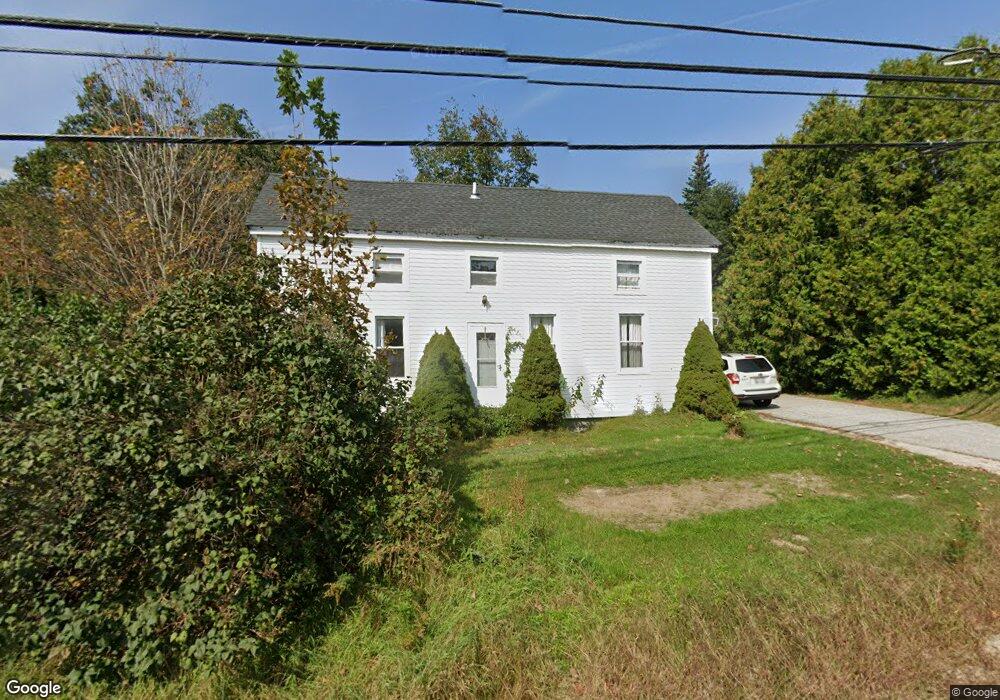
363 Gloucester Hill Rd New Gloucester, ME 04260
Estimated Value: $262,000 - $444,000
3
Beds
2
Baths
592
Sq Ft
$539/Sq Ft
Est. Value
About This Home
This home is located at 363 Gloucester Hill Rd, New Gloucester, ME 04260 and is currently estimated at $319,355, approximately $539 per square foot. 363 Gloucester Hill Rd is a home located in Cumberland County with nearby schools including Gray-New Gloucester High School and Fiddlehead School of Arts & Science.
Ownership History
Date
Name
Owned For
Owner Type
Purchase Details
Closed on
May 11, 2010
Sold by
Mahan Sean P
Bought by
Mahan Cynthia L
Current Estimated Value
Create a Home Valuation Report for This Property
The Home Valuation Report is an in-depth analysis detailing your home's value as well as a comparison with similar homes in the area
Home Values in the Area
Average Home Value in this Area
Purchase History
| Date | Buyer | Sale Price | Title Company |
|---|---|---|---|
| Mahan Cynthia L | -- | -- |
Source: Public Records
Tax History Compared to Growth
Tax History
| Year | Tax Paid | Tax Assessment Tax Assessment Total Assessment is a certain percentage of the fair market value that is determined by local assessors to be the total taxable value of land and additions on the property. | Land | Improvement |
|---|---|---|---|---|
| 2025 | $2,368 | $153,054 | $55,098 | $97,956 |
| 2024 | $2,279 | $153,054 | $55,098 | $97,956 |
| 2023 | $2,187 | $153,054 | $55,098 | $97,956 |
| 2022 | $2,112 | $153,054 | $55,098 | $97,956 |
| 2021 | $2,112 | $153,054 | $55,098 | $97,956 |
| 2020 | $2,089 | $153,054 | $55,098 | $97,956 |
| 2019 | $2,055 | $121,600 | $51,300 | $70,300 |
| 2018 | $1,921 | $121,600 | $51,300 | $70,300 |
| 2017 | $1,897 | $121,600 | $51,300 | $70,300 |
| 2016 | $1,788 | $121,600 | $51,300 | $70,300 |
| 2015 | $1,781 | $121,600 | $51,300 | $70,300 |
| 2014 | $1,763 | $121,600 | $51,300 | $70,300 |
| 2013 | $1,636 | $121,600 | $51,300 | $70,300 |
Source: Public Records
Map
Nearby Homes
- 29 Rockwood Dr
- 155 & 151 Gloucester Hill Rd
- 0018-C Gloucester Hill Rd
- 160 Gloucester Hill Rd
- 22 Shaw Rd
- TBD Targett Rd
- 271 Bennett Rd
- 10 Cobbs Bridge Rd
- 65 Blueberry Ln
- 0 Mayall
- 24 Swamp Rd
- 164 Intervale Rd
- 343 Shaker Rd
- 200 Woodman Rd
- 14 Golden Way
- 27 Callaway Dr Unit 27A
- 27 Callaway Dr Unit 27B
- 17 Callaway Dr Unit 17
- 423 Sabbathday Rd
- 136 Shaker Rd
- 365 Gloucester Hill Rd
- 359 Gloucester Hill Rd
- 362 Gloucester Hill Rd
- 371 Gloucester Hill Rd
- 353 Gloucester Hill Rd
- 0 Penney Rd Lot 3
- 356 Gloucester Hill Rd
- 352 Gloucester Hill Rd
- 370 Gloucester Hill Rd
- 381 Gloucester Hill Rd
- 382 Gloucester Hill Rd
- 291 Lewiston Rd
- 299 Lewiston Rd
- 387 Gloucester Hill Rd
- 339 Gloucester Hill Rd
- 19 Penney Rd
- 279 Lewiston Rd
- 313 Lewiston Rd
- 392 Gloucester Hill Rd
- 395 Gloucester Hill Rd