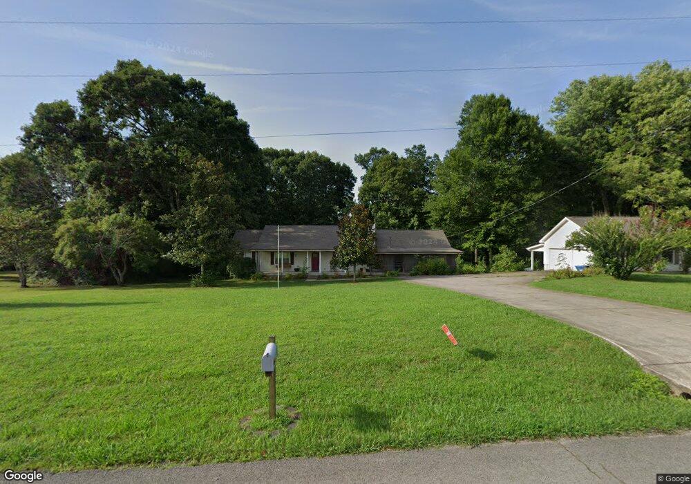
363 Joslin Branch Rd White Bluff, TN 37187
Estimated Value: $432,000 - $499,000
--
Bed
2
Baths
2,321
Sq Ft
$195/Sq Ft
Est. Value
About This Home
This home is located at 363 Joslin Branch Rd, White Bluff, TN 37187 and is currently estimated at $452,307, approximately $194 per square foot. 363 Joslin Branch Rd is a home located in Dickson County with nearby schools including White Bluff Elementary School, W. James Middle School, and Creek Wood High School.
Ownership History
Date
Name
Owned For
Owner Type
Purchase Details
Closed on
Aug 27, 2010
Sold by
Landry David J
Bought by
Greer Edward L
Current Estimated Value
Home Financials for this Owner
Home Financials are based on the most recent Mortgage that was taken out on this home.
Original Mortgage
$146,033
Outstanding Balance
$95,496
Interest Rate
4.25%
Mortgage Type
FHA
Estimated Equity
$356,811
Purchase Details
Closed on
Sep 10, 2002
Sold by
Hodges Rondy L
Bought by
Landry David J
Purchase Details
Closed on
May 30, 1996
Sold by
Hodges Rondy L
Bought by
Hodges Rondy L
Purchase Details
Closed on
Aug 13, 1986
Bought by
Hodges Rondy L
Create a Home Valuation Report for This Property
The Home Valuation Report is an in-depth analysis detailing your home's value as well as a comparison with similar homes in the area
Home Values in the Area
Average Home Value in this Area
Purchase History
| Date | Buyer | Sale Price | Title Company |
|---|---|---|---|
| Greer Edward L | $148,000 | -- | |
| Landry David J | $130,000 | -- | |
| Hodges Rondy L | -- | -- | |
| Hodges Rondy L | -- | -- |
Source: Public Records
Mortgage History
| Date | Status | Borrower | Loan Amount |
|---|---|---|---|
| Open | Hodges Rondy L | $146,033 |
Source: Public Records
Tax History Compared to Growth
Tax History
| Year | Tax Paid | Tax Assessment Tax Assessment Total Assessment is a certain percentage of the fair market value that is determined by local assessors to be the total taxable value of land and additions on the property. | Land | Improvement |
|---|---|---|---|---|
| 2024 | $1,655 | $97,900 | $23,275 | $74,625 |
| 2023 | $1,466 | $62,400 | $7,075 | $55,325 |
| 2022 | $1,466 | $62,400 | $7,075 | $55,325 |
| 2021 | $1,466 | $62,400 | $7,075 | $55,325 |
| 2020 | $1,466 | $62,400 | $7,075 | $55,325 |
| 2019 | $1,466 | $62,400 | $7,075 | $55,325 |
| 2018 | $1,244 | $46,075 | $6,075 | $40,000 |
| 2017 | $1,244 | $46,075 | $6,075 | $40,000 |
| 2016 | $1,244 | $46,075 | $6,075 | $40,000 |
| 2015 | $1,160 | $40,000 | $6,075 | $33,925 |
| 2014 | $1,160 | $40,000 | $6,075 | $33,925 |
Source: Public Records
Map
Nearby Homes
- 368 Joslin Branch Rd
- 208 Bell Forge Ct
- 1000 Corlew Ln
- 4145 Highway 70 E
- 105 Timber Crest Trail
- 4316 E Highway 70
- 506 Church St
- 1207 Old Charlotte Rd
- 0 Highway 70 E
- 440 Church St
- 502 Church St
- 120 Slater St
- 1120 Taylor Town Rd
- 1122 Taylortown Rd
- 305 Shady Oak Dr
- 227 Pleasant View Rd
- 229 Pleasant View Rd
- 0 Jones Creek Rd
- 255 Aulidge Loop
- 1346 Taylor Town Rd
- 357 Joslin Branch Rd
- 369 Joslin Branch Rd
- 370 Joslin Branch Rd
- 351 Joslin Branch Rd
- 351 Joslin Branch Rd
- 380 Joslin Branch Rd
- 377 Joslin Branch Rd
- 388 Joslin Branch Rd
- 384 Joslin Branch Rd
- 335 Joslin Branch Rd
- 399 Joslin Branch Rd
- 0 Diane Loop Lot 30 Unit 1991109
- 340 Joslin Branch Rd
- 199 Hollis Hill Rd
- 0 Diane Loop Lot 33 Unit 2050039
- 0 Diane Loop Lot 33 Unit 2094759
- 0 Diane Loop Lot 33 Unit 1991105
- 396 Joslin Branch Rd
- 334 Joslin Branch Rd
- 414 Joslin Branch Rd