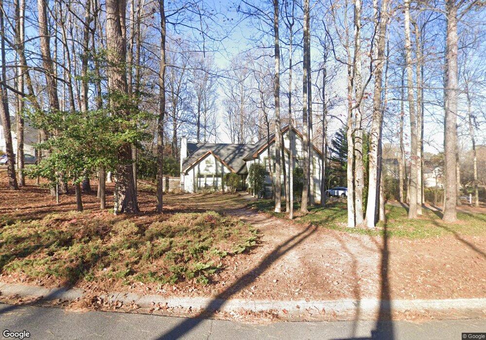
3630 Quail Creek Dr Unit 1 Buford, GA 30519
Estimated Value: $460,000 - $534,000
3
Beds
3
Baths
1,953
Sq Ft
$251/Sq Ft
Est. Value
About This Home
This home is located at 3630 Quail Creek Dr Unit 1, Buford, GA 30519 and is currently estimated at $490,762, approximately $251 per square foot. 3630 Quail Creek Dr Unit 1 is a home located in Gwinnett County with nearby schools including Harmony Elementary School, Glenn C. Jones Middle School, and Sugar Hill Christian Academy.
Ownership History
Date
Name
Owned For
Owner Type
Purchase Details
Closed on
Jun 20, 2019
Sold by
Brussack Gerrold M
Bought by
Orton Saul Kimberly
Current Estimated Value
Purchase Details
Closed on
May 28, 1993
Sold by
Carroll Gene
Bought by
Brussack Gerrold M
Home Financials for this Owner
Home Financials are based on the most recent Mortgage that was taken out on this home.
Original Mortgage
$126,600
Interest Rate
7.39%
Mortgage Type
FHA
Create a Home Valuation Report for This Property
The Home Valuation Report is an in-depth analysis detailing your home's value as well as a comparison with similar homes in the area
Home Values in the Area
Average Home Value in this Area
Purchase History
| Date | Buyer | Sale Price | Title Company |
|---|---|---|---|
| Orton Saul Kimberly | -- | -- | |
| Brussack Gerrold M | $128,900 | -- |
Source: Public Records
Mortgage History
| Date | Status | Borrower | Loan Amount |
|---|---|---|---|
| Previous Owner | Brussack Gerrold M | $126,600 |
Source: Public Records
Tax History Compared to Growth
Tax History
| Year | Tax Paid | Tax Assessment Tax Assessment Total Assessment is a certain percentage of the fair market value that is determined by local assessors to be the total taxable value of land and additions on the property. | Land | Improvement |
|---|---|---|---|---|
| 2024 | -- | $161,880 | $39,200 | $122,680 |
| 2023 | $4,989 | $183,480 | $39,200 | $144,280 |
| 2022 | $0 | $146,800 | $27,960 | $118,840 |
| 2021 | $4,085 | $114,680 | $27,960 | $86,720 |
| 2020 | $4,119 | $104,720 | $23,840 | $80,880 |
| 2019 | $315 | $104,720 | $23,840 | $80,880 |
| 2018 | $2,869 | $97,120 | $18,400 | $78,720 |
| 2016 | $2,641 | $85,440 | $14,800 | $70,640 |
| 2015 | $2,663 | $85,440 | $14,800 | $70,640 |
| 2014 | -- | $73,560 | $14,800 | $58,760 |
Source: Public Records
Map
Nearby Homes
- 3600 Devenwood Way
- 2361 Black Bear Ct Unit 2
- 2183 Ivy Crest Dr
- 3684 Heritage Crest Pkwy
- 2692 Bogan Creek Dr
- 2140 Harvest Ridge Cir
- 2040 Harvest Ridge Cir
- 2040 Harvest Ridge Cir NE
- 2330 Chandler Grove Dr
- 4041 Lost Mill Ln
- 3476 Harvest Ridge Ln
- 3685 Rolling Creek Dr
- 3573 Fallen Oak Dr
- 2551 E Maddox Rd
- 3568 Foxworth Ct
- 1970 Sturbridge Ln Unit 1
- 3534 Fallen Oak Ln
- 3665 Mystic Dr Unit 2
- 3650 Quail Creek Dr
- 3610 Quail Creek Dr
- 0 Fox Run Trail
- 3660 Quail Creek Dr Unit 1
- 3621 Quail Creek Dr Unit 1
- 2271 Black Bear Ct
- 2271 Black Bear Ct Unit 9
- 2295 Quail Creek Terrace Unit 11
- 3631 Quail Creek Dr
- 3611 Quail Creek Dr
- 3600 Quail Creek Dr
- 3661 Quail Creek Dr
- 3601 Quail Creek Dr
- 2285 Quail Creek Terrace Unit 1
- 2315 Quail Creek Terrace Unit 1
- 0 Quail Creek Dr Unit 9039961
- 0 Quail Creek Dr Unit 7129672
- 0 Quail Creek Dr Unit 7548713
- 2281 Black Bear Ct
- 2289 Fox Run Trail