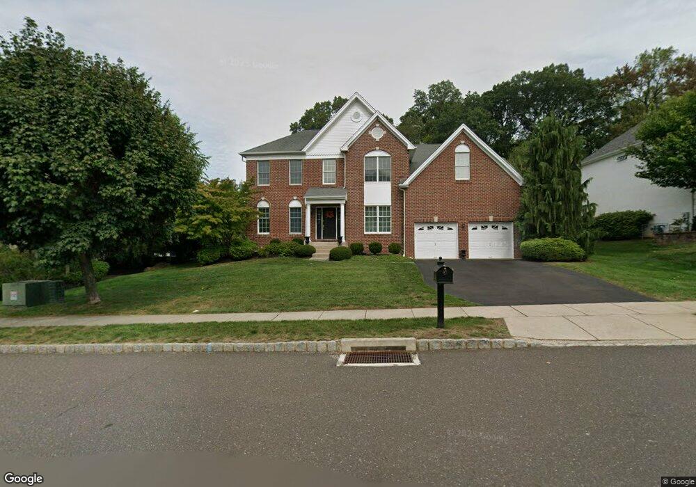
3634 Green Ridge Rd Furlong, PA 18925
Estimated Value: $966,375 - $1,116,000
4
Beds
3
Baths
3,508
Sq Ft
$289/Sq Ft
Est. Value
About This Home
This home is located at 3634 Green Ridge Rd, Furlong, PA 18925 and is currently estimated at $1,013,344, approximately $288 per square foot. 3634 Green Ridge Rd is a home located in Bucks County with nearby schools including Bridge Valley Elementary School, Holicong Middle School, and Central Bucks High School - East.
Ownership History
Date
Name
Owned For
Owner Type
Purchase Details
Closed on
Oct 6, 2005
Sold by
Toll Pa Lp
Bought by
Coyne Michael P and Coyne Kristen L
Current Estimated Value
Home Financials for this Owner
Home Financials are based on the most recent Mortgage that was taken out on this home.
Original Mortgage
$435,000
Outstanding Balance
$233,272
Interest Rate
5.79%
Mortgage Type
Fannie Mae Freddie Mac
Estimated Equity
$780,072
Create a Home Valuation Report for This Property
The Home Valuation Report is an in-depth analysis detailing your home's value as well as a comparison with similar homes in the area
Home Values in the Area
Average Home Value in this Area
Purchase History
| Date | Buyer | Sale Price | Title Company |
|---|---|---|---|
| Coyne Michael P | $603,601 | None Available |
Source: Public Records
Mortgage History
| Date | Status | Borrower | Loan Amount |
|---|---|---|---|
| Open | Coyne Michael P | $435,000 |
Source: Public Records
Tax History Compared to Growth
Tax History
| Year | Tax Paid | Tax Assessment Tax Assessment Total Assessment is a certain percentage of the fair market value that is determined by local assessors to be the total taxable value of land and additions on the property. | Land | Improvement |
|---|---|---|---|---|
| 2025 | $9,419 | $57,850 | $11,440 | $46,410 |
| 2024 | $9,419 | $57,850 | $11,440 | $46,410 |
| 2023 | $9,099 | $57,850 | $11,440 | $46,410 |
| 2022 | $8,990 | $57,850 | $11,440 | $46,410 |
| 2021 | $8,883 | $57,850 | $11,440 | $46,410 |
| 2020 | $8,883 | $57,850 | $11,440 | $46,410 |
| 2019 | $8,825 | $57,850 | $11,440 | $46,410 |
| 2018 | $8,825 | $57,850 | $11,440 | $46,410 |
| 2017 | $8,753 | $57,850 | $11,440 | $46,410 |
| 2016 | $8,839 | $57,850 | $11,440 | $46,410 |
| 2015 | -- | $57,850 | $11,440 | $46,410 |
| 2014 | -- | $57,850 | $11,440 | $46,410 |
Source: Public Records
Map
Nearby Homes
- 3772 Powder Horn Dr
- 3657 Powder Horn Dr
- 2209 Swamp Rd
- lot #3 next to 3739 York Rd
- 2294 Staffordshire Rd
- 1948 Forest Grove Rd
- 2059 Buckinghamshire Rd
- 0 Old York Rd Unit PABU2103356
- 0 Old York Rd Unit PABU2081846
- 3624 Robin Rd
- 3200 Brookside Dr
- 3889 Robin Rd
- 106 Saddle Dr
- 3138 E Brighton St Unit 37
- 2484 N Whittmore St
- 4549 Lower Mountain Rd
- 2310 S Whittmore St
- 3017 Dorchester St E Unit 125
- 2443 Sugar Bottom Rd
- 2113 Redbud Ln
- 3638 Green Ridge Rd
- 3630 Green Ridge Rd
- 3737 Powder Horn Dr
- 3646 Green Ridge Rd
- 3741 Powder Horn Dr
- 3641 Green Ridge Rd
- 3650 Green Ridge Rd
- 3633 Green Ridge Rd
- 3637 Green Ridge Rd
- 3645 Green Ridge Rd
- 3629 Green Ridge Rd
- 3747 Powder Horn Dr
- 3732 Powder Horn Dr
- 3654 Green Ridge Rd
- 3734 Powder Horn Dr
- 3738 Powder Horn Dr
- 3742 Powder Horn Dr
- 3625 Green Ridge Rd
- 3748 Powder Horn Dr
- 3751 Powder Horn Dr