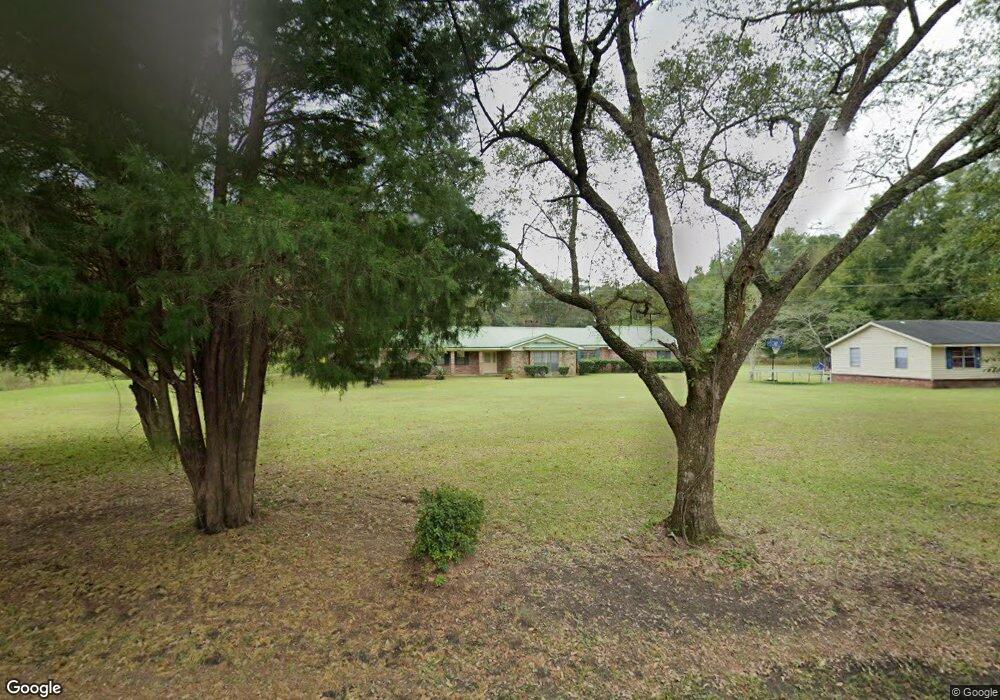
3636 Big Point Rd Moss Point, MS 39562
Estimated Value: $189,000 - $406,000
Studio
3
Baths
3,269
Sq Ft
$91/Sq Ft
Est. Value
About This Home
This home is located at 3636 Big Point Rd, Moss Point, MS 39562 and is currently estimated at $296,339, approximately $90 per square foot. 3636 Big Point Rd is a home located in Jackson County with nearby schools including East Central Lower Elementary School, East Central Upper Elementary School, and East Central Middle School.
Ownership History
Date
Name
Owned For
Owner Type
Purchase Details
Closed on
Jan 27, 2023
Sold by
Elkins Kerri V
Bought by
Wells Gavin L
Current Estimated Value
Purchase Details
Closed on
Jan 13, 2023
Sold by
Wells Gavin L
Bought by
Wells Gavin L
Purchase Details
Closed on
Jun 3, 2022
Sold by
Mae Wells Willie
Bought by
Wells Gavin L
Create a Home Valuation Report for This Property
The Home Valuation Report is an in-depth analysis detailing your home's value as well as a comparison with similar homes in the area
Purchase History
| Date | Buyer | Sale Price | Title Company |
|---|---|---|---|
| Wells Gavin L | -- | Pilger Title | |
| Wells Gavin L | -- | Pilger Title | |
| Wells Gavin L | -- | Pilger Title | |
| Wells Gavin L | -- | Pilger Title | |
| Wells Gavin L | -- | Pilger Title | |
| Wells Gavin L | -- | Pilger Title | |
| Wells Gavin L | -- | Pilger Title | |
| Brown Terri L | -- | Pilger Title | |
| Brown Terri L | -- | Pilger Title |
Source: Public Records
Tax History
| Year | Tax Paid | Tax Assessment Tax Assessment Total Assessment is a certain percentage of the fair market value that is determined by local assessors to be the total taxable value of land and additions on the property. | Land | Improvement |
|---|---|---|---|---|
| 2025 | $2,988 | $25,147 | $1,157 | $23,990 |
| 2024 | $2,988 | $24,100 | $1,127 | $22,973 |
| 2023 | $2,893 | $27,332 | $1,226 | $26,106 |
| 2022 | $3,188 | $27,332 | $1,226 | $26,106 |
| 2021 | $3,201 | $27,458 | $1,226 | $26,232 |
| 2020 | $1,294 | $18,213 | $818 | $17,395 |
| 2019 | $1,275 | $18,169 | $818 | $17,351 |
| 2018 | $1,303 | $18,200 | $818 | $17,382 |
| 2017 | $1,326 | $18,200 | $818 | $17,382 |
| 2016 | $1,273 | $18,200 | $818 | $17,382 |
| 2015 | $803 | $141,460 | $6,830 | $134,630 |
| 2014 | $852 | $14,751 | $752 | $13,999 |
| 2013 | $823 | $14,745 | $743 | $14,002 |
Source: Public Records
Map
Nearby Homes
- 17209 Red Top Ln
- 3016 Ed Parker Rd
- 0 Grafe Homestead Rd Unit 4137349
- 14004 Timber Ridge Dr
- 13875 Wolf Ridge Rd Unit LotWP001
- 19500 Angel Ln
- 19506 Highway 63
- 0 Perry St
- 0 Ms-613 Hwy Unit 4116583
- 0 Ms-613 Hwy Unit 4107607
- 0 Ms-613 Hwy Unit 4107612
- 0 Ms-613 Hwy Unit 4116582
- 7201 Bentwood Dr
- 26.1 Acres Brinkman Rd E
- 0 R B Dickerson Rd
- 4432 Lily Patch Ln
- 3601 Sandy Bayou Rd
- 20700 Cameron Ln
- 17500 Goff Farm Rd
- 01 Dap Rd E
- 3831 Big Point Rd
- 3913 Big Point Rd
- 3840 Big Point Rd
- 3900 Big Point Rd
- 3803 Big Point Rd Unit DRO
- 3921 Big Point Rd
- 3929 Big Point Rd
- 16400 Wolf Ridge Rd
- 00 Big Point Rd
- 0 Big Point Unit 4125782
- 0 Big Point Unit 3281950
- 16708 Sandy Wood Ln
- 16317 Wolf Ridge Rd
- 16303 Wolf Ridge Rd
- 16301 Wolf Ridge Rd
- 16204 Wolf Ridge Rd
- 16600 Gravel Ave
- 16116 Wolf Ridge Rd
- 3628 Big Point Rd
- 16729 Horace Wells Rd
Your Personal Tour Guide
Ask me questions while you tour the home.