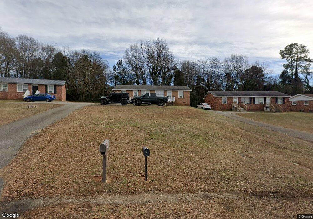
364 Anderson Drive Extension Unit 11 Spartanburg, SC 29302
Estimated Value: $113,000 - $167,000
3
Beds
2
Baths
1,325
Sq Ft
$98/Sq Ft
Est. Value
About This Home
This home is located at 364 Anderson Drive Extension Unit 11, Spartanburg, SC 29302 and is currently estimated at $129,463, approximately $97 per square foot. 364 Anderson Drive Extension Unit 11 is a home located in Spartanburg County with nearby schools including Spartanburg High School.
Ownership History
Date
Name
Owned For
Owner Type
Purchase Details
Closed on
Oct 8, 2015
Sold by
Luines Tyrone and Luines Tyrone
Bought by
Croft Investments Llc
Current Estimated Value
Purchase Details
Closed on
Feb 14, 2014
Sold by
Stolin Llc
Bought by
Luines Tyrone
Purchase Details
Closed on
Apr 17, 2007
Sold by
Striplin Keiko
Bought by
Rust Gary
Home Financials for this Owner
Home Financials are based on the most recent Mortgage that was taken out on this home.
Original Mortgage
$3,570
Interest Rate
15%
Mortgage Type
Stand Alone Second
Create a Home Valuation Report for This Property
The Home Valuation Report is an in-depth analysis detailing your home's value as well as a comparison with similar homes in the area
Home Values in the Area
Average Home Value in this Area
Purchase History
| Date | Buyer | Sale Price | Title Company |
|---|---|---|---|
| Croft Investments Llc | -- | -- | |
| Luines Tyrone | $19,900 | -- | |
| Stolin Llc | $18,000 | -- | |
| Rust Gary | $28,000 | None Available |
Source: Public Records
Mortgage History
| Date | Status | Borrower | Loan Amount |
|---|---|---|---|
| Previous Owner | Rust Gary | $3,570 | |
| Previous Owner | Rust Gary | $46,548 |
Source: Public Records
Tax History Compared to Growth
Tax History
| Year | Tax Paid | Tax Assessment Tax Assessment Total Assessment is a certain percentage of the fair market value that is determined by local assessors to be the total taxable value of land and additions on the property. | Land | Improvement |
|---|---|---|---|---|
| 2025 | $1,381 | $2,898 | $769 | $2,129 |
| 2024 | $1,381 | $2,898 | $769 | $2,129 |
| 2023 | $1,381 | $2,898 | $769 | $2,129 |
| 2022 | $1,191 | $2,520 | $360 | $2,160 |
| 2021 | $1,189 | $2,520 | $360 | $2,160 |
| 2020 | $1,171 | $2,520 | $360 | $2,160 |
| 2019 | $1,171 | $2,520 | $360 | $2,160 |
| 2018 | $1,341 | $2,926 | $752 | $2,174 |
| 2017 | $1,176 | $2,544 | $840 | $1,704 |
| 2016 | $1,176 | $2,544 | $840 | $1,704 |
| 2015 | $1,143 | $2,544 | $840 | $1,704 |
| 2014 | $1,123 | $2,544 | $840 | $1,704 |
Source: Public Records
Map
Nearby Homes
- 137 Anderson Dr
- 2504 W Croft Cir
- 117 Wardlaw Ave
- 218 Donavan Dr
- 203 Patch Dr
- 231 Patch Dr
- 0 Bethesda Rd
- 530 Patch Dr
- 1023 Four Mile Branch Rd
- 130 Landis St Unit 3
- 216 Dares Ferry Rd
- 1154 Edisto Dr
- 3420 E Croft Cir
- 240 Cotton Creek Dr
- ESSEX Plan at Riverdale Hills
- BERKSHIRE Plan at Riverdale Hills
- DUPONT Plan at Riverdale Hills
- CABOT Plan at Riverdale Hills
- BEAUMONT Plan at Riverdale Hills
- 104 Bagwell Farm Rd
- 364 Anderson Drive Extension
- 358 Anderson Dr
- 356 Anderson Drive Extension Unit 11
- 376 Anderson Drive Extension Unit 11
- 151 Headquarters Loop
- 348 Anderson Drive Extension
- 18922923 Headquarters Loop
- 334 Anderson Drive Extension
- 163 Griswald Cir Unit 11
- 151 Griswold Cir Unit 11
- 162 Headquarters Loop
- 328 Anderson Drive Extension
- 328 Anderson Drive Extension
- 137 Griswald Cir
- 137 Griswald Cir Unit 11
- 190 Headquarters Loop
- 178 Headquarters Loop
- 173 Griswald Cir Unit 175
- 320 Anderson Drive Extension
- 129 Griswald Cir Unit 11