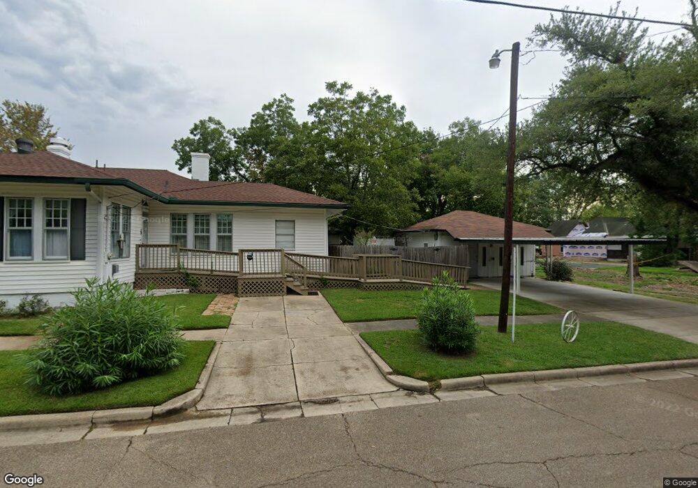
364 N Kelley St Lufkin, TX 75904
Estimated Value: $88,430 - $106,000
--
Bed
5
Baths
936
Sq Ft
$106/Sq Ft
Est. Value
About This Home
This home is located at 364 N Kelley St, Lufkin, TX 75904 and is currently estimated at $99,108, approximately $105 per square foot. 364 N Kelley St is a home located in Angelina County with nearby schools including Trout Primary School, Brookhollow Elementary School, and Lufkin Middle School.
Ownership History
Date
Name
Owned For
Owner Type
Purchase Details
Closed on
Sep 6, 2024
Sold by
Denman Joe C
Bought by
2043 Sul Ross Llc
Current Estimated Value
Purchase Details
Closed on
Feb 20, 2015
Sold by
Dewald John Patrick
Bought by
Costello Robert J
Home Financials for this Owner
Home Financials are based on the most recent Mortgage that was taken out on this home.
Original Mortgage
$39,150
Interest Rate
3.78%
Mortgage Type
New Conventional
Purchase Details
Closed on
Mar 3, 2006
Sold by
Havard Betty Lou
Bought by
Dewald Jack
Home Financials for this Owner
Home Financials are based on the most recent Mortgage that was taken out on this home.
Original Mortgage
$37,500
Interest Rate
6.19%
Mortgage Type
New Conventional
Create a Home Valuation Report for This Property
The Home Valuation Report is an in-depth analysis detailing your home's value as well as a comparison with similar homes in the area
Home Values in the Area
Average Home Value in this Area
Purchase History
| Date | Buyer | Sale Price | Title Company |
|---|---|---|---|
| 2043 Sul Ross Llc | -- | None Listed On Document | |
| Costello Robert J | -- | Angelina Title Llc | |
| Dewald Jack | $37,500 | None Available |
Source: Public Records
Mortgage History
| Date | Status | Borrower | Loan Amount |
|---|---|---|---|
| Previous Owner | Costello Robert J | $39,150 | |
| Previous Owner | Dewald Jack | $37,500 |
Source: Public Records
Tax History Compared to Growth
Tax History
| Year | Tax Paid | Tax Assessment Tax Assessment Total Assessment is a certain percentage of the fair market value that is determined by local assessors to be the total taxable value of land and additions on the property. | Land | Improvement |
|---|---|---|---|---|
| 2025 | $1,448 | $79,300 | $17,900 | $61,400 |
| 2024 | $1,213 | $79,260 | $17,900 | $61,360 |
| 2023 | $1,085 | $78,790 | $17,900 | $60,890 |
| 2022 | $1,202 | $63,730 | $7,450 | $56,280 |
| 2021 | $1,215 | $50,420 | $4,680 | $45,740 |
| 2020 | $1,117 | $45,370 | $4,680 | $40,690 |
| 2019 | $1,174 | $46,170 | $4,680 | $41,490 |
| 2018 | $134 | $45,600 | $4,680 | $40,920 |
| 2017 | $134 | $44,120 | $4,680 | $39,440 |
| 2016 | $1,112 | $43,560 | $4,680 | $38,880 |
| 2015 | $714 | $43,670 | $4,680 | $38,990 |
| 2014 | $714 | $41,350 | $4,680 | $36,670 |
Source: Public Records
Map
Nearby Homes
- 620 Mantooth Ave
- 803 Moore Ave
- 1007 Persimmon Ave
- 420 Mantooth Ave
- 1305 W Grove Ave
- Lot 5 Shady Elm
- Lot 9 Shady Elm
- Lot 3 Shady Elm
- Lot 8 Shady Elm
- Lot 4 Shady Elm
- Lot 6 Shady Elm
- 402 S Bynum St
- 122 Pine Branch Ct
- 112 Pine Branch Ct
- 4421 Farm-To-market
- 117 Pine Branch Ct
- 5700 Fm 2497
- 8250 Hwy 103w
- 10683 Hwy 103w
- 1305 West Grove
- 721 Mantooth Ave
- 715 Mantooth Ave
- 711 Mantooth Ave
- 805 Mantooth Ave
- 718 W Frank Ave
- 718 W Frank Ave
- 804 W Frank Ave
- 720 Mantooth Ave
- 701 Mantooth Ave
- 716 Mantooth Ave
- 802 Mantooth Ave
- 710 Mantooth Ave
- 817 Mantooth Ave
- 808 Mantooth Ave
- 719 W Frank Ave
- 715 W Frank Ave
- 704 Mantooth Ave
- 707 Frank St
- 807 W Frank Ave
- 707 W Frank Ave