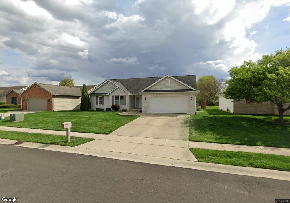
3640 Birkdale Dr Springfield, IL 62712
Estimated Value: $247,103 - $317,000
Studio
--
Bath
--
Sq Ft
10,193
Sq Ft
About This Home
This home is located at 3640 Birkdale Dr, Springfield, IL 62712 and is currently estimated at $283,776. 3640 Birkdale Dr is a home located in Sangamon County with nearby schools including Rochester Elementary Ec-1 School, Rochester Elementary School, and Rochester Intermediate School.
Ownership History
Date
Name
Owned For
Owner Type
Purchase Details
Closed on
Jun 24, 2005
Current Estimated Value
Purchase Details
Closed on
Oct 20, 2004
Purchase Details
Closed on
Apr 19, 2004
Create a Home Valuation Report for This Property
The Home Valuation Report is an in-depth analysis detailing your home's value as well as a comparison with similar homes in the area
Purchase History
| Date | Buyer | Sale Price | Title Company |
|---|---|---|---|
| -- | $177,000 | -- | |
| -- | $30,500 | -- | |
| -- | $31,400 | -- |
Source: Public Records
Tax History
| Year | Tax Paid | Tax Assessment Tax Assessment Total Assessment is a certain percentage of the fair market value that is determined by local assessors to be the total taxable value of land and additions on the property. | Land | Improvement |
|---|---|---|---|---|
| 2024 | $4,860 | $73,317 | $15,830 | $57,487 |
| 2023 | $5,348 | $77,500 | $14,459 | $63,041 |
| 2022 | $5,102 | $73,095 | $13,716 | $59,379 |
| 2021 | $4,920 | $70,358 | $13,202 | $57,156 |
| 2020 | $4,738 | $70,464 | $13,222 | $57,242 |
| 2019 | $4,642 | $70,218 | $13,176 | $57,042 |
| 2018 | $4,662 | $69,876 | $13,112 | $56,764 |
| 2017 | $4,583 | $68,972 | $12,942 | $56,030 |
| 2016 | $4,517 | $65,957 | $12,753 | $53,204 |
| 2015 | $4,470 | $65,169 | $12,601 | $52,568 |
| 2014 | $4,278 | $64,749 | $12,520 | $52,229 |
| 2013 | $4,252 | $62,602 | $12,519 | $50,083 |
Source: Public Records
Map
Nearby Homes
- 3120 Red Bud Ln
- 66 White Birch Rd
- 5 Swannanoa Unit 1
- 53 Mishawaka Dr Unit 1
- 2632 Hilltop Rd
- 329-331 Harbor Point Place
- 312 Harbor Point Place
- 314 Harbor Point Place
- 2616 Kent Dr
- 0 Oak Hill Rd
- 2632 Steiler Place
- 3518 Sheffield Rd Unit 1
- 2906 Taylor Ave Unit 11
- 0 Varsity Ct
- 2875 Taylor Ave
- 3100 Butler St Unit 1833
- 4013 S Milan Rd
- 2800 Via Rosso St Unit 135
- 3301 Stanton St Unit 1
- 3719 E Hooker St Unit 1
- 3644 Birkdale Dr
- 3636 Birkdale Dr
- 3648 Birkdale Dr
- 3632 Birkdale Dr
- 3617 Carnoustie Dr
- 3616 Carnoustie Dr
- 3628 Birkdale Dr
- 3617 Saint Annes Dr
- 3617 Saint Anne's Dr
- 3627 Birkdale Dr
- 3612 Carnoustie Dr
- 3613 Carnoustie Dr
- 3609 Saint Annes Dr
- 3624 Birkdale Dr
- 3612 Lytham Dr
- 3610 Lytham Dr
- 3609 Carnoustie Dr
- 3608 Carnoustie Dr
- 3605 Saint Annes Dr
- 3608 Lytham Dr
Your Personal Tour Guide
Ask me questions while you tour the home.