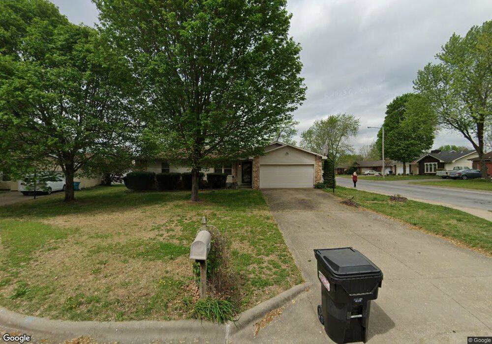
3643 N Olive Ct Springfield, MO 65803
Estimated Value: $217,605 - $265,000
3
Beds
2
Baths
1,532
Sq Ft
$153/Sq Ft
Est. Value
About This Home
This home is located at 3643 N Olive Ct, Springfield, MO 65803 and is currently estimated at $233,901, approximately $152 per square foot. 3643 N Olive Ct is a home located in Greene County with nearby schools including Truman Elementary School, Pleasant View K-8 School, and Hillcrest High School.
Ownership History
Date
Name
Owned For
Owner Type
Purchase Details
Closed on
May 30, 2006
Sold by
Collins Robin M
Bought by
Greene County
Current Estimated Value
Purchase Details
Closed on
Mar 16, 2006
Sold by
Ellsaton Charles E and Ellston Catherine L
Bought by
Collins Robin M
Home Financials for this Owner
Home Financials are based on the most recent Mortgage that was taken out on this home.
Original Mortgage
$105,560
Interest Rate
6.19%
Mortgage Type
FHA
Purchase Details
Closed on
Apr 15, 2005
Sold by
Lane Steven and Lane Danna
Bought by
Ellston Charles E and Ellston Cahterine L
Home Financials for this Owner
Home Financials are based on the most recent Mortgage that was taken out on this home.
Original Mortgage
$60,500
Interest Rate
5.89%
Mortgage Type
New Conventional
Create a Home Valuation Report for This Property
The Home Valuation Report is an in-depth analysis detailing your home's value as well as a comparison with similar homes in the area
Purchase History
| Date | Buyer | Sale Price | Title Company |
|---|---|---|---|
| Greene County | -- | None Available | |
| Collins Robin M | -- | None Available | |
| Ellston Charles E | -- | None Available |
Source: Public Records
Mortgage History
| Date | Status | Borrower | Loan Amount |
|---|---|---|---|
| Previous Owner | Collins Robin M | $105,560 | |
| Previous Owner | Ellston Charles E | $60,500 |
Source: Public Records
Tax History
| Year | Tax Paid | Tax Assessment Tax Assessment Total Assessment is a certain percentage of the fair market value that is determined by local assessors to be the total taxable value of land and additions on the property. | Land | Improvement |
|---|---|---|---|---|
| 2025 | $1,243 | $22,990 | $6,650 | $16,340 |
| 2024 | $1,048 | $18,110 | $2,850 | $15,260 |
| 2023 | $1,043 | $18,110 | $2,850 | $15,260 |
| 2022 | $979 | $16,660 | $2,850 | $13,810 |
| 2021 | $936 | $16,660 | $2,850 | $13,810 |
| 2020 | $964 | $16,280 | $2,850 | $13,430 |
| 2019 | $937 | $16,280 | $2,850 | $13,430 |
| 2018 | $1,034 | $17,880 | $4,370 | $13,510 |
| 2017 | $1,025 | $16,990 | $4,370 | $12,620 |
| 2016 | $972 | $16,990 | $4,370 | $12,620 |
| 2015 | $965 | $16,990 | $4,370 | $12,620 |
| 2014 | $970 | $16,990 | $4,370 | $12,620 |
Source: Public Records
Map
Nearby Homes
- 3645 N Oak Point Ave
- 3582 N Thistlewood Ct
- 3714 N Mount Zion Ct
- 3740 N Oak Point Ave
- 3630 N Thistlewood Ct
- 671 W Bridgewood Ct
- 1122 W Vancouver St
- 3879 N Williams Ct
- 1632 N Grant Ave
- 3764 N Huntington Ave
- 1420 W Farm Road 102
- 3486 N Farm Road 143
- 1.16 Acres W Norton Rd
- 1835 W Farm Road 102
- 4353 N Toby Ave
- 4377 N Toby Ave
- 725 E Smith St
- 2829 N Grant Ave
- 4449 N Toby Ave
- 3144 N Pierce Ave
- 3633 N Olive Ct
- 3642 N Dawn Ct
- 3632 N Dawn Ct
- 3631 N Olive Ct
- 729 W Beverly Hills Dr
- 723 W Beverly Hills Dr
- 805 W Beverly Hills Dr
- 3630 N Olive Ct
- 715 W Beverly Hills Dr
- 811 W Beverly Hills Dr
- 3630 N Dawn Ct
- 3634 N Olive Ct
- 709 W Beverly Hills Dr
- 821 W Beverly Hills Dr
- 3703 N Farm Road 151
- 3621 N Farm Road 151
- 3631 N Dawn Ct
- 3643 N Dawn Ct
- 827 W Beverly Hills Dr
- 3633 N Dawn Ct
Your Personal Tour Guide
Ask me questions while you tour the home.