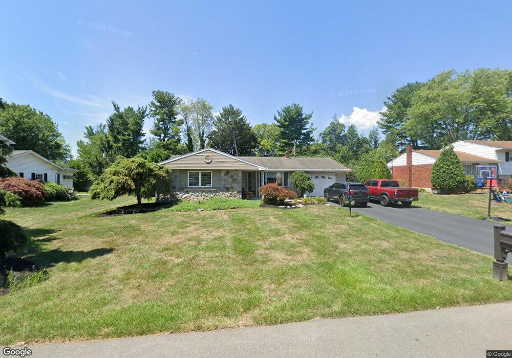
3645 Walt Whitman Ln Bethlehem, PA 18017
Estimated Value: $347,551 - $389,000
4
Beds
2
Baths
1,078
Sq Ft
$341/Sq Ft
Est. Value
About This Home
This home is located at 3645 Walt Whitman Ln, Bethlehem, PA 18017 and is currently estimated at $367,888, approximately $341 per square foot. 3645 Walt Whitman Ln is a home located in Northampton County with nearby schools including Nitschmann Middle School, Liberty High School, and Lehigh Valley Academy Regional Charter School.
Ownership History
Date
Name
Owned For
Owner Type
Purchase Details
Closed on
May 10, 2010
Sold by
Wambold Cynthia A
Bought by
Hall Jason and Hall Joanna Marie
Current Estimated Value
Home Financials for this Owner
Home Financials are based on the most recent Mortgage that was taken out on this home.
Original Mortgage
$212,044
Outstanding Balance
$138,242
Interest Rate
4.5%
Mortgage Type
FHA
Estimated Equity
$229,646
Create a Home Valuation Report for This Property
The Home Valuation Report is an in-depth analysis detailing your home's value as well as a comparison with similar homes in the area
Home Values in the Area
Average Home Value in this Area
Purchase History
| Date | Buyer | Sale Price | Title Company |
|---|---|---|---|
| Hall Jason | $214,900 | None Available |
Source: Public Records
Mortgage History
| Date | Status | Borrower | Loan Amount |
|---|---|---|---|
| Open | Hall Jason | $212,044 |
Source: Public Records
Tax History Compared to Growth
Tax History
| Year | Tax Paid | Tax Assessment Tax Assessment Total Assessment is a certain percentage of the fair market value that is determined by local assessors to be the total taxable value of land and additions on the property. | Land | Improvement |
|---|---|---|---|---|
| 2025 | $621 | $57,500 | $20,600 | $36,900 |
| 2024 | $4,192 | $57,500 | $20,600 | $36,900 |
| 2023 | $4,206 | $57,500 | $20,600 | $36,900 |
| 2022 | $4,166 | $57,500 | $20,600 | $36,900 |
| 2021 | $4,133 | $57,500 | $20,600 | $36,900 |
| 2020 | $4,138 | $57,500 | $20,600 | $36,900 |
| 2019 | $4,121 | $57,500 | $20,600 | $36,900 |
| 2018 | $4,039 | $57,500 | $20,600 | $36,900 |
| 2017 | $4,011 | $57,500 | $20,600 | $36,900 |
| 2016 | -- | $57,500 | $20,600 | $36,900 |
| 2015 | -- | $57,500 | $20,600 | $36,900 |
| 2014 | -- | $57,500 | $20,600 | $36,900 |
Source: Public Records
Map
Nearby Homes
- 1560 Chaucer Ln
- 3474 Lord Byron Dr
- 1560 Stafore Dr
- 1410 Stoke Park Rd
- 3760 Jacksonville Rd
- 4064 Autumn Ridge Rd
- 1225 Brentwood Ave
- 1179 Blair Rd
- 4110 Greenfield Rd
- 1215 W MacAda Rd
- 2850 Red Oak Ln
- 4410 Greenfield Rd
- 1075 W MacAda Rd
- 922 Wedgewood Rd
- 4145 Hanover St
- 4621 Maryann Ln
- 6075 Airport Rd
- 1434 Colgate Dr
- 6172 Airport Rd
- 5722 Frederick Dr Unit Stavanger III
- 3655 Walt Whitman Ln
- 3635 Walt Whitman Ln
- 3630 Emerson Cir
- 3640 Emerson Cir
- 3625 Walt Whitman Ln
- 3665 Walt Whitman Ln
- 3660 Walt Whitman Ln
- 3620 Emerson Cir
- 3670 Walt Whitman Ln
- 3650 Walt Whitman Ln
- 3615 Walt Whitman Ln
- 3680 Walt Whitman Ln
- 3650 Emerson Cir
- 2075 Mark Twain Cir
- 3640 Walt Whitman Ln
- 2055 Mark Twain Cir
- 3610 Emerson Cir
- 3630 Walt Whitman Ln
- 2125 Mark Twain Cir
- 3605 Walt Whitman Ln