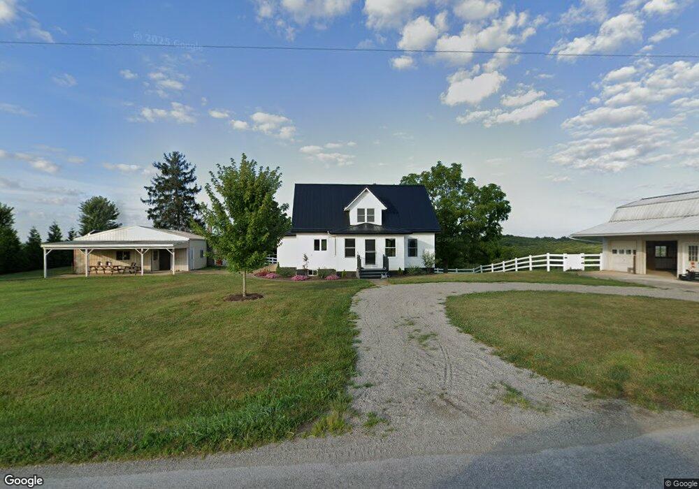
3645 Wheat Ridge Rd West Union, OH 45693
Estimated Value: $346,000 - $548,298
3
Beds
1
Bath
2,400
Sq Ft
$182/Sq Ft
Est. Value
About This Home
This home is located at 3645 Wheat Ridge Rd, West Union, OH 45693 and is currently estimated at $437,325, approximately $182 per square foot. 3645 Wheat Ridge Rd is a home located in Adams County with nearby schools including North Adams Elementary School and North Adams High School.
Ownership History
Date
Name
Owned For
Owner Type
Purchase Details
Closed on
Dec 9, 2016
Sold by
Miller John Alan and Miller Laura
Bought by
Schrock Anthony and Schrock Rachel
Current Estimated Value
Home Financials for this Owner
Home Financials are based on the most recent Mortgage that was taken out on this home.
Original Mortgage
$241,000
Outstanding Balance
$194,723
Interest Rate
3.54%
Mortgage Type
Future Advance Clause Open End Mortgage
Estimated Equity
$242,602
Purchase Details
Closed on
Nov 17, 2016
Sold by
Schrock Harvey and Schrock Anna
Bought by
Miller John Alan and Miller Laura
Home Financials for this Owner
Home Financials are based on the most recent Mortgage that was taken out on this home.
Original Mortgage
$241,000
Outstanding Balance
$194,723
Interest Rate
3.54%
Mortgage Type
Future Advance Clause Open End Mortgage
Estimated Equity
$242,602
Purchase Details
Closed on
Sep 17, 1999
Sold by
Schrock Harvey
Bought by
Miller John Alan
Purchase Details
Closed on
Sep 2, 1975
Bought by
Schrock Harvey
Create a Home Valuation Report for This Property
The Home Valuation Report is an in-depth analysis detailing your home's value as well as a comparison with similar homes in the area
Home Values in the Area
Average Home Value in this Area
Purchase History
| Date | Buyer | Sale Price | Title Company |
|---|---|---|---|
| Schrock Anthony | $255,000 | None Available | |
| Miller John Alan | -- | None Available | |
| Miller John Alan | $98,400 | -- | |
| Schrock Harvey | -- | -- |
Source: Public Records
Mortgage History
| Date | Status | Borrower | Loan Amount |
|---|---|---|---|
| Open | Schrock Anthony | $241,000 |
Source: Public Records
Tax History Compared to Growth
Tax History
| Year | Tax Paid | Tax Assessment Tax Assessment Total Assessment is a certain percentage of the fair market value that is determined by local assessors to be the total taxable value of land and additions on the property. | Land | Improvement |
|---|---|---|---|---|
| 2024 | $1,231 | $141,480 | $90,270 | $51,210 |
| 2023 | $1,238 | $141,480 | $90,270 | $51,210 |
| 2022 | $2,460 | $115,820 | $69,930 | $45,890 |
| 2021 | $2,416 | $115,820 | $69,930 | $45,890 |
| 2020 | $2,466 | $115,820 | $69,930 | $45,890 |
| 2019 | $2,349 | $115,820 | $69,930 | $45,890 |
| 2018 | $2,033 | $100,700 | $60,800 | $39,900 |
| 2017 | $1,976 | $100,700 | $60,800 | $39,900 |
| 2016 | $969 | $94,150 | $54,250 | $39,900 |
| 2015 | $2,179 | $90,060 | $45,750 | $44,310 |
| 2014 | $2,181 | $90,060 | $45,750 | $44,310 |
Source: Public Records
Map
Nearby Homes
- 4016 Unity Rd
- 4603 Wheat Ridge Rd
- 3551 Unity Rd
- 210 Walt Alsgood Rd
- 2157 Tater Ridge Rd
- 831 Tom Brown Rd
- 13529 Ohio 247
- 363 Crystal Rd
- 19004 State Route 41
- 125 Robinette Rd
- 0 Paradise Valley Rd Unit 1852764
- 0 Lawshe Rd Unit 1854673
- 668 Fawcett Rd
- 3460 Logans Ln
- 0 Tranquility Pike
- 292 Larry Baynum Rd
- 1425 Jacksonville Rd
- 150 Roslin Dr
- LOT 4 Jacksonville Rd
- LOT 2 Jacksonville Rd
- 3735 Wheat Ridge Rd
- 4ac Wheat Ridge Rd
- 3815 Wheat Ridge Rd
- 3813 Wheat Ridge Rd
- 3813 Wheat Ridge Rd
- 3819 Wheat Ridge Rd
- 3824 Wheat Ridge Rd
- 3883 Wheat Ridge Rd
- 59 Port Rd
- 329 Port Rd
- 3590 Wheat Ridge Rd
- 4100 Wheat Ridge Rd
- 4141 Wheat Ridge Rd
- 2775 Grange Hall Rd
- 4185 Wheat Ridge Rd
- 3088 Wheat Ridge Rd
- 2543 Wheat Ridge Rd
- 4238 Wheat Ridge Rd
- 4222 Wheat Ridge Rd
- 4222 Wheat Ridge Rd