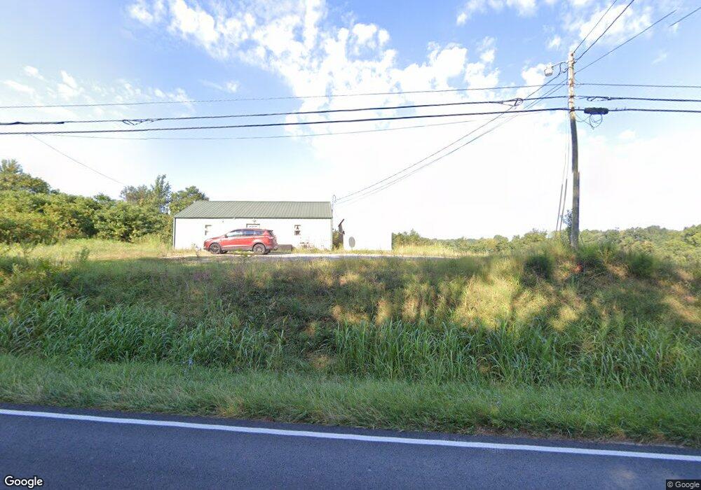
3647 Roberts Matthews Hwy Sparta, TN 38583
Estimated Value: $179,345 - $467,000
--
Bed
1
Bath
1,216
Sq Ft
$221/Sq Ft
Est. Value
About This Home
This home is located at 3647 Roberts Matthews Hwy, Sparta, TN 38583 and is currently estimated at $268,586, approximately $220 per square foot. 3647 Roberts Matthews Hwy is a home with nearby schools including Northfield Elementary School, White County Middle School, and White County High School.
Ownership History
Date
Name
Owned For
Owner Type
Purchase Details
Closed on
Jul 27, 2023
Sold by
Lizarraga Gustavo
Bought by
Aasha Trust and Walker
Current Estimated Value
Purchase Details
Closed on
Dec 1, 2014
Sold by
Walker Cynthia
Bought by
Walker Dale A and Walker Cynthia
Purchase Details
Closed on
Nov 22, 2013
Bought by
Walker Cynthia
Purchase Details
Closed on
Feb 20, 2003
Bought by
Walker Dale A and Walker Cynthia
Purchase Details
Closed on
Dec 31, 1993
Bought by
Walker Jack and Walker Lynda K
Purchase Details
Closed on
Dec 3, 1993
Bought by
Walker Dale
Create a Home Valuation Report for This Property
The Home Valuation Report is an in-depth analysis detailing your home's value as well as a comparison with similar homes in the area
Home Values in the Area
Average Home Value in this Area
Purchase History
| Date | Buyer | Sale Price | Title Company |
|---|---|---|---|
| Aasha Trust | $80,000 | None Listed On Document | |
| Aasha Trust | $80,000 | None Listed On Document | |
| Walker Dale A | -- | -- | |
| Walker Cynthia | -- | -- | |
| Walker Dale A | -- | -- | |
| Walker Jack | -- | -- | |
| Walker Dale | $16,000 | -- |
Source: Public Records
Tax History Compared to Growth
Tax History
| Year | Tax Paid | Tax Assessment Tax Assessment Total Assessment is a certain percentage of the fair market value that is determined by local assessors to be the total taxable value of land and additions on the property. | Land | Improvement |
|---|---|---|---|---|
| 2024 | $332 | $16,200 | $3,550 | $12,650 |
| 2023 | $332 | $16,200 | $3,550 | $12,650 |
| 2022 | $332 | $16,200 | $3,550 | $12,650 |
| 2021 | $332 | $16,200 | $3,550 | $12,650 |
| 2020 | $332 | $16,200 | $3,550 | $12,650 |
| 2019 | $326 | $15,920 | $4,320 | $11,600 |
| 2018 | $326 | $15,920 | $4,320 | $11,600 |
| 2017 | $326 | $15,920 | $4,320 | $11,600 |
| 2016 | $326 | $15,920 | $4,320 | $11,600 |
| 2015 | $295 | $15,920 | $4,320 | $11,600 |
| 2014 | -- | $15,920 | $4,320 | $11,600 |
| 2013 | -- | $17,680 | $3,960 | $13,720 |
Source: Public Records
Map
Nearby Homes
- lot 7 James Holman Rd
- lot 6 James Holman Rd
- 221 Magnolia Rd
- 191 Rustling Oaks Dr
- 159 Rustling Oaks Dr
- 1236 Swamp Rd
- 00 Oakcrest Dr
- 147 Bob White Dr
- 1045 Mullican Rd
- 130 Mallard Dr
- 0 Saylor Rd
- 00 Saylor Rd
- 761 Walter Stone Rd
- 470 Black Oak Rd
- 486 Black Oak Rd
- 00 Milk Plant Rd
- 366 S Bunker Hill Rd
- 678 Black Oak Rd
- 241 Clouse Rd
- 3661 Roberts Matthews Hwy
- 268 James Holman Rd
- 250 James Holman Rd Unit 252
- 228 James Holman Rd Unit 230
- 3703 Roberts Matthews Hwy
- 278 James Holman Rd
- 185 Clouse Rd
- 141 Spruce Ln
- 303 James Holman Rd
- 123 Spruce Ln
- 296 James Holman Rd
- 3714 Roberts Matthews Hwy
- 226 Torrence Ln
- 190 James Holman Rd Unit 192
- 107 Spruce Ln
- 288 Clouse Rd
- 206 Torrence Ln
- 314 James Holman Rd
- 327 James Holman Rd