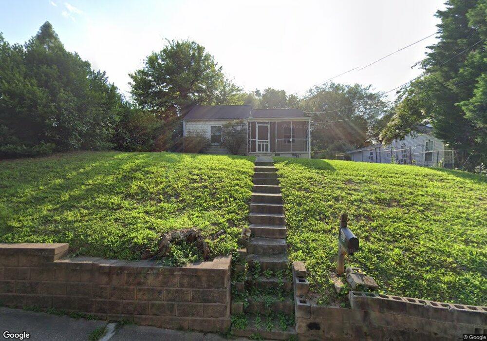
365 Allgood Rd NE Marietta, GA 30060
Estimated Value: $155,000 - $244,000
1
Bed
1
Bath
756
Sq Ft
$281/Sq Ft
Est. Value
About This Home
This home is located at 365 Allgood Rd NE, Marietta, GA 30060 and is currently estimated at $212,334, approximately $280 per square foot. 365 Allgood Rd NE is a home located in Cobb County with nearby schools including Marietta Sixth Grade Academy, A.L. Burruss Elementary School, and Marietta Middle School.
Ownership History
Date
Name
Owned For
Owner Type
Purchase Details
Closed on
Feb 9, 2016
Sold by
Compass Residential Llc
Bought by
Ccap Inc
Current Estimated Value
Purchase Details
Closed on
Jan 15, 2016
Sold by
First Citizens Bank & Trust Co
Bought by
Compass Residential Llc
Purchase Details
Closed on
Dec 1, 2015
Sold by
Ruddell E R
Bought by
First Citizens Bank & Trust Co
Purchase Details
Closed on
Dec 6, 2011
Sold by
Cobb County Tax Commission
Bought by
Shepherd William Donald
Purchase Details
Closed on
May 3, 2005
Sold by
Vickery Carole C
Bought by
Atlanta Investment Specialists
Create a Home Valuation Report for This Property
The Home Valuation Report is an in-depth analysis detailing your home's value as well as a comparison with similar homes in the area
Home Values in the Area
Average Home Value in this Area
Purchase History
| Date | Buyer | Sale Price | Title Company |
|---|---|---|---|
| Ccap Inc | $53,000 | -- | |
| Compass Residential Llc | $52,000 | -- | |
| First Citizens Bank & Trust Co | $50,000 | -- | |
| Shepherd William Donald | $1,500 | -- | |
| Atlanta Investment Specialists | $39,000 | -- |
Source: Public Records
Tax History Compared to Growth
Tax History
| Year | Tax Paid | Tax Assessment Tax Assessment Total Assessment is a certain percentage of the fair market value that is determined by local assessors to be the total taxable value of land and additions on the property. | Land | Improvement |
|---|---|---|---|---|
| 2024 | $343 | $40,524 | $19,372 | $21,152 |
| 2023 | $377 | $40,524 | $19,372 | $21,152 |
| 2022 | $277 | $32,700 | $18,396 | $14,304 |
| 2021 | $281 | $32,700 | $18,396 | $14,304 |
| 2020 | $312 | $36,276 | $18,396 | $17,880 |
| 2019 | $240 | $27,984 | $16,492 | $11,492 |
| 2018 | $240 | $27,984 | $16,492 | $11,492 |
| 2017 | $140 | $20,340 | $12,688 | $7,652 |
| 2016 | $73 | $10,608 | $3,496 | $7,112 |
| 2015 | $80 | $10,608 | $3,496 | $7,112 |
| 2014 | $80 | $10,366 | $3,496 | $6,870 |
Source: Public Records
Map
Nearby Homes
- 357 Allgood Rd NE
- 355 Wellons St NE
- 349 Allgood Rd NE
- 356 Wellons St NE
- 368 Allgood Rd NE Unit 370
- 390 Avery St NE
- 358 Allgood Rd NE Unit 360
- 343 Allgood Rd NE
- 0 Wellons Ave NE Unit 7469610
- 0 Wellons Ave NE Unit 7446206
- 0 Wellons Ave NE Unit 7029185
- 0 Wellons Ave NE Unit 8351239
- 0 Wellons Ave NE Unit 8031930
- 397 Wellons Ave NE
- 397 Wellons Ave NE
- 0 Wellons Ave NE
- 383 Montgomery St NE
- 382 Avery St NE
- 390 Wellons St NE
- 433 Birney St NE Unit 435