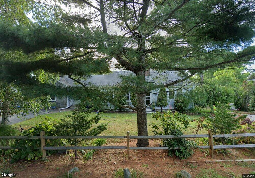
365 Depot St Dennis Port, MA 02639
Dennis Port NeighborhoodEstimated Value: $560,000 - $718,000
2
Beds
1
Bath
1,201
Sq Ft
$517/Sq Ft
Est. Value
About This Home
This home is located at 365 Depot St, Dennis Port, MA 02639 and is currently estimated at $621,009, approximately $517 per square foot. 365 Depot St is a home located in Barnstable County with nearby schools including Dennis-Yarmouth Regional High School and St. Pius X. School.
Ownership History
Date
Name
Owned For
Owner Type
Purchase Details
Closed on
Jul 6, 2006
Sold by
Holmes Doreen F and Holmes Stephen R
Bought by
Holmes Jennifer
Current Estimated Value
Home Financials for this Owner
Home Financials are based on the most recent Mortgage that was taken out on this home.
Original Mortgage
$256,000
Outstanding Balance
$151,561
Interest Rate
6.6%
Mortgage Type
Purchase Money Mortgage
Estimated Equity
$469,448
Purchase Details
Closed on
Aug 9, 1999
Sold by
Hayes John S
Bought by
Holmes Stephen R and Holmes Doreen F
Home Financials for this Owner
Home Financials are based on the most recent Mortgage that was taken out on this home.
Original Mortgage
$114,210
Interest Rate
7.54%
Mortgage Type
Purchase Money Mortgage
Purchase Details
Closed on
Oct 25, 1989
Sold by
Mccauley Mabel C
Bought by
Hayes John S
Home Financials for this Owner
Home Financials are based on the most recent Mortgage that was taken out on this home.
Original Mortgage
$40,000
Interest Rate
9.94%
Mortgage Type
Purchase Money Mortgage
Create a Home Valuation Report for This Property
The Home Valuation Report is an in-depth analysis detailing your home's value as well as a comparison with similar homes in the area
Home Values in the Area
Average Home Value in this Area
Purchase History
| Date | Buyer | Sale Price | Title Company |
|---|---|---|---|
| Holmes Jennifer | $320,000 | -- | |
| Holmes Stephen R | $126,900 | -- | |
| Hayes John S | $100,000 | -- |
Source: Public Records
Mortgage History
| Date | Status | Borrower | Loan Amount |
|---|---|---|---|
| Open | Holmes Jennifer | $256,000 | |
| Previous Owner | Holmes Stephen R | $114,210 | |
| Previous Owner | Hayes John S | $40,000 |
Source: Public Records
Tax History Compared to Growth
Tax History
| Year | Tax Paid | Tax Assessment Tax Assessment Total Assessment is a certain percentage of the fair market value that is determined by local assessors to be the total taxable value of land and additions on the property. | Land | Improvement |
|---|---|---|---|---|
| 2025 | $2,373 | $548,100 | $129,100 | $419,000 |
| 2024 | $2,311 | $526,400 | $131,500 | $394,900 |
| 2023 | $2,235 | $478,500 | $119,500 | $359,000 |
| 2022 | $2,167 | $387,000 | $119,600 | $267,400 |
| 2021 | $1,918 | $318,100 | $105,500 | $212,600 |
| 2020 | $1,818 | $298,100 | $105,500 | $192,600 |
| 2019 | $1,691 | $274,100 | $103,500 | $170,600 |
| 2018 | $1,593 | $251,300 | $98,500 | $152,800 |
| 2017 | $1,514 | $246,200 | $98,500 | $147,700 |
| 2016 | $1,508 | $231,000 | $109,400 | $121,600 |
| 2015 | $1,440 | $225,000 | $109,400 | $115,600 |
| 2014 | $1,290 | $203,200 | $87,600 | $115,600 |
Source: Public Records
Map
Nearby Homes
- 11 Lane Rd
- 91 Depot Rd W
- 24 Indian Trail
- 9 Country Ln
- 78 Upper County Rd Unit A&B
- 78 Upper County Rd
- 47 Telegraph Rd Unit 1
- 141 Division St
- 141 Division St
- 12 Candlewood Ln Unit 2-9
- 10 Candlewood Ln Unit 2-1
- 537 Depot St
- 45 Route 28
- 9 Bells Neck Rd Unit 10
- 20 Aunt Debbys Rd
- 9 Mansion St
- 40 Willow St
- 360 Center St
- 171 Searsville Rd
- 79 Massachusetts 28