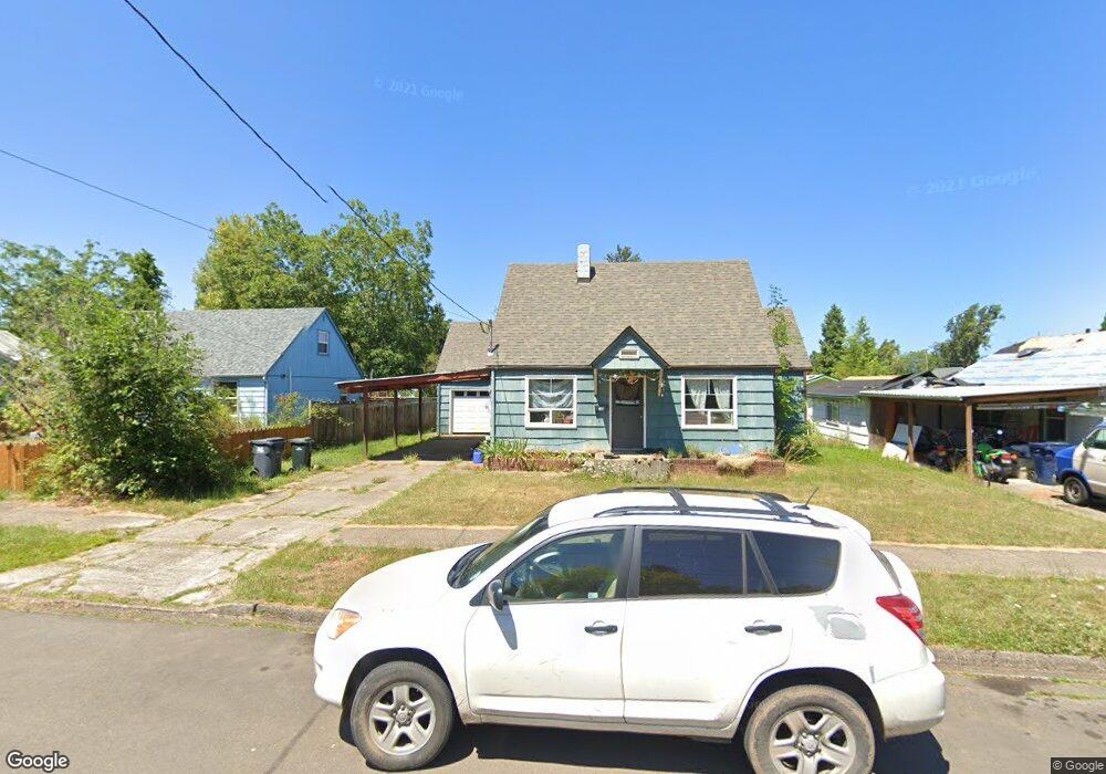
365 E 31st Ave Eugene, OR 97405
Southeast Eugene NeighborhoodEstimated Value: $391,000 - $462,000
About This Home
This home is located at 365 E 31st Ave, Eugene, OR 97405 and is currently estimated at $430,491, approximately $324 per square foot. 365 E 31st Ave is a home located in Lane County with nearby schools including Adams Elementary School, Spencer Butte Middle School, and South Eugene High School.
Ownership History
We collect this data history from publicly available records. To have your information removed, we recommend requesting removal directly through your county’s website.
Purchase Details
Purchase Details
Purchase Details
Home Financials for this Owner
Home Financials are based on the most recent Mortgage that was taken out on this home.Home Values in the Area
Average Home Value in this Area
Purchase History
We collect this data history from publicly available records. To have your information removed, we recommend requesting removal directly through your county’s website.
| Date | Buyer | Sale Price | Title Company |
|---|---|---|---|
| -- | Evergreen Land Title | ||
| -- | None Available | ||
| -- | Title Guaranty |
Mortgage History
We collect this data history from publicly available records. To have your information removed, we recommend requesting removal directly through your county’s website.
| Date | Status | Borrower | Loan Amount |
|---|---|---|---|
| Previous Owner | $89,250 |
Tax History
We collect this data history from publicly available records. To have your information removed, we recommend requesting removal directly through your county’s website.
| Year | Tax Paid | Tax Assessment Tax Assessment Total Assessment is a certain percentage of the fair market value that is determined by local assessors to be the total taxable value of land and additions on the property. | Land | Improvement |
|---|---|---|---|---|
| 2025 | $3,263 | $167,470 | -- | -- |
| 2024 | $3,222 | $162,593 | -- | -- |
| 2023 | $3,222 | $157,858 | -- | -- |
| 2022 | $3,019 | $153,261 | $0 | $0 |
| 2021 | $2,835 | $148,798 | $0 | $0 |
| 2020 | $2,845 | $144,465 | $0 | $0 |
| 2019 | $2,748 | $140,258 | $0 | $0 |
| 2018 | $2,587 | $132,207 | $0 | $0 |
| 2017 | $2,471 | $132,207 | $0 | $0 |
| 2016 | $2,410 | $128,356 | $0 | $0 |
| 2015 | $2,340 | $124,617 | $0 | $0 |
| 2014 | $2,293 | $120,987 | $0 | $0 |
Map
- 310 1/2 E 31st Ave Unit 1
- 3023 Hummingbird Ln
- 3031 Hummingbird Ln
- 2840 Ferry St
- 2963 Alder St
- 2815 Hilyard St
- 3025 Harris St
- 45 W 27th Ave Unit E
- 3398 Olive St
- 3295 Potter St
- 2682 Harris St
- 2655 Kincaid St
- 0 University St
- 2661 Harris St
- 97 W 36th Ave
- 60 W 36th Ave
- 350 Loma Linda Ln
- 2860 Baker Blvd
- 425 W 28th Ave
- 450 W 28th Ave
- 325 E 31st Ave
- 335 E 31st Ave
- 315 E 31st Ave
- 345 E 31st Ave
- 305 E 31st Ave
- 390 E 30th Ave
- 375 E 31st Ave
- 297 E 31st Ave
- 430 E 30th Ave
- 380 E 30th Ave
- 420 E 30th Ave
- 440 E 30th Ave
- 400 E 30th Ave
- -1 Mill St
- 405 E 31st Ave
- 330 E 31st Ave
- 310 E 31st Ave 005
- 310 E 31st Ave
- 310 E 31st Ave Unit 5
- 295 E 31st Ave
Ask me questions while you tour the home.