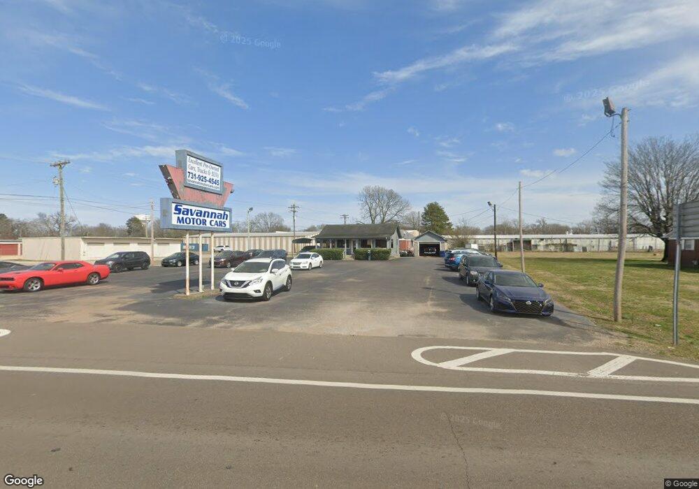
365 Florence Rd Savannah, TN 38372
Estimated Value: $135,000 - $296,000
--
Bed
1
Bath
704
Sq Ft
$292/Sq Ft
Est. Value
About This Home
This home is located at 365 Florence Rd, Savannah, TN 38372 and is currently estimated at $205,645, approximately $292 per square foot. 365 Florence Rd is a home with nearby schools including Hardin County High School and Hardin County Christian School.
Ownership History
Date
Name
Owned For
Owner Type
Purchase Details
Closed on
May 23, 2022
Sold by
Gregory Berry
Bought by
Thomas Patrick and Thomas Tori L
Current Estimated Value
Purchase Details
Closed on
Feb 6, 2014
Sold by
Berry Tiffany
Bought by
Berry Gregory Lee
Purchase Details
Closed on
Nov 7, 2003
Sold by
Pate Russell
Bought by
Berry Greg
Purchase Details
Closed on
Feb 5, 1991
Bought by
Pate Russell and Pate Barbara
Purchase Details
Closed on
Mar 23, 1990
Purchase Details
Closed on
Sep 21, 1978
Bought by
H & K Investments Inc
Create a Home Valuation Report for This Property
The Home Valuation Report is an in-depth analysis detailing your home's value as well as a comparison with similar homes in the area
Home Values in the Area
Average Home Value in this Area
Purchase History
| Date | Buyer | Sale Price | Title Company |
|---|---|---|---|
| Thomas Patrick | -- | Parrish J Gilbert | |
| Berry Gregory Lee | -- | -- | |
| Berry Greg | $175,000 | -- | |
| Pate Russell | $44,000 | -- | |
| -- | $20,000 | -- | |
| H & K Investments Inc | -- | -- |
Source: Public Records
Tax History Compared to Growth
Tax History
| Year | Tax Paid | Tax Assessment Tax Assessment Total Assessment is a certain percentage of the fair market value that is determined by local assessors to be the total taxable value of land and additions on the property. | Land | Improvement |
|---|---|---|---|---|
| 2024 | $1,782 | $72,760 | $47,160 | $25,600 |
| 2023 | $1,782 | $72,760 | $47,160 | $25,600 |
| 2022 | $1,716 | $62,200 | $44,400 | $17,800 |
| 2021 | $1,716 | $62,200 | $44,400 | $17,800 |
| 2020 | $1,716 | $62,200 | $44,400 | $17,800 |
| 2019 | $1,716 | $62,200 | $44,400 | $17,800 |
| 2018 | $1,674 | $62,200 | $44,400 | $17,800 |
| 2017 | $1,691 | $60,800 | $44,400 | $16,400 |
| 2016 | $1,691 | $60,800 | $44,400 | $16,400 |
| 2015 | $1,532 | $60,800 | $44,400 | $16,400 |
| 2014 | $1,532 | $60,800 | $44,400 | $16,400 |
Source: Public Records
Map
Nearby Homes
- 0 High Pointe Dr Unit 10202679
- 6 High Pointe Dr
- 7 High Pointe Dr
- 105 Pinhook Dr
- 190 Turner Kyle Dr
- 530 Main St E
- 25 Northcutt St
- 230 White St
- 80 Northcutt St
- 7085 Cravens Rd
- 10 Deberry St
- 171 White St
- 00 Enoch Blvd
- 710 Main St E
- 0 Hwy 128 Hwy Unit LotWP001 22873478
- 0 Hwy 128 Hwy Unit RTC2801964
- 0 Hwy 128 Hwy Unit 10143254
- 250 Ranch St
- 13305 U S Highway 64
- 250 Parkview Dr
- 420 Malcomb St
- 395 Florence Rd
- 319 Malcomb St
- 330 Florence Rd
- 350 Pinhook Dr
- 310 Florence Rd
- 455 Florence Rd
- 320 Malcomb St
- 460 Florence Rd
- 25 High St
- 505 Malcomb St
- 5 and 6 High Pointe Dr
- 475 Florence Rd
- 17 High St
- 345 Deberry St
- 480 Florence Rd
- 525 Malcomb St
- 300 Pinhook Dr
- 340 Deberry St
- 335 Deberry St
