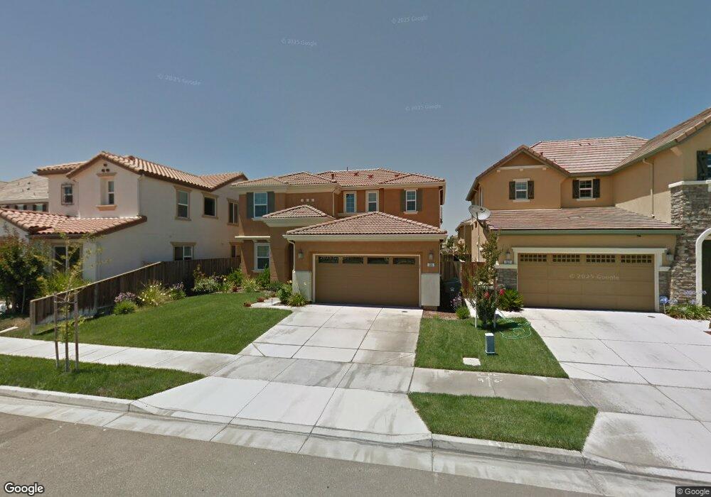
365 Johnson Ferry Rd Lathrop, CA 95330
Estimated Value: $242,000 - $649,000
4
Beds
3
Baths
2,290
Sq Ft
$229/Sq Ft
Est. Value
About This Home
This home is located at 365 Johnson Ferry Rd, Lathrop, CA 95330 and is currently estimated at $525,023, approximately $229 per square foot. 365 Johnson Ferry Rd is a home located in San Joaquin County with nearby schools including Mossdale Elementary School, Lathrop High School, and River Island School of Technology.
Ownership History
Date
Name
Owned For
Owner Type
Purchase Details
Closed on
Apr 28, 2022
Sold by
Damaso Charlie R and Damaso Aida B
Bought by
Charlie & Aida Damaso Family Trust
Current Estimated Value
Purchase Details
Closed on
Aug 24, 2010
Sold by
Kb Home Central Valley Inc
Bought by
Damaso Charlie and Damaso Aida
Home Financials for this Owner
Home Financials are based on the most recent Mortgage that was taken out on this home.
Original Mortgage
$176,000
Interest Rate
4.52%
Mortgage Type
New Conventional
Create a Home Valuation Report for This Property
The Home Valuation Report is an in-depth analysis detailing your home's value as well as a comparison with similar homes in the area
Home Values in the Area
Average Home Value in this Area
Purchase History
| Date | Buyer | Sale Price | Title Company |
|---|---|---|---|
| Charlie & Aida Damaso Family Trust | -- | -- | |
| Damaso Charlie | $220,000 | First American Title Company |
Source: Public Records
Mortgage History
| Date | Status | Borrower | Loan Amount |
|---|---|---|---|
| Previous Owner | Damaso Charlie | $176,000 |
Source: Public Records
Tax History Compared to Growth
Tax History
| Year | Tax Paid | Tax Assessment Tax Assessment Total Assessment is a certain percentage of the fair market value that is determined by local assessors to be the total taxable value of land and additions on the property. | Land | Improvement |
|---|---|---|---|---|
| 2025 | $5,333 | $281,844 | $70,459 | $211,385 |
| 2024 | $5,209 | $276,319 | $69,078 | $207,241 |
| 2023 | $5,093 | $270,902 | $67,724 | $203,178 |
| 2022 | $5,132 | $265,592 | $66,397 | $199,195 |
| 2021 | $5,037 | $260,386 | $65,096 | $195,290 |
| 2020 | $4,899 | $257,717 | $64,429 | $193,288 |
| 2019 | $4,836 | $252,665 | $63,166 | $189,499 |
| 2018 | $4,769 | $247,712 | $61,928 | $185,784 |
| 2017 | $4,701 | $242,856 | $60,714 | $182,142 |
| 2016 | $4,614 | $238,095 | $59,524 | $178,571 |
| 2014 | $4,402 | $229,927 | $57,482 | $172,445 |
Source: Public Records
Map
Nearby Homes
- 375 Colonial Trail
- 15492 Warbler Place
- 2595 Garden Farms Ave
- 2812 Garden Farms Ave
- 833 Tern Dr
- 16796 English Country Trail
- 17002 Pecan Hollow Way
- 428 Pismo Dr
- 316 Pismo Dr
- 334 Pismo Dr
- 16116 Pirates Cove Ln
- 347 Pismo Dr
- 431 Pismo Dr
- 16119 Pirates Cove Ln
- 16095 Pirates Cove Ln
- Plan 2 at Westwind at River Islands
- Plan 1 at Westwind at River Islands
- Plan 3 at Westwind at River Islands
- 16083 Pirates Cove Ln
- Plan 2 at Stanford Crossing - Journey
- 357 Johnson Ferry Rd
- 373 Johnson Ferry Rd
- 370 Craftsman Dr
- 382 Craftsman Dr
- 381 Johnson Ferry Rd
- 349 Johnson Ferry Rd
- 388 Craftsman Dr
- 354 Craftsman Dr
- 366 Johnson Ferry Rd
- 341 Johnson Ferry Rd
- 358 Johnson Ferry Rd
- 378 Johnson Ferry Rd
- 16724 Colonial Trail
- 348 Craftsman Dr
- 350 Johnson Ferry Rd
- 342 Johnson Ferry Rd
- 16700 Colonial Trail
- 382 Johnson Ferry Rd
- 333 Johnson Ferry Rd
- 16719 Lorina Ct