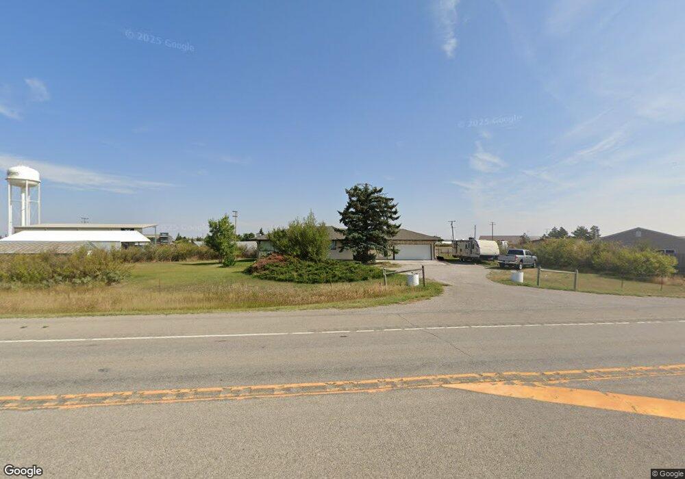
36509 Us Highway 87 Stanford, MT 59479
Estimated Value: $223,000 - $343,883
--
Bed
--
Bath
1,380
Sq Ft
$205/Sq Ft
Est. Value
About This Home
This home is located at 36509 Us Highway 87, Stanford, MT 59479 and is currently estimated at $283,442, approximately $205 per square foot. 36509 Us Highway 87 is a home with nearby schools including Stanford Elementary School, Stanford Junior High School, and Stanford High School.
Ownership History
Date
Name
Owned For
Owner Type
Purchase Details
Closed on
Nov 19, 2016
Sold by
Bayview Loan Servicing Llc
Bought by
Parsons Don and Parsons Joanne
Current Estimated Value
Home Financials for this Owner
Home Financials are based on the most recent Mortgage that was taken out on this home.
Original Mortgage
$76,000
Interest Rate
3.54%
Mortgage Type
Commercial
Purchase Details
Closed on
Dec 12, 2011
Sold by
Mcbride Ranch Lp
Bought by
Mcbride Donald K
Create a Home Valuation Report for This Property
The Home Valuation Report is an in-depth analysis detailing your home's value as well as a comparison with similar homes in the area
Home Values in the Area
Average Home Value in this Area
Purchase History
| Date | Buyer | Sale Price | Title Company |
|---|---|---|---|
| Parsons Don | $95,000 | First American Title | |
| Mcbride Donald K | -- | None Available |
Source: Public Records
Mortgage History
| Date | Status | Borrower | Loan Amount |
|---|---|---|---|
| Closed | Parsons Don | $76,000 |
Source: Public Records
Tax History Compared to Growth
Tax History
| Year | Tax Paid | Tax Assessment Tax Assessment Total Assessment is a certain percentage of the fair market value that is determined by local assessors to be the total taxable value of land and additions on the property. | Land | Improvement |
|---|---|---|---|---|
| 2025 | $1,241 | $291,400 | $0 | $0 |
| 2024 | $1,673 | $220,600 | $0 | $0 |
| 2023 | $1,687 | $220,600 | $0 | $0 |
| 2022 | $1,114 | $155,700 | $0 | $0 |
| 2021 | $1,159 | $155,700 | $0 | $0 |
| 2020 | $1,075 | $143,910 | $0 | $0 |
| 2019 | $1,060 | $143,910 | $0 | $0 |
| 2018 | $1,119 | $145,800 | $0 | $0 |
| 2017 | $679 | $95,300 | $0 | $0 |
| 2016 | $1,426 | $75,687 | $0 | $0 |
| 2015 | $553 | $75,687 | $0 | $0 |
| 2014 | $769 | $58,484 | $0 | $0 |
Source: Public Records
Map
Nearby Homes
- 205 3rd St S
- 114 3rd Ave S
- 90 3rd Ave S
- 108 2nd Ave S
- 118 1st St N
- 210 3rd Ave N
- TBD Montana 200
- 403 Main St
- TBD Agate Rd
- 500 Main St
- 42 Ruby Dr
- NHN Sapphire Village
- 0 Sapphire Village Unit 22-830
- 7068 S Peak Rd
- 0 Rogers Ln Unit 24031302
- 0 Rogers Ln Unit 353973
- 3816 Mt Hwy 400
- 413 2nd St S
- TBD Vacant Land
- 0 Kolin Rd
- 503 3rd St S
- 511 3rd St S
- 36377 Us Highway 87
- 413 3rd St S
- 409 3rd St S
- 405 3rd St S
- TBD Us Hwy 87 Stanford Judith Basin
- 321 3rd St S
- TBD Us Highway 87
- 313 3rd St S
- 221 4th Ave S
- 402 3rd Ave S
- 309 3rd St S
- 207 4th Ave S
- 211 4th Ave S
- 301 3rd St S
- 317 2nd St S
- 220 3rd Ave S
- 213 5th Ave South Stanford
- 317 3rd Ave S