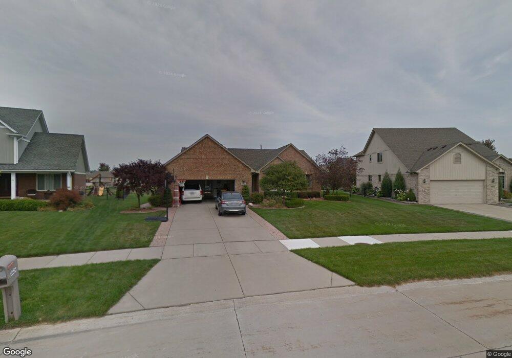
36529 Brennan Rd New Baltimore, MI 48047
Estimated Value: $346,158 - $455,000
--
Bed
--
Bath
1,959
Sq Ft
$207/Sq Ft
Est. Value
About This Home
This home is located at 36529 Brennan Rd, New Baltimore, MI 48047 and is currently estimated at $405,790, approximately $207 per square foot. 36529 Brennan Rd is a home located in Macomb County with nearby schools including Ashley Elementary School, Anchor Bay Middle School North, and Anchor Bay High School.
Ownership History
Date
Name
Owned For
Owner Type
Purchase Details
Closed on
Mar 28, 2002
Sold by
Creative Phase Building
Bought by
Paul Craig M
Current Estimated Value
Home Financials for this Owner
Home Financials are based on the most recent Mortgage that was taken out on this home.
Original Mortgage
$175,000
Interest Rate
6.87%
Mortgage Type
Purchase Money Mortgage
Purchase Details
Closed on
Sep 5, 2001
Sold by
Ashley Farms Associates Llc
Bought by
Creative Phase Building Inc
Create a Home Valuation Report for This Property
The Home Valuation Report is an in-depth analysis detailing your home's value as well as a comparison with similar homes in the area
Home Values in the Area
Average Home Value in this Area
Purchase History
| Date | Buyer | Sale Price | Title Company |
|---|---|---|---|
| Paul Craig M | $227,959 | -- | |
| Creative Phase Building Inc | $47,500 | Chicago Title Insurance Co |
Source: Public Records
Mortgage History
| Date | Status | Borrower | Loan Amount |
|---|---|---|---|
| Previous Owner | Paul Craig M | $175,000 |
Source: Public Records
Tax History Compared to Growth
Tax History
| Year | Tax Paid | Tax Assessment Tax Assessment Total Assessment is a certain percentage of the fair market value that is determined by local assessors to be the total taxable value of land and additions on the property. | Land | Improvement |
|---|---|---|---|---|
| 2025 | $4,606 | $163,600 | $0 | $0 |
| 2024 | $3,861 | $157,800 | $0 | $0 |
| 2023 | $3,676 | $147,600 | $0 | $0 |
| 2022 | $4,184 | $137,200 | $0 | $0 |
| 2021 | $4,029 | $131,400 | $0 | $0 |
| 2020 | $3,403 | $128,600 | $0 | $0 |
| 2019 | $3,838 | $120,500 | $0 | $0 |
| 2018 | $3,762 | $116,200 | $0 | $0 |
| 2017 | $3,754 | $107,700 | $23,800 | $83,900 |
| 2016 | $3,725 | $107,700 | $0 | $0 |
| 2015 | -- | $102,100 | $0 | $0 |
| 2014 | -- | $89,300 | $0 | $0 |
Source: Public Records
Map
Nearby Homes
- 53561 Mary Ann Ln
- 36285 Jackson St
- lot 56 & 57 County Line Rd
- 53120 Fox Pointe Dr
- 35990 Windridge Dr Unit 113
- 36556 Orchard Lake Dr
- 54161 Carrigan Dr Unit 106
- 35925 Windridge Dr Unit 82
- 35962 Cascade Dr Unit 103
- 54690 Shady Creek Dr
- 53185 Woodland Dr
- 53214 Woodland Dr
- 54261 Cascade Ct Unit 96
- 35955 Glenville Dr Unit 187
- 51400 Ashley St
- 35873 Glenville Dr Unit 182
- 36711 N Pointe Dr
- 53531 Bree Dr
- 51520 Bedford St
- Bingham Colonial Plan at Windridge Estates
- 36541 Brennan Rd
- 36517 Brennan Rd
- 53827 Dana Ct
- 36542 Saint Clair Dr
- 36558 Saint Clair Dr
- 36505 Brennan Rd
- 36553 Brennan Rd
- 36530 Saint Clair Dr
- 36566 Saint Clair Dr
- 53821 Dana Ct
- 36520 Brennan Rd
- 36491 Brennan Rd
- 53830 Dana Ct
- 36538 Brennan Rd
- 36500 Brennan Rd
- 36518 Saint Clair Dr
- 36578 Saint Clair Dr
- 36556 Brennan Rd
- 36535 Haley Dr
- 36479 Brennan Rd