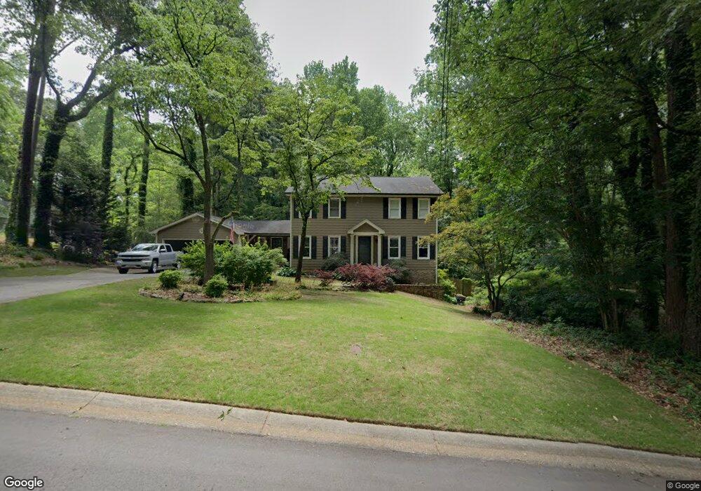
3654 Hunting Ridge Dr SW Unit 1 Lilburn, GA 30047
Estimated Value: $405,000 - $446,000
4
Beds
3
Baths
2,422
Sq Ft
$176/Sq Ft
Est. Value
About This Home
This home is located at 3654 Hunting Ridge Dr SW Unit 1, Lilburn, GA 30047 and is currently estimated at $427,066, approximately $176 per square foot. 3654 Hunting Ridge Dr SW Unit 1 is a home located in Gwinnett County with nearby schools including Head Elementary School, Five Forks Middle School, and Brookwood High School.
Ownership History
Date
Name
Owned For
Owner Type
Purchase Details
Closed on
Dec 29, 2010
Sold by
Haun Robert K
Bought by
Kohl-Haun Devin T
Current Estimated Value
Purchase Details
Closed on
Mar 26, 2004
Sold by
Justice Justice E and Justice Jeanette
Bought by
Glenn Keith C and Glenn Theresa
Home Financials for this Owner
Home Financials are based on the most recent Mortgage that was taken out on this home.
Original Mortgage
$17,990
Interest Rate
5.77%
Mortgage Type
Unknown
Create a Home Valuation Report for This Property
The Home Valuation Report is an in-depth analysis detailing your home's value as well as a comparison with similar homes in the area
Home Values in the Area
Average Home Value in this Area
Purchase History
| Date | Buyer | Sale Price | Title Company |
|---|---|---|---|
| Kohl-Haun Devin T | -- | -- | |
| Glenn Keith C | $175,500 | -- |
Source: Public Records
Mortgage History
| Date | Status | Borrower | Loan Amount |
|---|---|---|---|
| Previous Owner | Glenn Keith C | $17,990 | |
| Previous Owner | Glenn Keith C | $140,400 |
Source: Public Records
Tax History Compared to Growth
Tax History
| Year | Tax Paid | Tax Assessment Tax Assessment Total Assessment is a certain percentage of the fair market value that is determined by local assessors to be the total taxable value of land and additions on the property. | Land | Improvement |
|---|---|---|---|---|
| 2025 | $4,439 | $162,160 | $30,000 | $132,160 |
| 2024 | $4,475 | $157,440 | $30,000 | $127,440 |
| 2023 | $4,475 | $145,520 | $35,600 | $109,920 |
| 2022 | $4,195 | $145,520 | $35,600 | $109,920 |
| 2021 | $3,493 | $109,080 | $23,200 | $85,880 |
| 2020 | $3,302 | $99,120 | $23,200 | $75,920 |
| 2019 | $3,140 | $95,800 | $20,000 | $75,800 |
| 2018 | $3,143 | $95,800 | $20,000 | $75,800 |
| 2016 | $2,834 | $80,560 | $17,600 | $62,960 |
| 2015 | $2,858 | $80,560 | $17,600 | $62,960 |
| 2014 | $2,072 | $80,560 | $17,600 | $62,960 |
Source: Public Records
Map
Nearby Homes
- 3663 Stonelake Ct SW Unit 1
- 1776 Bear Cave SW
- 3725 Hunting Ridge Dr SW
- 3728 Kelin Ct SW
- 1795 Elmwood Cir
- 1893 Hedgestone Ct
- 3594 Hedgestone Ln
- 3588 Kelin Ct SW
- 1721 Bruckner Ct
- 3868 Buckland Dr SW
- 2350 Action Way
- 1905 Embassy Walk Ln
- 1725 Spindle Top Ct SW
- 1640 Killian Hill Rd SW
- 4000 Embassy Way
- 1535 Pathfinder Way SW Unit 1
- 3331 Manchester Dr SW
- 3664 Hunting Ridge Dr SW Unit 1
- 1697 Rivermist Dr SW
- 1697 Rivermist Dr SW Unit 1
- 1707 Rivermist Dr SW
- 3674 Hunting Ridge Dr SW
- 3665 Hunting Ridge Dr SW
- 1677 Rivermist Dr SW
- 1717 Rivermist Dr SW
- 3675 Hunting Ridge Dr SW Unit 1
- 3684 Hunting Ridge Dr SW
- 1667 Rivermist Dr SW
- 1688 Rivermist Dr SW
- 1678 Rivermist Dr SW
- 1698 Rivermist Dr SW
- 3662 Stonelake Ct SW
- 1737 Rivermist Dr SW
- 3694 Hunting Ridge Dr SW
- 1708 Rivermist Dr SW Unit 1
- 3672 Stonelake Ct SW Unit 1
- 1668 Rivermist Dr SW