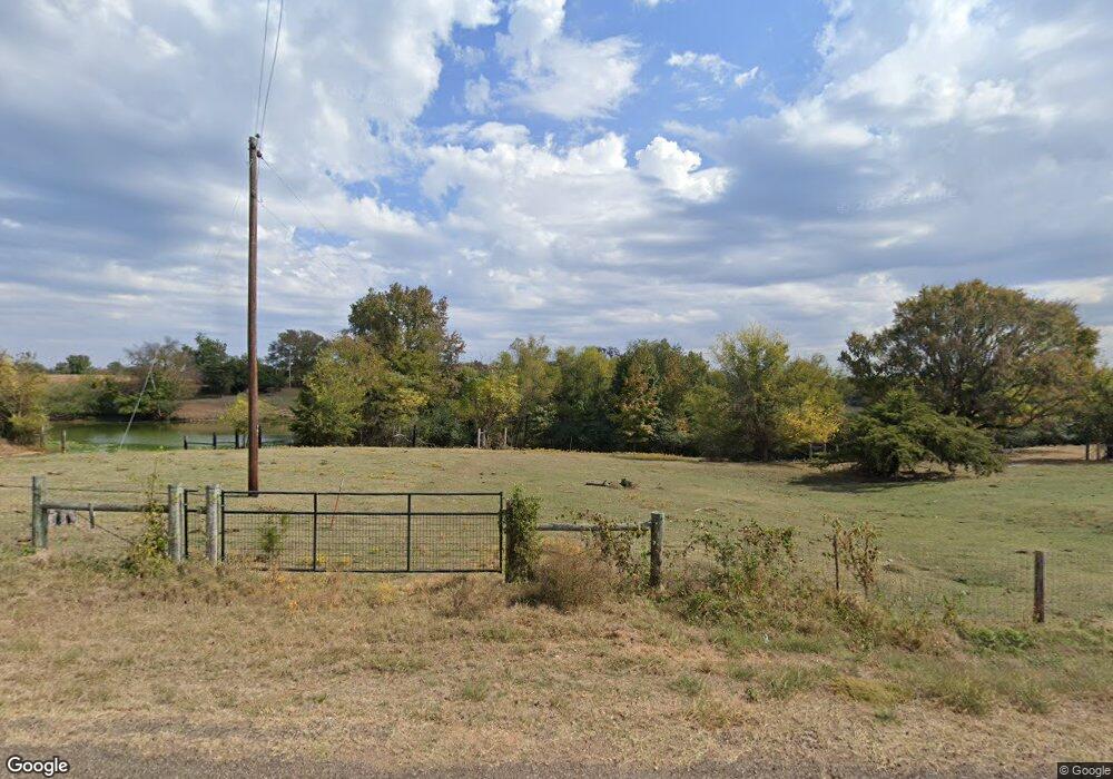
366 Apache Trail de Queen, AR 71832
Estimated Value: $218,000 - $349,000
Studio
2
Baths
2,064
Sq Ft
$134/Sq Ft
Est. Value
About This Home
This home is located at 366 Apache Trail, de Queen, AR 71832 and is currently estimated at $277,579, approximately $134 per square foot. 366 Apache Trail is a home located in Sevier County with nearby schools including Dequeen Primary School, Dequeen Elementary School, and Dequeen Junior High School.
Ownership History
Date
Name
Owned For
Owner Type
Purchase Details
Closed on
Feb 24, 2023
Sold by
Simer Milton D and Simer Tonya S
Bought by
Martinez Teobaldo I V
Current Estimated Value
Purchase Details
Closed on
Jun 17, 2014
Bought by
Vargas Teobaldo I
Purchase Details
Closed on
Mar 3, 2008
Bought by
Cole John L and Cole Priscilla
Purchase Details
Closed on
Feb 23, 1998
Bought by
Boyd Roger and Mary Lou
Purchase Details
Closed on
Nov 23, 1994
Bought by
Wishard Gregory A and Wishard Stephanie
Create a Home Valuation Report for This Property
The Home Valuation Report is an in-depth analysis detailing your home's value as well as a comparison with similar homes in the area
Purchase History
| Date | Buyer | Sale Price | Title Company |
|---|---|---|---|
| Martinez Teobaldo I V | $185,000 | De Queen Abs Co Inc | |
| Vargas Teobaldo I | $200,000 | -- | |
| Cole John L | $180,000 | -- | |
| Boyd Roger | $208,000 | -- | |
| Wishard Gregory A | $100,000 | -- |
Source: Public Records
Tax History
| Year | Tax Paid | Tax Assessment Tax Assessment Total Assessment is a certain percentage of the fair market value that is determined by local assessors to be the total taxable value of land and additions on the property. | Land | Improvement |
|---|---|---|---|---|
| 2025 | $413 | $23,120 | $3,080 | $20,040 |
| 2024 | $413 | $23,120 | $3,080 | $20,040 |
| 2023 | $488 | $23,120 | $3,080 | $20,040 |
| 2022 | $538 | $23,120 | $3,080 | $20,040 |
| 2021 | $538 | $23,120 | $3,080 | $20,040 |
| 2020 | $538 | $23,120 | $3,080 | $20,040 |
| 2019 | $716 | $18,130 | $2,490 | $15,640 |
| 2018 | $716 | $18,130 | $2,490 | $15,640 |
| 2017 | $627 | $18,130 | $2,490 | $15,640 |
| 2016 | $627 | $18,130 | $2,490 | $15,640 |
| 2015 | $627 | $18,130 | $2,490 | $15,640 |
| 2014 | $627 | $17,580 | $2,180 | $15,400 |
Source: Public Records
Map
Nearby Homes
- 135 Rolling Oaks Dr
- 156 N Rolling Oaks Dr
- 150 N Rolling Oaks Dr
- 151 N Rolling Oaks Dr
- 102 Rolling Oaks Dr
- 101 Rolling Oaks Dr
- 110 Rolling Oaks Dr
- 143 N Rolling Oaks Dr
- 344 Crosstrails Rd
- 374 Avon Rd
- 325 Crosstrails Rd
- 1426 Highway 71
- 117 N Rolling Oaks Dr
- 118 Rolling Oaks Dr
- 125 Rolling Oaks Dr
- 904 E Collin Raye Dr
- TBD Collin Raye Dr
- 407 N 4th St
- 608 W Eighty Thousand Rd
- 0 To Be Determined Unit 23001783
- 152 Choctaw Trail
- 299 Apache Trail
- 138 Choctaw Trail
- 400 Apache Trail
- 269 Apache Trail
- 179 Woodridge Rd
- 412 Apache Trail
- 212 Apache Trail
- 216 Choctaw Trail
- 180 Apache Trail
- 206 Apache Trail
- 219 Apache Trail
- 187 Apache Trail
- 142 Warren Dr
- 123 Ottawa Rd
- 577 Highway 71 N
- 577 Highway 71 N
- 126 Warren Dr
- 536 Highway 71 N
- 590 Highway 71 N
