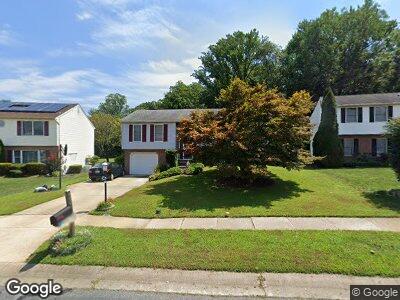
367 Point to Point Rd Bel Air, MD 21015
Hunters Run NeighborhoodEstimated Value: $421,000 - $467,000
3
Beds
3
Baths
1,682
Sq Ft
$259/Sq Ft
Est. Value
About This Home
This home is located at 367 Point to Point Rd, Bel Air, MD 21015 and is currently estimated at $434,973, approximately $258 per square foot. 367 Point to Point Rd is a home located in Harford County with nearby schools including Ring Factory Elementary School, Patterson Mill Middle School, and Patterson Mill High School.
Ownership History
Date
Name
Owned For
Owner Type
Purchase Details
Closed on
Jan 7, 2010
Sold by
Bates William R
Bought by
Glendon Dana Lynn
Current Estimated Value
Purchase Details
Closed on
Dec 13, 1996
Sold by
Honchar Kevin C
Bought by
Bates William R and Bates Valerie J
Purchase Details
Closed on
Oct 21, 1987
Sold by
Ward Bob Inc
Bought by
Honchar Kevin C
Home Financials for this Owner
Home Financials are based on the most recent Mortgage that was taken out on this home.
Original Mortgage
$91,200
Interest Rate
11.58%
Create a Home Valuation Report for This Property
The Home Valuation Report is an in-depth analysis detailing your home's value as well as a comparison with similar homes in the area
Home Values in the Area
Average Home Value in this Area
Purchase History
| Date | Buyer | Sale Price | Title Company |
|---|---|---|---|
| Glendon Dana Lynn | $295,500 | -- | |
| Bates William R | $138,000 | -- | |
| Honchar Kevin C | $115,200 | -- |
Source: Public Records
Mortgage History
| Date | Status | Borrower | Loan Amount |
|---|---|---|---|
| Open | Glendon Dana Lynn | $273,621 | |
| Previous Owner | Glendon Dana Lynn | $301,853 | |
| Previous Owner | Honchar Kevin C | $91,200 | |
| Closed | Glendon Dana Lynn | -- |
Source: Public Records
Tax History Compared to Growth
Tax History
| Year | Tax Paid | Tax Assessment Tax Assessment Total Assessment is a certain percentage of the fair market value that is determined by local assessors to be the total taxable value of land and additions on the property. | Land | Improvement |
|---|---|---|---|---|
| 2024 | $3,310 | $303,700 | $0 | $0 |
| 2023 | $3,123 | $286,500 | $109,100 | $177,400 |
| 2022 | $3,087 | $283,233 | $0 | $0 |
| 2021 | $3,193 | $279,967 | $0 | $0 |
| 2020 | $3,193 | $276,700 | $109,100 | $167,600 |
| 2019 | $3,139 | $272,000 | $0 | $0 |
| 2018 | $3,057 | $267,300 | $0 | $0 |
| 2017 | $3,003 | $262,600 | $0 | $0 |
| 2016 | -- | $260,800 | $0 | $0 |
| 2015 | $3,279 | $259,000 | $0 | $0 |
| 2014 | $3,279 | $257,200 | $0 | $0 |
Source: Public Records
Map
Nearby Homes
- 363 Point to Point Rd
- 2207 Oak Hunt Ct
- 332 Hunters Run Dr
- 603 E Wheel Rd
- 318 Bright Oaks Dr
- 2229 Hunters Chase
- 57 Oak Crest Ct
- 140 Royal Oak Dr Unit 140-A
- 100H Hazelnut Ct
- 2423 Parliament Dr
- 338 Sullivan Dr
- 1402 Thorndon Dr
- 111 Laurel Valley Ct
- 2539 Merrick Ct
- 614 Cedarday Dr
- 216 Rolling Knoll Dr
- 133 Laurel Woods Ct
- 1802 Rollins Ct
- 238 Maple Wreath Ct
- 2703 Merrick Way