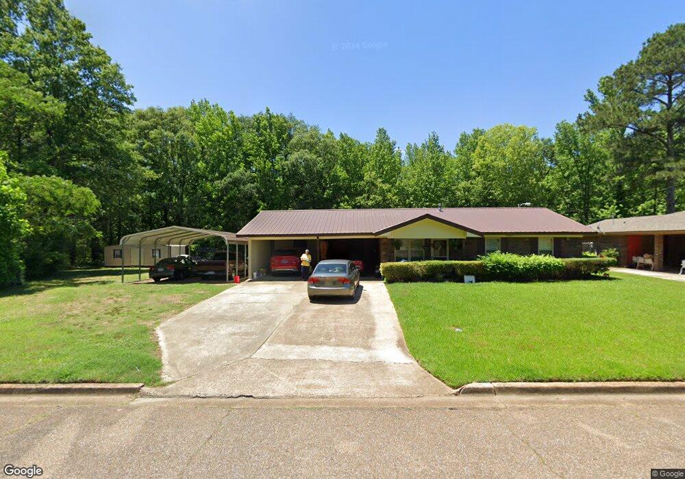
367 Tedford Dr West Point, MS 39773
Estimated Value: $125,987 - $165,000
3
Beds
--
Bath
1,432
Sq Ft
$101/Sq Ft
Est. Value
About This Home
This home is located at 367 Tedford Dr, West Point, MS 39773 and is currently estimated at $143,997, approximately $100 per square foot. 367 Tedford Dr is a home located in Clay County with nearby schools including East Side Elementary School, West Clay Elementary School, and Church Hill Elementary School.
Create a Home Valuation Report for This Property
The Home Valuation Report is an in-depth analysis detailing your home's value as well as a comparison with similar homes in the area
Home Values in the Area
Average Home Value in this Area
Tax History Compared to Growth
Tax History
| Year | Tax Paid | Tax Assessment Tax Assessment Total Assessment is a certain percentage of the fair market value that is determined by local assessors to be the total taxable value of land and additions on the property. | Land | Improvement |
|---|---|---|---|---|
| 2024 | $666 | $12,276 | $2,083 | $10,193 |
| 2023 | $1,541 | $10,295 | $2,083 | $8,212 |
| 2022 | $547 | $10,033 | $2,083 | $7,950 |
| 2021 | $543 | $10,033 | $2,083 | $7,950 |
| 2020 | $545 | $10,033 | $2,083 | $7,950 |
| 2019 | $499 | $9,723 | $2,083 | $7,640 |
| 2018 | $475 | $9,581 | $2,083 | $7,498 |
| 2017 | $475 | $9,581 | $2,083 | $7,498 |
| 2016 | $464 | $9,581 | $2,083 | $7,498 |
| 2015 | $439 | $8,866 | $2,083 | $6,783 |
| 2014 | $133 | $8,866 | $2,083 | $6,783 |
| 2013 | $133 | $8,866 | $2,083 | $6,783 |
Source: Public Records
Map
Nearby Homes
- 91 Fagan Blvd
- 229 S Division St
- 228 S Division St
- 206 S Division St
- 0 Hwy 45 Alt N
- 98 Court St
- 346 E Brame Ave
- 0 Us Hwy 45a Unit 22-3720
- 0 Us Hwy 45a Unit 4033641
- 593 Lone Oak Dr
- 8143 N Hwy 45 Alt
- 864 E Broad St
- 402 Cromwell St
- 238 Calhoun St
- 26852 E Main St
- 480 E Westbrook St
- 1104 E Broad St
- 593 Lone Oak Park
- 564 E Morrow St
- 1153 E Broad St