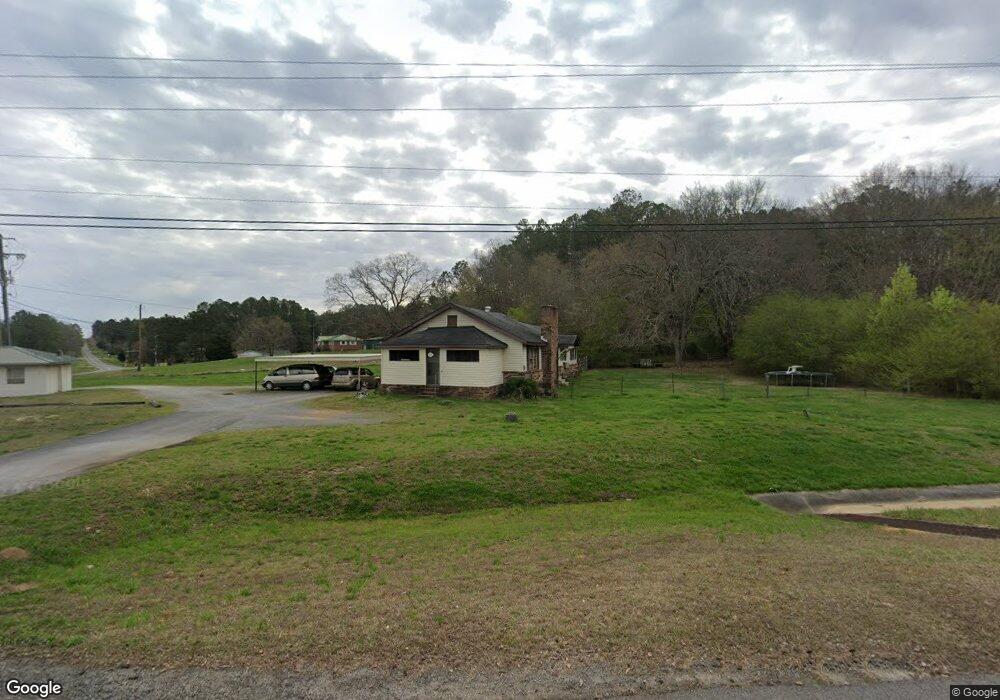
3673 Buchanan Hwy Cedartown, GA 30125
Estimated Value: $189,000 - $225,000
2
Beds
1
Bath
1,320
Sq Ft
$157/Sq Ft
Est. Value
About This Home
This home is located at 3673 Buchanan Hwy, Cedartown, GA 30125 and is currently estimated at $206,998, approximately $156 per square foot. 3673 Buchanan Hwy is a home located in Polk County.
Ownership History
Date
Name
Owned For
Owner Type
Purchase Details
Closed on
Jun 24, 2025
Sold by
Winkles Betty Louise
Bought by
Bevel Deborah and Bevel Eddie
Current Estimated Value
Purchase Details
Closed on
Feb 13, 2014
Sold by
Bevel Eddie
Bought by
Winkles Howard Randall
Purchase Details
Closed on
Nov 30, 1995
Sold by
Martin Anthony H and Martin Terri H
Bought by
Bevel Eddie and Bevel Deborah
Purchase Details
Closed on
Nov 28, 1995
Sold by
Puckett Gary Randall * Adonna M
Bought by
Martin Anthony H and Martin Terri H
Purchase Details
Closed on
Jul 17, 1992
Sold by
Puckett Gary R
Bought by
Martin Anthony H
Purchase Details
Closed on
Oct 4, 1982
Bought by
Puckett Gary R
Purchase Details
Closed on
Nov 1, 1979
Sold by
Murdock Zelma G
Bought by
Puckett Gary R
Purchase Details
Closed on
Jan 1, 1979
Sold by
Murdock R L
Bought by
Murdock Edward
Purchase Details
Closed on
Oct 20, 1945
Bought by
Murdock R L
Create a Home Valuation Report for This Property
The Home Valuation Report is an in-depth analysis detailing your home's value as well as a comparison with similar homes in the area
Home Values in the Area
Average Home Value in this Area
Purchase History
| Date | Buyer | Sale Price | Title Company |
|---|---|---|---|
| Bevel Deborah | -- | -- | |
| Winkles Betty Louise | -- | -- | |
| Winkles Howard Randall | -- | -- | |
| Bevel Eddie | $44,900 | -- | |
| Martin Anthony H | -- | -- | |
| Martin Anthony H | $39,000 | -- | |
| Puckett Gary R | -- | -- | |
| Puckett Gary R | -- | -- | |
| Murdock Zelma G | -- | -- | |
| Murdock Edward | -- | -- | |
| Murdock R L | -- | -- |
Source: Public Records
Tax History Compared to Growth
Tax History
| Year | Tax Paid | Tax Assessment Tax Assessment Total Assessment is a certain percentage of the fair market value that is determined by local assessors to be the total taxable value of land and additions on the property. | Land | Improvement |
|---|---|---|---|---|
| 2024 | $1,089 | $52,097 | $3,701 | $48,396 |
| 2023 | $816 | $34,365 | $3,701 | $30,664 |
| 2022 | $681 | $28,687 | $2,467 | $26,220 |
| 2021 | $690 | $28,687 | $2,467 | $26,220 |
| 2020 | $691 | $28,687 | $2,467 | $26,220 |
| 2019 | $550 | $20,498 | $2,467 | $18,031 |
| 2018 | $550 | $19,969 | $2,467 | $17,502 |
| 2017 | $543 | $19,969 | $2,467 | $17,502 |
| 2016 | $570 | $20,956 | $3,454 | $17,502 |
| 2015 | $572 | $20,956 | $3,454 | $17,502 |
| 2014 | $521 | $20,956 | $3,454 | $17,502 |
Source: Public Records
Map
Nearby Homes
- 0 Youngs Farm Rd Unit 24829378
- 0 Buchanan Hwy Unit 10558945
- 4550 Buchanan Hwy
- 4267 Buchanan Hwy
- 525 Grogan Rd
- 539 Grogan Rd
- 557 Grogan Rd
- 160 Tate Rd
- 00 Antioch Rd
- 95 Wieuca Way
- 0 Wieuca Way Unit 10614129
- 000 Wieuca Way
- 142 Acres On Judkin Mill Rd
- 00 Buchanan Hwy
- 766 Antioch Rd
- 1987 Buchanan Hwy
- 35 Old Mill Rd
- 497 Judkin Mill Rd
- 1870 Tallapoosa Hwy
- 7474 Highway 27
- 0 Youngs Valley Rd
- 00 Youngs Valley Rd
- 0 Youngs Farm Rd Unit 7473824
- 0 Youngs Farm Rd Unit 7084863
- 0 Youngs Farm Rd Unit 7436130
- 0 Youngs Farm Rd Unit 8609763
- 0 Youngs Farm Rd Unit 8457880
- 0 Youngs Farm Rd Unit 8089860
- 0 Youngs Farm Rd Unit 8038183
- 0 Youngs Farm Rd Unit 8434200
- 0 Youngs Farm Rd Unit 7052155
- 0 Youngs Farm Rd Unit 7127084
- 0 Youngs Farm Rd Unit 7233746
- 0 Youngs Farm Rd Unit 3191711
- 0 Youngs Farm Rd Unit 3124064
- 0 Youngs Farm Rd Unit 7142754
- 0 Youngs Farm Rd Unit 3120244
- 0 Youngs Farm Rd Unit 7142714
- 0 Youngs Farm Rd Unit 7298021
- 0 Youngs Farm Rd Unit 7160666