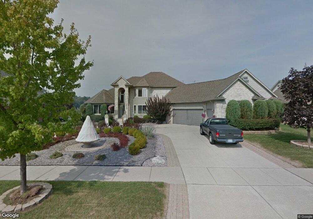
36743 N Pointe Cir New Baltimore, MI 48047
Estimated Value: $502,000 - $574,000
4
Beds
4
Baths
3,000
Sq Ft
$181/Sq Ft
Est. Value
About This Home
This home is located at 36743 N Pointe Cir, New Baltimore, MI 48047 and is currently estimated at $542,964, approximately $180 per square foot. 36743 N Pointe Cir is a home located in Macomb County with nearby schools including Ashley Elementary School, Anchor Bay Middle School North, and Anchor Bay High School.
Ownership History
Date
Name
Owned For
Owner Type
Purchase Details
Closed on
Jun 8, 2000
Sold by
Baltimore Properties Int
Bought by
Slupski James
Current Estimated Value
Home Financials for this Owner
Home Financials are based on the most recent Mortgage that was taken out on this home.
Original Mortgage
$205,000
Outstanding Balance
$73,968
Interest Rate
8.55%
Mortgage Type
Purchase Money Mortgage
Estimated Equity
$468,996
Create a Home Valuation Report for This Property
The Home Valuation Report is an in-depth analysis detailing your home's value as well as a comparison with similar homes in the area
Home Values in the Area
Average Home Value in this Area
Purchase History
| Date | Buyer | Sale Price | Title Company |
|---|---|---|---|
| Slupski James | $42,500 | -- |
Source: Public Records
Mortgage History
| Date | Status | Borrower | Loan Amount |
|---|---|---|---|
| Open | Slupski James | $205,000 |
Source: Public Records
Tax History Compared to Growth
Tax History
| Year | Tax Paid | Tax Assessment Tax Assessment Total Assessment is a certain percentage of the fair market value that is determined by local assessors to be the total taxable value of land and additions on the property. | Land | Improvement |
|---|---|---|---|---|
| 2025 | $6,685 | $234,200 | $0 | $0 |
| 2024 | $5,609 | $230,300 | $0 | $0 |
| 2023 | $5,345 | $219,900 | $0 | $0 |
| 2022 | $6,081 | $188,800 | $0 | $0 |
| 2021 | $5,854 | $180,600 | $0 | $0 |
| 2020 | $4,946 | $178,500 | $0 | $0 |
| 2019 | $5,575 | $169,400 | $0 | $0 |
| 2018 | $5,484 | $163,000 | $0 | $0 |
| 2017 | $5,453 | $149,200 | $31,600 | $117,600 |
| 2016 | $5,411 | $149,200 | $0 | $0 |
| 2015 | -- | $147,400 | $0 | $0 |
| 2014 | -- | $127,400 | $0 | $0 |
Source: Public Records
Map
Nearby Homes
- 36711 N Pointe Dr
- 36556 Orchard Lake Dr
- 37196 25 Mile Rd
- 35962 Cascade Dr Unit 103
- 54161 Carrigan Dr Unit 106
- 53561 Mary Ann Ln
- 35873 Glenville Dr Unit 182
- 53572 Mary Ann Ln
- 54261 Cascade Ct Unit 96
- 35990 Windridge Dr Unit 113
- 35925 Windridge Dr Unit 82
- 35736 Addison Dr Unit VAC
- 35704 Addison Dr
- 35689 Windridge Dr Unit 143
- 35603 Addison Dr Unit 166
- 35542 Addison Dr
- 37433 26 Mile Rd
- 53175 Woodland Dr
- 53179 Woodland Dr
- 37330 Burrstone Ln
- 36725 N Pointe Dr
- 36767 N Pointe Cir
- 54882 Shady Creek Dr
- 36718 N Pointe Dr
- 36779 N Pointe Cir
- 36691 N Pointe Dr
- 54846 Shady Creek Dr
- 36770 N Pointe Cir
- 36780 N Pointe Cir
- 36700 N Pointe Dr
- 36776 N Pointe Cir
- 36677 N Pointe Dr
- 54833 Shady Creek Dr
- 54818 Shady Creek Dr
- 36684 N Pointe Dr
- 36769 Shady Creek Cir
- 36663 N Pointe Dr
- 54799 Shady Creek Dr
- 54834 Pine St
- 54784 Shady Creek Dr