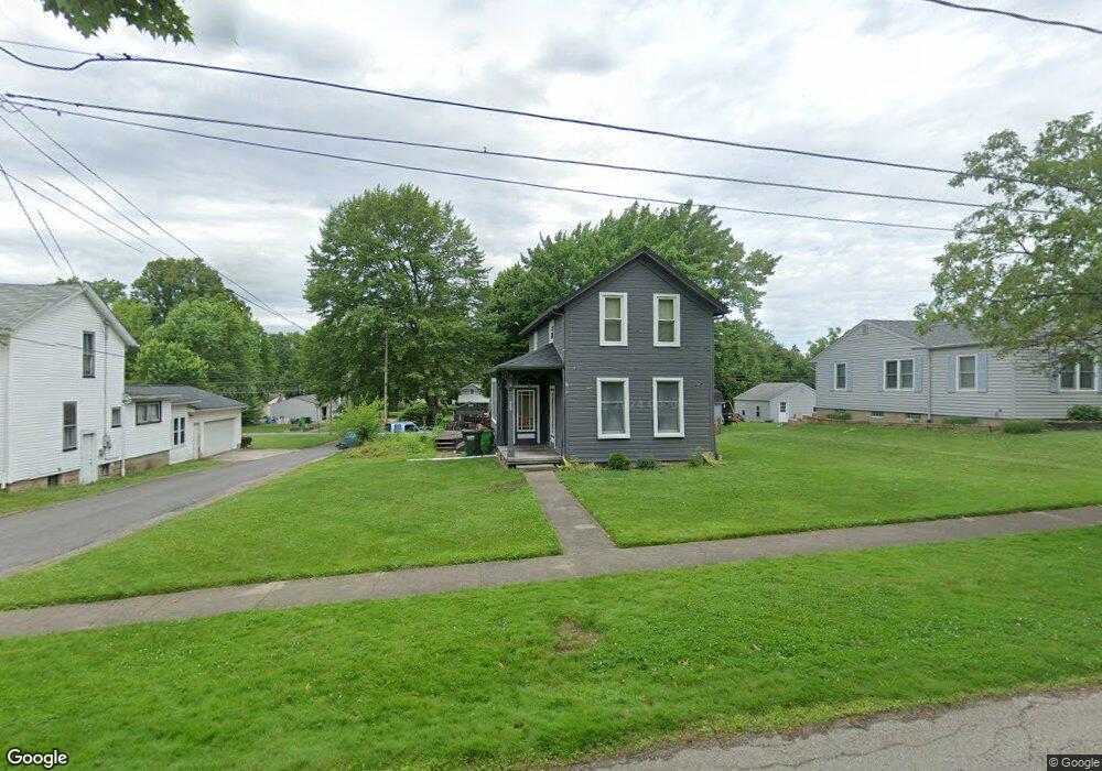
368 High St Doylestown, OH 44230
Estimated Value: $166,000 - $192,000
2
Beds
2
Baths
1,216
Sq Ft
$148/Sq Ft
Est. Value
About This Home
This home is located at 368 High St, Doylestown, OH 44230 and is currently estimated at $179,761, approximately $147 per square foot. 368 High St is a home located in Wayne County with nearby schools including Hazel Harvey Elementary School, Chippewa Intermediate School, and Chippewa Jr./Sr. High School.
Ownership History
Date
Name
Owned For
Owner Type
Purchase Details
Closed on
Feb 25, 2021
Sold by
Hines David P and Hines Family Revocable Living
Bought by
Swiger Benjamin R
Current Estimated Value
Purchase Details
Closed on
Sep 9, 2020
Sold by
Hines David P and Hines Family Revocable Living
Bought by
Swiger Benjamin R
Purchase Details
Closed on
Aug 2, 2019
Sold by
Hines Deborah J and Swiger Deborah J
Bought by
Hines David P and Hines Family Revocable Living Trust
Purchase Details
Closed on
Jun 15, 1999
Sold by
Marksz Daniel C
Bought by
Swiger Deborah J
Home Financials for this Owner
Home Financials are based on the most recent Mortgage that was taken out on this home.
Original Mortgage
$82,450
Interest Rate
6.99%
Mortgage Type
New Conventional
Create a Home Valuation Report for This Property
The Home Valuation Report is an in-depth analysis detailing your home's value as well as a comparison with similar homes in the area
Home Values in the Area
Average Home Value in this Area
Purchase History
| Date | Buyer | Sale Price | Title Company |
|---|---|---|---|
| Swiger Benjamin R | -- | None Available | |
| Swiger Benjamin R | -- | None Available | |
| Hines David P | -- | None Available | |
| Swiger Deborah J | $85,000 | -- |
Source: Public Records
Mortgage History
| Date | Status | Borrower | Loan Amount |
|---|---|---|---|
| Previous Owner | Swiger Deborah J | $82,450 |
Source: Public Records
Tax History
| Year | Tax Paid | Tax Assessment Tax Assessment Total Assessment is a certain percentage of the fair market value that is determined by local assessors to be the total taxable value of land and additions on the property. | Land | Improvement |
|---|---|---|---|---|
| 2025 | $1,521 | $41,600 | $13,710 | $27,890 |
| 2024 | $1,521 | $41,600 | $13,710 | $27,890 |
| 2023 | $1,528 | $41,840 | $13,710 | $28,130 |
| 2022 | $1,315 | $32,680 | $10,710 | $21,970 |
| 2021 | $1,323 | $32,680 | $10,710 | $21,970 |
| 2020 | $1,364 | $32,680 | $10,710 | $21,970 |
| 2019 | $1,457 | $34,450 | $14,850 | $19,600 |
| 2018 | $1,471 | $34,450 | $14,850 | $19,600 |
| 2017 | $1,439 | $34,450 | $14,850 | $19,600 |
| 2016 | $1,424 | $33,130 | $14,280 | $18,850 |
| 2015 | $1,418 | $33,130 | $14,280 | $18,850 |
| 2014 | $1,256 | $33,130 | $14,280 | $18,850 |
| 2013 | $1,267 | $32,480 | $14,760 | $17,720 |
Source: Public Records
Map
Nearby Homes
- 680 Thorn Way
- 620 Thorn Way
- 580 Thorn Way
- VL 1067 Homan Dr
- 497 Gates St
- 233 Homan Dr
- 204 Circle Dr
- V/L 1050 Melanie Ln
- 14831 Calaboone Rd
- V/L approx 67.56ac Gates St
- 100 Merlot Ct
- 0 S Portage St
- 0 Akron Rd Unit 5123781
- 500 W Clinton St
- 15500 Freedom Dr
- 14525 Serfass Rd
- 15899 Mccallum Dr
- 12214 Vince Dr
- 14740 Oak Grove Dr Unit 41
- 12045 Coal Bank Rd
Your Personal Tour Guide
Ask me questions while you tour the home.