Estimated Value: $121,176 - $273,000
Studio
1
Bath
1,220
Sq Ft
$153/Sq Ft
Est. Value
About This Home
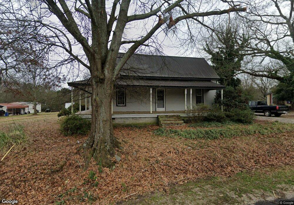
This home is located at 368 Highway 72 E, Comer, GA 30629 and is currently estimated at $186,794, approximately $153 per square foot. 368 Highway 72 E is a home located in Madison County with nearby schools including Madison County High School.
Ownership History
Date
Name
Owned For
Owner Type
Purchase Details
Closed on
May 11, 2006
Sold by
Anderson William Harlon
Bought by
Anderson Mary E
Current Estimated Value
Purchase Details
Closed on
Nov 3, 2005
Sold by
Strickland Donnie
Bought by
Anderson William Harlon
Purchase Details
Closed on
Jun 6, 2005
Sold by
Conner Judith L
Bought by
Strickland Donnie
Purchase Details
Closed on
Jan 1, 1988
Bought by
Taylor Barbara Elain
Create a Home Valuation Report for This Property
The Home Valuation Report is an in-depth analysis detailing your home's value as well as a comparison with similar homes in the area
Purchase History
| Date | Buyer | Sale Price | Title Company |
|---|---|---|---|
| Anderson Mary E | -- | -- | |
| Anderson William Harlon | $36,932 | -- | |
| Strickland Donnie | $32,000 | -- | |
| Taylor Barbara Elain | $24,000 | -- |
Source: Public Records
Tax History
| Year | Tax Paid | Tax Assessment Tax Assessment Total Assessment is a certain percentage of the fair market value that is determined by local assessors to be the total taxable value of land and additions on the property. | Land | Improvement |
|---|---|---|---|---|
| 2025 | $924 | $32,281 | $6,806 | $25,475 |
| 2024 | $9 | $31,435 | $6,806 | $24,629 |
| 2023 | $1,032 | $28,582 | $5,672 | $22,910 |
| 2022 | $711 | $23,986 | $3,903 | $20,083 |
| 2021 | $565 | $17,427 | $3,903 | $13,524 |
| 2020 | $479 | $16,860 | $3,336 | $13,524 |
| 2019 | $475 | $16,538 | $3,336 | $13,202 |
| 2018 | $446 | $15,623 | $3,052 | $12,571 |
| 2017 | $517 | $15,035 | $2,836 | $12,199 |
| 2016 | $326 | $12,806 | $2,578 | $10,228 |
| 2015 | $324 | $12,806 | $2,578 | $10,228 |
| 2014 | $357 | $13,869 | $3,480 | $10,389 |
| 2013 | -- | $13,869 | $3,480 | $10,389 |
Source: Public Records
Map
Nearby Homes
- 540 Sunset Ave
- 113 Sidetrack Cir
- 79 Gholston St
- 77 Laurel Ave
- 12 Laurel Ave
- 0 Clairmont Ave Unit 10700774
- 549 Gholston St
- 2633 Paoli St Unit TRACT 1
- 130 Shannons Place
- 2665 Paoli St Unit TRACT 3
- 640 Gholston St
- 10 Shannons Ln
- 1360 Hill St
- 116 Scarlett Oak Ln
- 52 Willow Oak Cir
- 0 Lowe Rd Unit 10614126
- 2975 Georgia 72
- 0 Paoli Rd Unit 23882833
- 1104 Farm Rd
- 2987 Georgia 72
- 346 Highway 72 E
- 396 Highway 72 E
- 346 Georgia 72
- 389 Highway 72 E
- 325 Hwy 72e
- 325 Highway 72 E
- 325 Georgia 72
- 413 Georgia 72
- 413 Hwy 72e
- 2024 Oak St
- 717 E Sunset Ave
- 2048 Poplar St
- 717 Highway 72 Ave E
- 2040 Oak St
- Lot 18 Royal Oaks Dr
- 440 Laurel Ave
- 276 Highway 72 E
- 500 Laurel Ave
- 276 Highway 72 St E
- 404 Laurel Ave
Your Personal Tour Guide
Ask me questions while you tour the home.