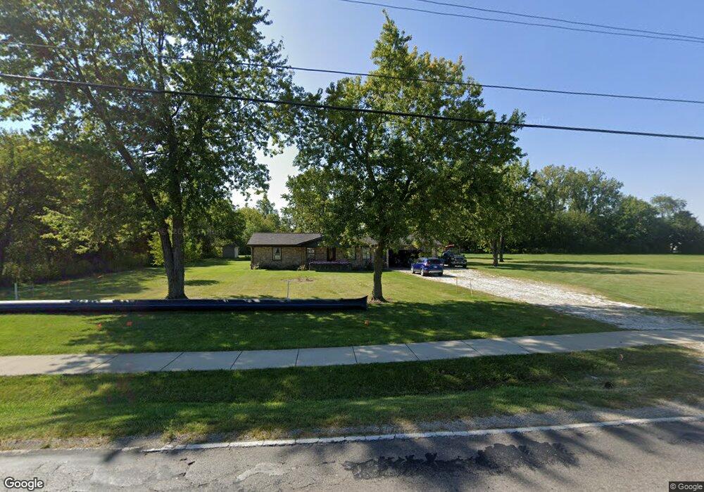
3681 W State Road 47 Sheridan, IN 46069
Estimated Value: $221,000 - $246,000
3
Beds
2
Baths
1,125
Sq Ft
$211/Sq Ft
Est. Value
About This Home
This home is located at 3681 W State Road 47, Sheridan, IN 46069 and is currently estimated at $237,244, approximately $210 per square foot. 3681 W State Road 47 is a home located in Hamilton County with nearby schools including Sheridan Elementary School, Sheridan Middle School, and Sheridan High School.
Ownership History
Date
Name
Owned For
Owner Type
Purchase Details
Closed on
Apr 13, 2023
Sold by
Freeman Rex A and Freeman Karen Sue
Bought by
State Of Indiana
Current Estimated Value
Purchase Details
Closed on
Dec 7, 2022
Sold by
Freeman Rex A and Freeman Karen Sue
Bought by
State Of Indiana
Purchase Details
Closed on
Jun 10, 2016
Sold by
Freeman Rex A and Rex A Freeman Revocable Trust
Bought by
Freeman Rex A and Freeman Karen Sue
Purchase Details
Closed on
Aug 16, 2012
Sold by
Sheridan Trace Development Co Llc
Bought by
Tbg2 Inc
Purchase Details
Closed on
Dec 22, 2009
Sold by
Freeman Rex A
Bought by
Freeman Rex A and Rex A Freeman Revocable Trust
Purchase Details
Closed on
Sep 28, 2006
Sold by
Sheridan Trace Development Co Llc
Bought by
Master Automotive Services Group Llc
Purchase Details
Closed on
May 18, 2005
Sold by
Sheridan Trace Development Co Llc
Bought by
C P Morgan Communities Lp
Create a Home Valuation Report for This Property
The Home Valuation Report is an in-depth analysis detailing your home's value as well as a comparison with similar homes in the area
Home Values in the Area
Average Home Value in this Area
Purchase History
| Date | Buyer | Sale Price | Title Company |
|---|---|---|---|
| State Of Indiana | $17,100 | None Listed On Document | |
| State Of Indiana | $17,100 | None Listed On Document | |
| Freeman Rex A | -- | None Available | |
| Tbg2 Inc | -- | None Available | |
| Freeman Rex A | -- | None Available | |
| Master Automotive Services Group Llc | -- | First Title Of Indiana Inc | |
| C P Morgan Communities Lp | -- | -- | |
| C P Morgan Communities Lp | -- | -- | |
| C P Morgan Communities Lp | -- | -- |
Source: Public Records
Tax History Compared to Growth
Tax History
| Year | Tax Paid | Tax Assessment Tax Assessment Total Assessment is a certain percentage of the fair market value that is determined by local assessors to be the total taxable value of land and additions on the property. | Land | Improvement |
|---|---|---|---|---|
| 2024 | $1,829 | $170,900 | $51,200 | $119,700 |
| 2023 | $1,854 | $166,200 | $55,000 | $111,200 |
| 2022 | $1,843 | $153,500 | $55,000 | $98,500 |
| 2021 | $1,650 | $139,200 | $53,400 | $85,800 |
| 2020 | $1,470 | $131,800 | $53,400 | $78,400 |
| 2019 | $1,441 | $130,900 | $34,700 | $96,200 |
| 2018 | $1,481 | $127,000 | $34,700 | $92,300 |
| 2017 | $1,413 | $121,200 | $34,700 | $86,500 |
| 2016 | $1,278 | $115,800 | $31,700 | $84,100 |
| 2014 | $1,187 | $109,300 | $29,300 | $80,000 |
| 2013 | $1,187 | $109,300 | $29,300 | $80,000 |
Source: Public Records
Map
Nearby Homes
- 1102 Maple Run Dr
- 1134 Maple Trace Way
- 407 W 8th St
- 511 Tomahawk St
- 1225 Maple Trace Way
- 1224 Maple Trace Way
- 907 S Ohio St
- 3936 W State Road 47
- 413 Shadetree Ct
- 1300 Shadetree Ln
- 414 Elm Ave
- 707 S Hamilton Ave
- 600 S Georgia St
- 21650 Mule Barn Rd
- 903&905 S Georgia St
- 405 W 3rd St
- 308 E 8th St
- 400 S Georgia St
- 390 W State Road 38
- Spruce Plan at Maple Run
- 3447 State Road 47
- 3447 W Sr 47
- 3447 W 47
- 904 S Hamilton St
- 906 S Sheridan Ave
- 1004 Maple Run Dr
- 1002 Maple Run Dr
- 1006 Maple Run Dr
- 730 W 236th St
- 2067 W 236th St
- 904 S Sheridan Ave
- 1008 Maple Run Dr
- 3774 W State Road 47
- 1010 Maple Run Dr
- 1012 Maple Run Dr
- 1109 Maple Run Dr
- 1014 Maple Run Dr
- 1113 Maple Run Dr
- 807 S Hamilton Ave
- 909 S Sheridan Ave