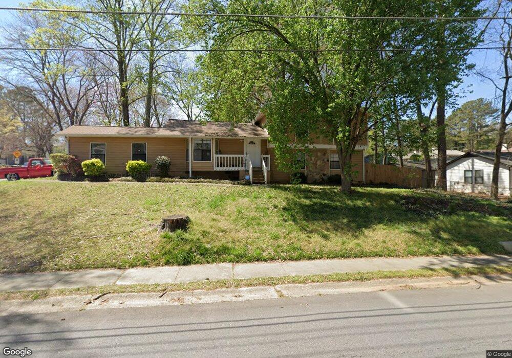
369 Cedar Trace SW Unit 1 Marietta, GA 30008
Southwestern Marietta NeighborhoodEstimated Value: $303,000 - $346,000
3
Beds
2
Baths
1,375
Sq Ft
$237/Sq Ft
Est. Value
About This Home
This home is located at 369 Cedar Trace SW Unit 1, Marietta, GA 30008 and is currently estimated at $326,019, approximately $237 per square foot. 369 Cedar Trace SW Unit 1 is a home located in Cobb County with nearby schools including Dunleith Elementary School, Marietta Sixth Grade Academy, and Marietta Middle School.
Ownership History
Date
Name
Owned For
Owner Type
Purchase Details
Closed on
Jul 28, 2003
Sold by
Wright Maxine
Bought by
Rosas-Enriquez Martin R
Current Estimated Value
Home Financials for this Owner
Home Financials are based on the most recent Mortgage that was taken out on this home.
Original Mortgage
$132,914
Outstanding Balance
$56,125
Interest Rate
5.17%
Mortgage Type
FHA
Estimated Equity
$269,894
Purchase Details
Closed on
Sep 30, 1994
Sold by
Thrift Frank
Bought by
Wright Maxine
Home Financials for this Owner
Home Financials are based on the most recent Mortgage that was taken out on this home.
Original Mortgage
$76,943
Interest Rate
8.46%
Mortgage Type
FHA
Create a Home Valuation Report for This Property
The Home Valuation Report is an in-depth analysis detailing your home's value as well as a comparison with similar homes in the area
Home Values in the Area
Average Home Value in this Area
Purchase History
| Date | Buyer | Sale Price | Title Company |
|---|---|---|---|
| Rosas-Enriquez Martin R | $135,000 | -- | |
| Wright Maxine | $77,000 | -- |
Source: Public Records
Mortgage History
| Date | Status | Borrower | Loan Amount |
|---|---|---|---|
| Open | Rosas-Enriquez Martin R | $132,914 | |
| Previous Owner | Wright Maxine | $76,943 |
Source: Public Records
Tax History Compared to Growth
Tax History
| Year | Tax Paid | Tax Assessment Tax Assessment Total Assessment is a certain percentage of the fair market value that is determined by local assessors to be the total taxable value of land and additions on the property. | Land | Improvement |
|---|---|---|---|---|
| 2025 | $698 | $82,464 | $23,400 | $59,064 |
| 2024 | $698 | $82,464 | $23,400 | $59,064 |
| 2023 | $698 | $82,464 | $23,400 | $59,064 |
| 2022 | $585 | $69,156 | $23,400 | $45,756 |
| 2021 | $594 | $69,156 | $23,400 | $45,756 |
| 2020 | $514 | $59,792 | $10,800 | $48,992 |
| 2019 | $514 | $59,792 | $10,800 | $48,992 |
| 2018 | $514 | $59,792 | $10,800 | $48,992 |
| 2017 | $345 | $50,076 | $10,800 | $39,276 |
| 2016 | $257 | $37,268 | $5,400 | $31,868 |
| 2015 | $280 | $37,268 | $5,400 | $31,868 |
| 2014 | $289 | $37,268 | $0 | $0 |
Source: Public Records
Map
Nearby Homes
- 393 Cedar Trace SW Unit 1
- 264 Juliet Ln SW
- 1048 Brownstone Dr Unit 3
- 1166 Booth Rd SW Unit 407
- 1166 Booth Rd SW Unit 205
- 1166 Booth Rd SW Unit 906
- 1166 Booth Rd SW Unit 908
- 1166 Booth Rd SW Unit 610
- 243 Brownstone Cir Unit 25
- 994 Powder Springs St
- 1038 Arden Dr SW
- 1230 Arden Dr SW
- 852 Hickory Dr SW
- 644 Laurel Wood Dr SW
- 105 Grampian Ct Unit 13
- 1239 Grampian Pass Unit 11
- 1252 Grampian Pass Unit 9
- 840 Hickory Dr SW
- 373 Cedar Trace SW
- 460 Booth Cir SW Unit 462
- 368 Cedar Trace SW
- 377 Cedar Trace SW Unit 1
- 452 Booth Cir SW
- 372 Cedar Trace SW
- 450 450 Booth Cir
- 1229 Brownstone Dr Unit 15
- 1229 Brownstone Dr
- 1225 Brownstone Dr Unit 59
- 1225 Brownstone Dr Unit 15
- 1221 Brownstone Dr
- 1221 Brownstone Dr SW
- 1217 Brownstone Dr Unit 15
- 985 Brownstone Ln
- 381 Cedar Trace SW
- 378 Cedar Trace SW
- 989 Brownstone Ln Unit 62
- 989 Brownstone Ln
- 987 Brownstone Ln Unit 63