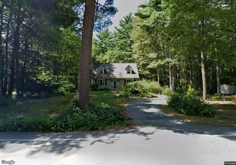
369 Osgood Rd Milford, NH 03055
Estimated Value: $508,700 - $554,000
3
Beds
2
Baths
1,638
Sq Ft
$326/Sq Ft
Est. Value
About This Home
This home is located at 369 Osgood Rd, Milford, NH 03055 and is currently estimated at $534,675, approximately $326 per square foot. 369 Osgood Rd is a home with nearby schools including Jacques Memorial Elementary School, Heron Pond Elementary School, and Milford Middle School.
Ownership History
Date
Name
Owned For
Owner Type
Purchase Details
Closed on
Jun 1, 1998
Sold by
Donaher William M and Donaher Margaret N
Bought by
Groves Dana F and Groves Holly R
Current Estimated Value
Home Financials for this Owner
Home Financials are based on the most recent Mortgage that was taken out on this home.
Original Mortgage
$148,190
Interest Rate
7.12%
Create a Home Valuation Report for This Property
The Home Valuation Report is an in-depth analysis detailing your home's value as well as a comparison with similar homes in the area
Home Values in the Area
Average Home Value in this Area
Purchase History
| Date | Buyer | Sale Price | Title Company |
|---|---|---|---|
| Groves Dana F | $149,900 | -- |
Source: Public Records
Mortgage History
| Date | Status | Borrower | Loan Amount |
|---|---|---|---|
| Open | Groves Dana F | $199,000 | |
| Closed | Groves Dana F | $206,000 | |
| Closed | Groves Dana F | $59,200 | |
| Closed | Groves Dana F | $148,190 |
Source: Public Records
Tax History Compared to Growth
Tax History
| Year | Tax Paid | Tax Assessment Tax Assessment Total Assessment is a certain percentage of the fair market value that is determined by local assessors to be the total taxable value of land and additions on the property. | Land | Improvement |
|---|---|---|---|---|
| 2024 | $7,269 | $307,100 | $86,800 | $220,300 |
| 2023 | $6,808 | $307,100 | $86,800 | $220,300 |
| 2022 | $6,385 | $307,100 | $86,800 | $220,300 |
| 2021 | $6,188 | $307,100 | $86,800 | $220,300 |
| 2020 | $10,869 | $283,300 | $70,100 | $213,200 |
| 2019 | $7,357 | $283,300 | $70,100 | $213,200 |
| 2018 | $5,134 | $233,400 | $70,100 | $163,300 |
| 2017 | $5,618 | $233,400 | $70,100 | $163,300 |
| 2016 | $4,968 | $233,400 | $70,100 | $163,300 |
| 2015 | $6,535 | $228,800 | $70,100 | $158,700 |
| 2014 | $6,246 | $228,800 | $70,100 | $158,700 |
| 2013 | $6,171 | $228,800 | $70,100 | $158,700 |
Source: Public Records
Map
Nearby Homes
- 88 Noons Quarry Rd
- 26 Melendy Rd Unit 97
- 47 Cadran Crossing
- 0 Ball Hill Rd
- 00 Ruonala Rd
- 81 Badger Hill Dr
- 32 Larch Rd
- 131 Badger Hill Dr
- 24 Spaulding St
- 0 Briar Cliff Dr
- 126 Boynton Hill Rd
- 112 Union St
- 119 Boynton Hill Rd
- 30 Holden Ln
- 28 Christine Dr
- 545 Elm St Unit 34
- 30 Perkins St Unit 1
- 254 Nashua St
- 339 Nashua St
- 14 Reserve Way