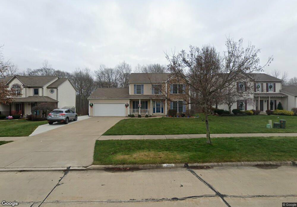
369 Silver Meadow Dr Wadsworth, OH 44281
Estimated Value: $356,000 - $390,000
4
Beds
3
Baths
2,114
Sq Ft
$176/Sq Ft
Est. Value
About This Home
This home is located at 369 Silver Meadow Dr, Wadsworth, OH 44281 and is currently estimated at $371,280, approximately $175 per square foot. 369 Silver Meadow Dr is a home located in Medina County with nearby schools including Overlook Elementary School, Wadsworth Middle School, and Central Intermediate School.
Ownership History
Date
Name
Owned For
Owner Type
Purchase Details
Closed on
May 7, 2004
Sold by
Elson J Hershberger Construction Inc
Bought by
Horstman Phillip A and Horstman Melissa R
Current Estimated Value
Home Financials for this Owner
Home Financials are based on the most recent Mortgage that was taken out on this home.
Original Mortgage
$194,200
Interest Rate
4%
Mortgage Type
Purchase Money Mortgage
Create a Home Valuation Report for This Property
The Home Valuation Report is an in-depth analysis detailing your home's value as well as a comparison with similar homes in the area
Home Values in the Area
Average Home Value in this Area
Purchase History
| Date | Buyer | Sale Price | Title Company |
|---|---|---|---|
| Horstman Phillip A | $49,900 | -- |
Source: Public Records
Mortgage History
| Date | Status | Borrower | Loan Amount |
|---|---|---|---|
| Closed | Horstman Phillip A | $194,200 |
Source: Public Records
Tax History Compared to Growth
Tax History
| Year | Tax Paid | Tax Assessment Tax Assessment Total Assessment is a certain percentage of the fair market value that is determined by local assessors to be the total taxable value of land and additions on the property. | Land | Improvement |
|---|---|---|---|---|
| 2024 | $4,098 | $93,350 | $20,780 | $72,570 |
| 2023 | $4,098 | $93,350 | $20,780 | $72,570 |
| 2022 | $4,111 | $93,350 | $20,780 | $72,570 |
| 2021 | $3,884 | $74,150 | $16,630 | $57,520 |
| 2020 | $3,397 | $74,150 | $16,630 | $57,520 |
| 2019 | $3,401 | $74,150 | $16,630 | $57,520 |
| 2018 | $2,914 | $59,580 | $14,330 | $45,250 |
| 2017 | $2,915 | $59,580 | $14,330 | $45,250 |
| 2016 | $2,963 | $59,580 | $14,330 | $45,250 |
| 2015 | $2,933 | $56,200 | $13,510 | $42,690 |
| 2014 | $2,981 | $56,200 | $13,510 | $42,690 |
| 2013 | $2,985 | $56,200 | $13,510 | $42,690 |
Source: Public Records
Map
Nearby Homes
- 957 Devonwood Dr Unit 15
- 411 Treeview Dr
- 660 Oakcrest Dr
- 811 Archwood Rd
- 0 Silvercrest Rd
- 785 Queens Gate Way
- 264 Windfall Ln
- 9900 Homestead Rd
- 405 Broad St
- 371 Broad St
- 269 Water St
- 268 E Walnut St
- 178 Fairlawn Ave
- 273 E Boyer St
- 119 Park St
- 301 S Lyman St
- 0 Silvercreek Rd
- 272 S Lyman St
- Woodside Plan at The Reserve at Sharon
- Bourges Plan at The Reserve at Sharon
- 363 Silver Meadow Dr
- 379 Silver Meadow Dr
- 355 Silver Meadow Dr
- 370 Silver Meadow Dr
- 378 Silver Meadow Dr
- 347 Silver Meadow Dr
- 354 Silver Meadow Dr
- 951 Glendale Dr
- 943 Glendale Dr
- 937 Glendale Dr
- 348 Silver Meadow Dr
- 341 Silver Meadow Dr
- 929 Glendale Dr
- 363 Meadowcreek Dr
- 340 Silver Meadow Dr
- 371 Meadowcreek Dr
- 357 Meadowcreek Dr
- 333 Silver Meadow Dr
- 921 Glendale Dr
- 332 Silver Meadow Dr