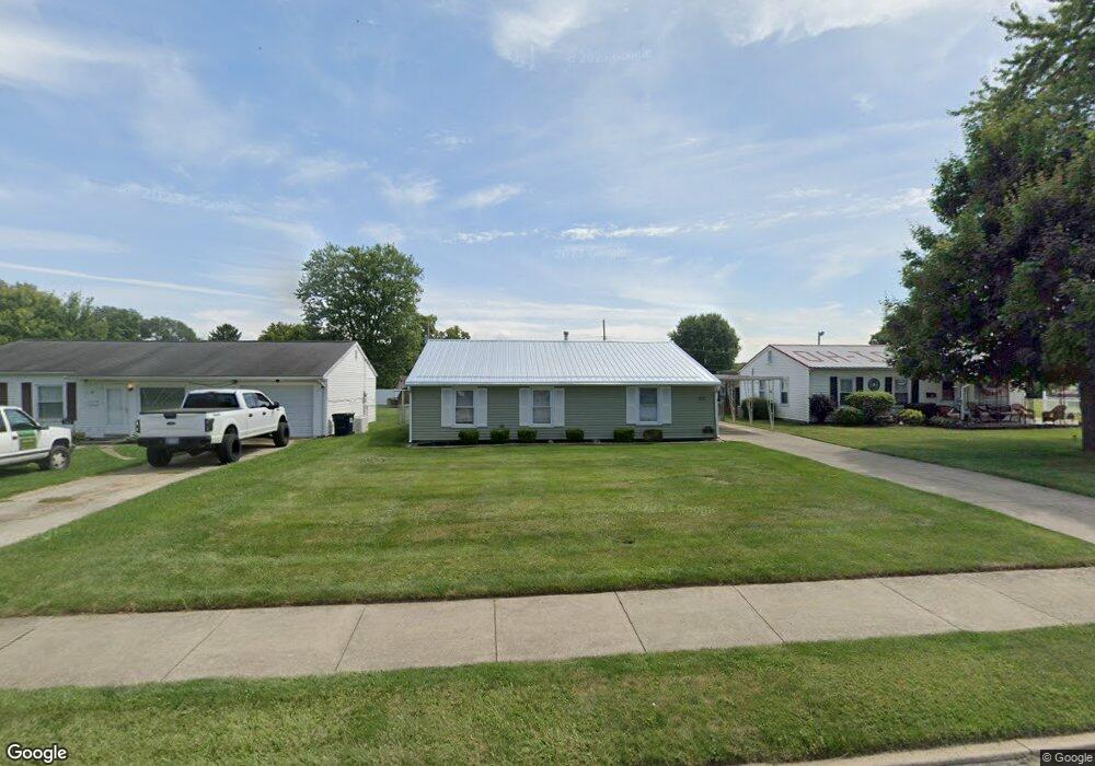
369 Union St Newark, OH 43055
Estimated Value: $181,000 - $197,062
3
Beds
1
Bath
1,080
Sq Ft
$174/Sq Ft
Est. Value
About This Home
This home is located at 369 Union St, Newark, OH 43055 and is currently estimated at $187,766, approximately $173 per square foot. 369 Union St is a home located in Licking County with nearby schools including Mcguffey Elementary School, Wilson Middle School, and Newark High School.
Ownership History
Date
Name
Owned For
Owner Type
Purchase Details
Closed on
May 12, 2003
Sold by
Cox Shirley A and Cox Daniel S
Bought by
Powell William S and Powell Dawn A
Current Estimated Value
Home Financials for this Owner
Home Financials are based on the most recent Mortgage that was taken out on this home.
Original Mortgage
$70,300
Interest Rate
5.9%
Mortgage Type
Unknown
Create a Home Valuation Report for This Property
The Home Valuation Report is an in-depth analysis detailing your home's value as well as a comparison with similar homes in the area
Home Values in the Area
Average Home Value in this Area
Purchase History
| Date | Buyer | Sale Price | Title Company |
|---|---|---|---|
| Powell William S | $74,000 | -- |
Source: Public Records
Mortgage History
| Date | Status | Borrower | Loan Amount |
|---|---|---|---|
| Previous Owner | Powell William S | $70,300 |
Source: Public Records
Tax History
| Year | Tax Paid | Tax Assessment Tax Assessment Total Assessment is a certain percentage of the fair market value that is determined by local assessors to be the total taxable value of land and additions on the property. | Land | Improvement |
|---|---|---|---|---|
| 2024 | $1,356 | $47,710 | $19,810 | $27,900 |
| 2023 | $1,376 | $47,710 | $19,810 | $27,900 |
| 2022 | $1,390 | $43,370 | $11,060 | $32,310 |
| 2021 | $1,458 | $43,370 | $11,060 | $32,310 |
| 2020 | $1,491 | $43,370 | $11,060 | $32,310 |
| 2019 | $1,136 | $34,130 | $11,060 | $23,070 |
| 2018 | $1,137 | $0 | $0 | $0 |
| 2017 | $1,089 | $0 | $0 | $0 |
| 2016 | $877 | $0 | $0 | $0 |
| 2015 | $896 | $0 | $0 | $0 |
| 2014 | $1,666 | $0 | $0 | $0 |
| 2013 | $851 | $0 | $0 | $0 |
Source: Public Records
Map
Nearby Homes
- 452 Saint James Gate
- 132 Cambria St
- 149 Maholm St
- 114-116 Maholm St
- 389 Kells Ct E
- 384 Kells Ct E
- 224 Walden Rd
- 606 W Main St
- 30 Neal Ave
- 42 Union St
- 231 Fieldpoint Rd
- 915 W Main St
- 645 Kensington Dr Unit 645
- 616 Huron Dr
- 148 N 21st St
- 233 Wildwood Ct Unit 233C
- 90 Franklin Ave
- 0 Jefferson St
- 346 W Main St
- 139 N 26th St
Your Personal Tour Guide
Ask me questions while you tour the home.